

Places to go.

The country’s best parks, gardens, beaches and springs, worth the drive. Roam the map, jump to a state, or dive into a collection.

Pick a state, or click the map to zoom
BeachesSpringsLakes & riversMountainsCanyons & desertsForestsCavesVolcanoesGardens & wildlifeAttractionsBreweries

Curated across the United States

Cross-state guides to the places worth the trip.

All collections →
The United States National Parks
Featured collection

The United States National Parks

All 63 of America's national parks in one place: the geysers and canyons, glaciers and giant sequoias, coral reefs and live volcanoes the country set aside for everyone. From the Grand Canyon to the Everglades to the wilds of Alaska, this is the complete collection, each one worth building a whole trip around.

See all 63 places →
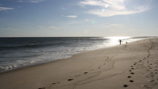
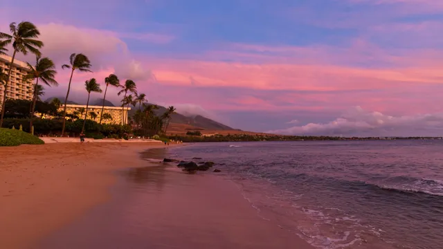
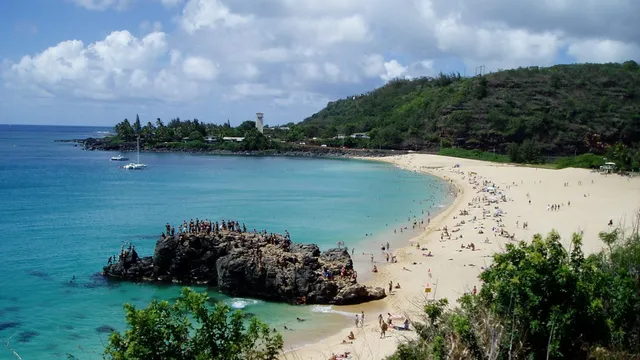
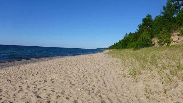
Best Beaches in the US
Featured collection

Best Beaches in the US

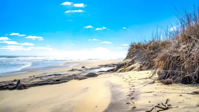
From Pacific cliffs and Hawaiian bays to Outer Banks dunes, Great Lakes sand, and Gulf sugar, these are the beaches across the country worth the drive, the flight, or the ferry. Some you walk a mile to reach, some you take a boat or a ferry, and a few you just pull off the highway and gasp. The best beaches in America, coast to coast to coast.

See all 26 places →
The Blue Ridge Mountains
Featured collection

The Blue Ridge Mountains

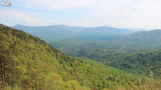
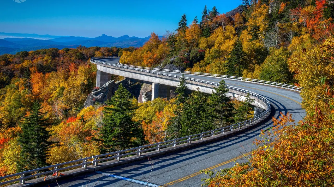
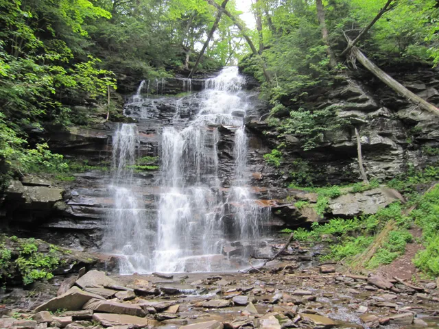
The ancient, blue-hazed peaks of the southern Appalachians, threaded by the Blue Ridge Parkway from Shenandoah to the Smokies. Mile-high summits and the highest peak east of the Mississippi, waterfalls you can walk behind, long-range overlooks, and mountain towns like Asheville with the Biltmore at their heart. Go in October for the color, but the haze is blue year-round.

See all 26 places →
The Rocky Mountains
Featured collection

The Rocky Mountains

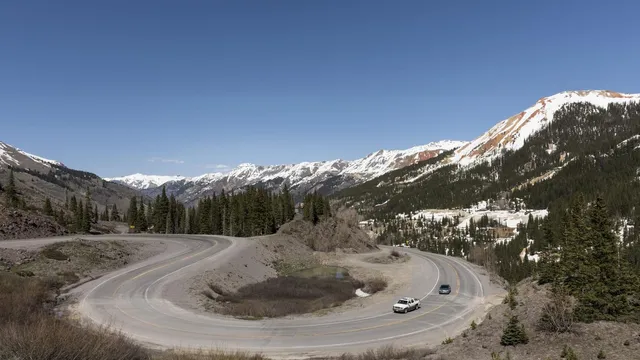
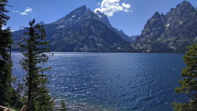
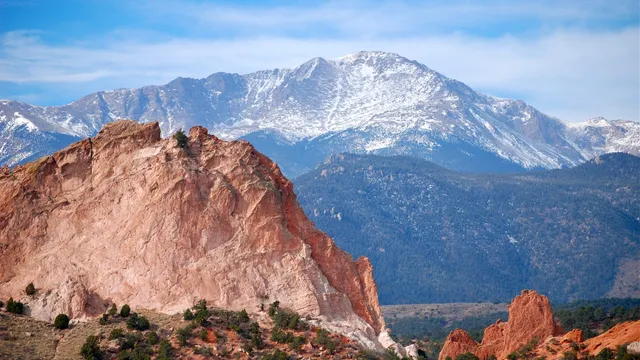
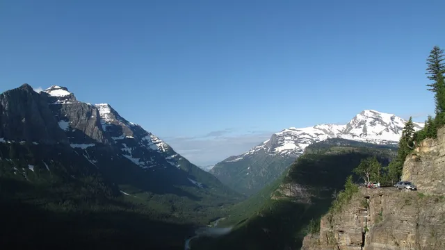
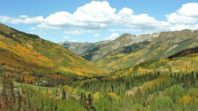
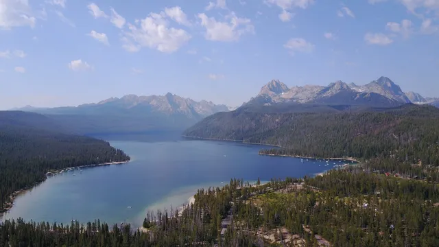
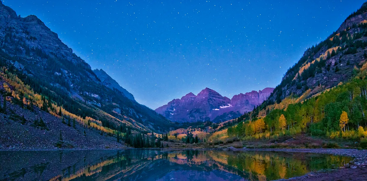
Alpine lakes, fourteeners, and golden aspen along the spine of the West. The Rockies at their most iconic: the Maroon Bells mirrored in their lake, the Tetons rising straight off the valley floor, Glacier's Going-to-the-Sun Road, the red spires of the Garden of the Gods, and Idaho's serrated Sawtooths over Redfish Lake. From Colorado's San Juans to the Wyoming Tetons, Montana's Glacier, and the Idaho high country, with high passes and old mining towns in between.

See all 21 places →
America's Best Caves
Featured collection

America's Best Caves

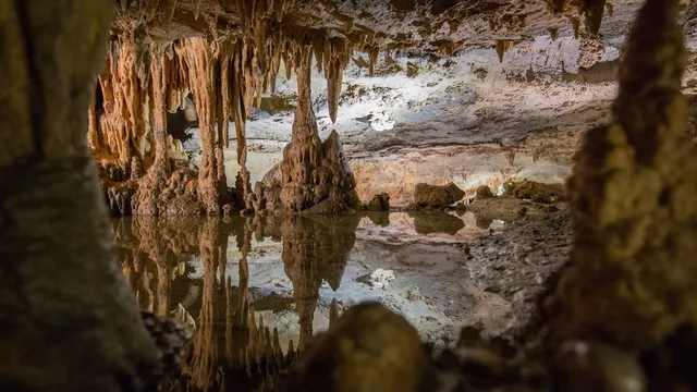
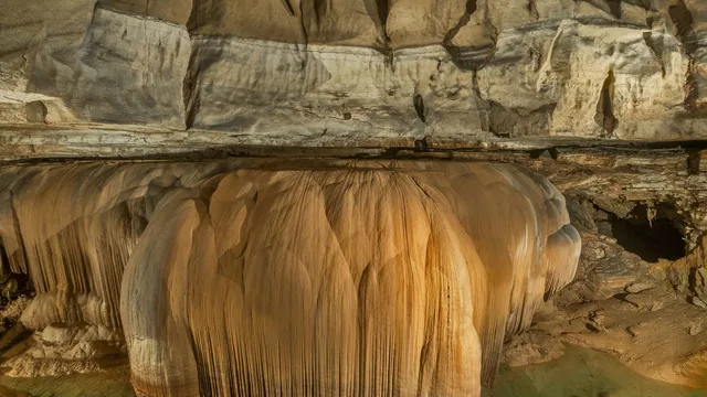
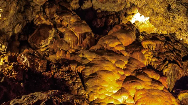
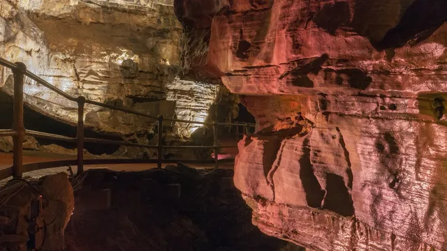
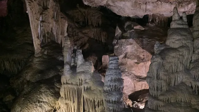
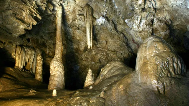
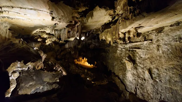
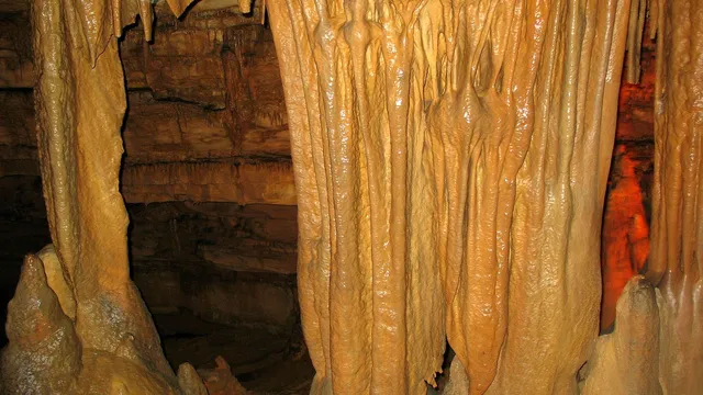
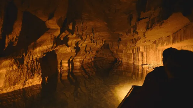
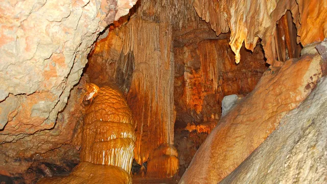
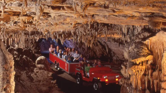
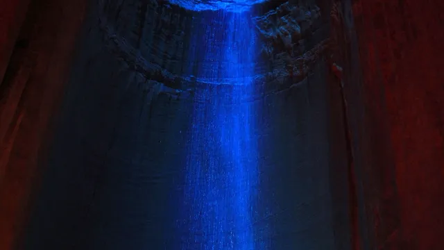
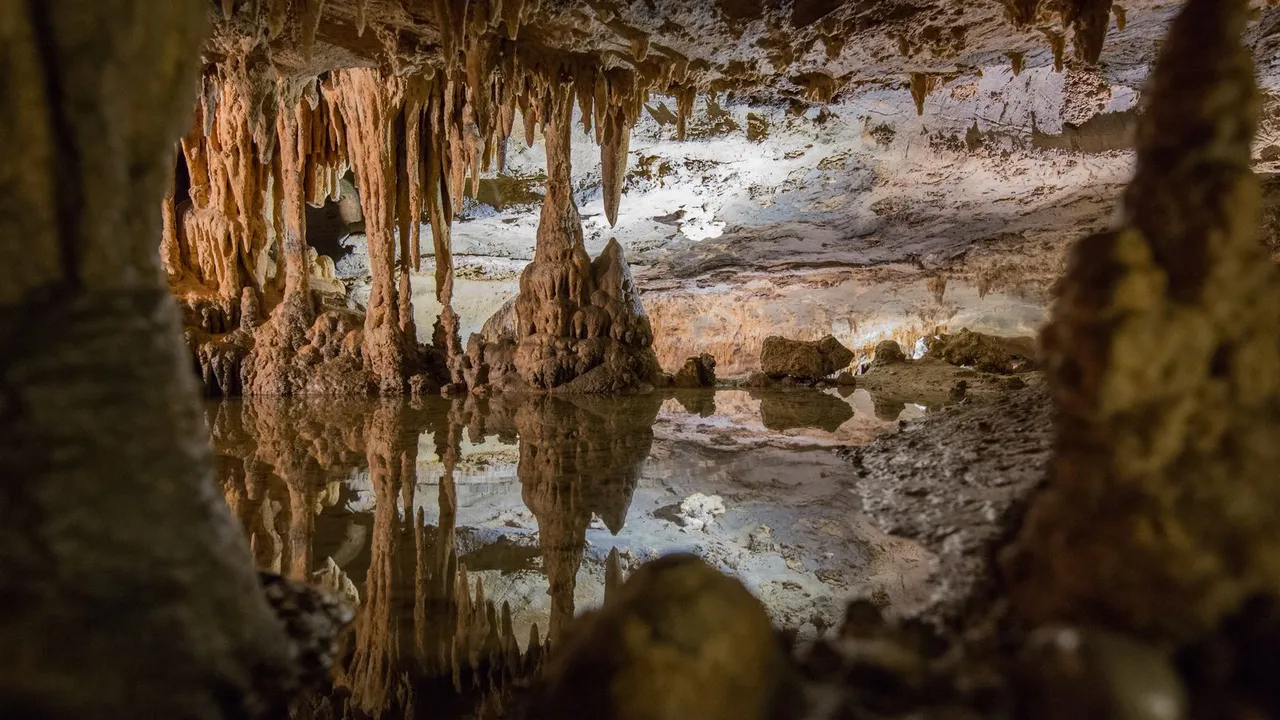
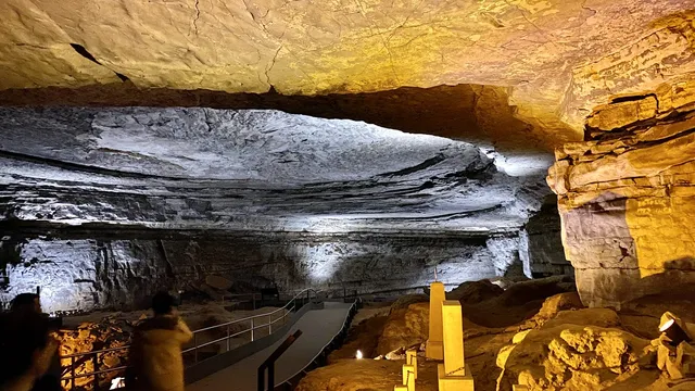
Step out of the daylight into another world: the longest cave on the planet in Kentucky, a desert chamber big enough to swallow a stadium in New Mexico, an underground waterfall in Tennessee, and a living crystal cavern in Arizona. Some you walk, some you ride a boat through, and one you crawl with a headlamp. America's great caves and caverns, from the national parks to the lantern-lit show caves.

See all 22 places →

All places

Browse everything by category or region.

434 places

Everglades National Park Lakes & rivers

Everglades National Park

Homestead, FL · The Everglades

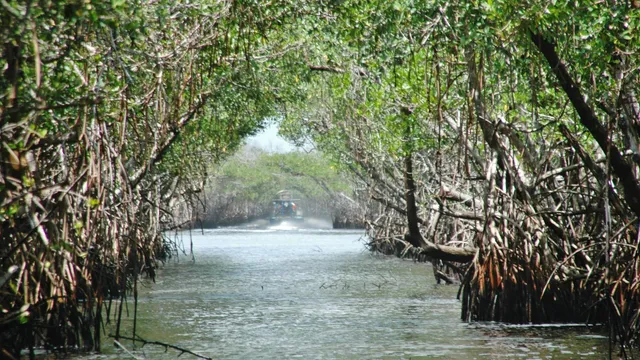
Everglades National Park protects 1.5 million acres of subtropical wilderness at the southern tip of Florida, the largest such ecosystem in North America. It is the only place in the world where alligators and crocodiles coexist, and a UNESCO World Heritage Site home to manatees, wading birds, and the elusive Florida panther. Visitors can walk the famed Anhinga Trail, paddle mangrove waterways, or take an airboat-free ranger tour through the 'River of Grass.'
Dry Tortugas National Park Lakes & rivers

Dry Tortugas National Park

Key West, FL · Florida Keys

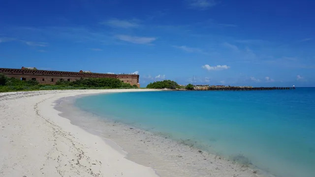
Located almost 70 miles west of Key West in the Gulf of Mexico, Dry Tortugas National Park is a remote cluster of seven small islands reachable only by ferry or seaplane. Its centerpiece is Fort Jefferson, one of the nation's largest 19th-century masonry forts, surrounded by crystal-clear waters renowned for snorkeling, coral reefs, and shipwrecks. The park is also a haven for nesting seabirds and migratory birds.

J.N. "Ding" Darling National Wildlife Refuge Gardens & wildlife

J.N. "Ding" Darling National Wildlife Refuge

Sanibel, FL · Southwest Florida

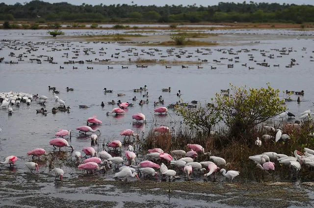
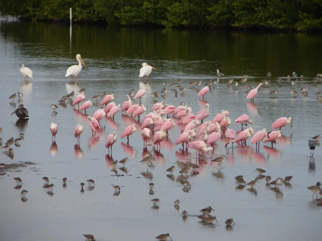
Spanning more than 6,400 acres on Sanibel Island, this refuge protects one of the largest undeveloped mangrove ecosystems in the United States. Its four-mile Wildlife Drive winds past tidal flats and estuaries teeming with roseate spoonbills, herons, ibis, and alligators. The refuge is renowned among birders and is best explored by car, bike, kayak, or on foot.

Merritt Island National Wildlife Refuge Gardens & wildlife

Merritt Island National Wildlife Refuge

Titusville, FL · Space Coast

Sharing its boundary with NASA's Kennedy Space Center, this 140,000-acre refuge is one of the most biologically diverse in the country, home to more endangered and threatened species than almost any other refuge in the continental U.S. Visitors can drive the Black Point Wildlife Drive to spot alligators, manatees, bald eagles, and thousands of migratory birds. Hiking trails and the visitor center round out a rich wildlife experience along Florida's Space Coast.

Audubon Corkscrew Swamp Sanctuary Gardens & wildlife

Audubon Corkscrew Swamp Sanctuary

Naples, FL · Southwest Florida

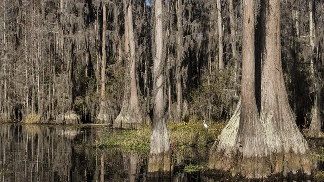
Managed by the National Audubon Society, Corkscrew Swamp Sanctuary protects the largest remaining old-growth bald cypress forest in North America. A 2.25-mile raised boardwalk loops through pine flatwoods, wet prairie, and ancient cypress stands, offering close encounters with wading birds, alligators, and rare orchids. It is one of Florida's premier spots for quiet, immersive nature walking.

St. Marks National Wildlife Refuge Gardens & wildlife

St. Marks National Wildlife Refuge

St. Marks, FL · Big Bend

Established in 1931, this 86,000-acre coastal refuge protects roughly 43 miles of north Florida's Gulf shoreline and serves as winter habitat for migratory birds, with more than 250 species recorded throughout the year. At its southern tip stands the historic St. Marks Lighthouse, completed in 1842 and the oldest lighthouse on Florida's Gulf coast. Wildlife drives, hiking and biking trails, and a stretch of the Florida National Scenic Trail make it a premier spot for birding, alligator watching, and butterfly migrations.

Ginnie Springs Springs

Ginnie Springs

High Springs, FL · North Central Florida

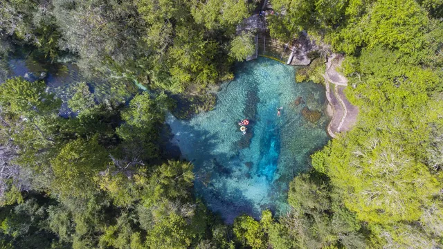
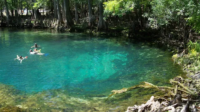
Ginnie Springs is a privately owned cluster of seven crystalline springs on the banks of the Santa Fe River near High Springs, where the water holds a constant 72 degrees and visibility so clear that divers call it gin-clear. Float the lazy river run on a rented tube, snorkel the swimming basins, or drop into the Devil Spring cave system that has drawn cave divers from around the world. Summer and early fall bring the clearest river water and the liveliest crowds.

Ichetucknee Springs State Park Springs

Ichetucknee Springs State Park

Fort White, FL · North Central Florida

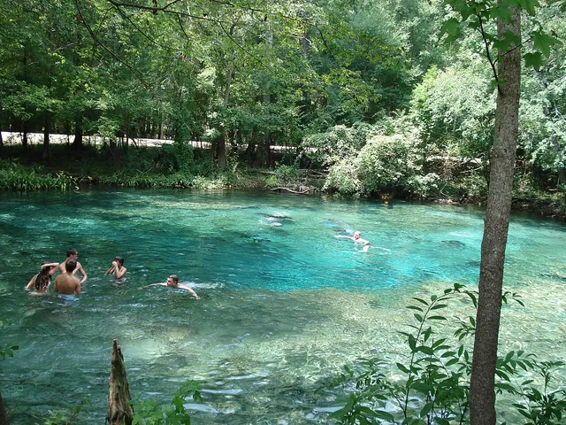
Ichetucknee Springs State Park protects a National Natural Landmark headspring that pours out cool, sapphire-clear water to form one of Florida's premier tubing rivers near Fort White. Drift the spring run beneath a canopy of cypress and oak, watch for otters, turtles, and wading birds, and cool off in the 72-degree swimming areas at the headspring and Blue Hole. Tubing from the upper river runs only from late May through Labor Day, so plan summer trips accordingly.

Rainbow Springs State Park Springs

Rainbow Springs State Park

Dunnellon, FL · North Central Florida

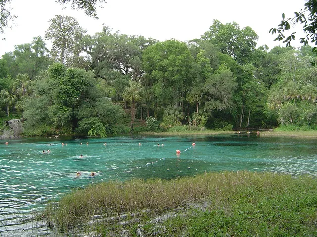
Rainbow Springs is a first-magnitude spring near Dunnellon that pushes out hundreds of millions of gallons a day to form the clear Rainbow River. Swim in the headspring basin at a constant 72 degrees, then wander 1930s ornamental gardens past three man-made waterfalls built into old mine tailings. From April to September a separate entrance launches tubers for the lazy float downriver.

Weeki Wachee Springs State Park Springs

Weeki Wachee Springs State Park

Spring Hill, FL · Nature Coast

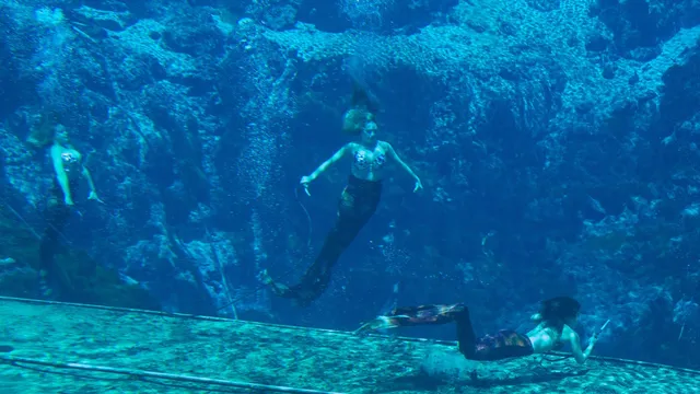
Weeki Wachee Springs State Park near Spring Hill is the only place on the planet still staging live underwater mermaid shows, performed since 1947 in a 400-seat theater built right into the limestone below the spring's surface. Watch costumed swimmers breathe from hidden air hoses as fish drift past the glass. In summer, cool off at Buccaneer Bay, Florida's only spring-fed waterpark, with slides, a lazy river, and a white sand beach.

Three Sisters Springs Springs

Three Sisters Springs

Crystal River, FL · Nature Coast

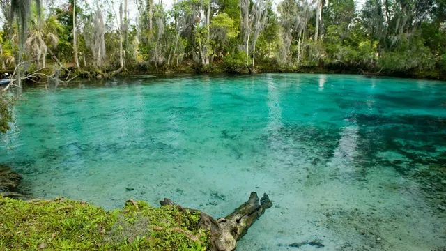
Three Sisters Springs in Crystal River is the only refuge created specifically to protect the Florida manatee, and in winter its sapphire spring run fills with hundreds of them seeking the warm 72 degree water. Follow the boardwalk above the springs for postcard views, or, when conditions allow, swim with the gentle giants in the clear shallows. Go on a cold morning from mid November through March for the biggest gatherings.

Silver Springs State Park Springs

Silver Springs State Park

Ocala, FL · North Central Florida

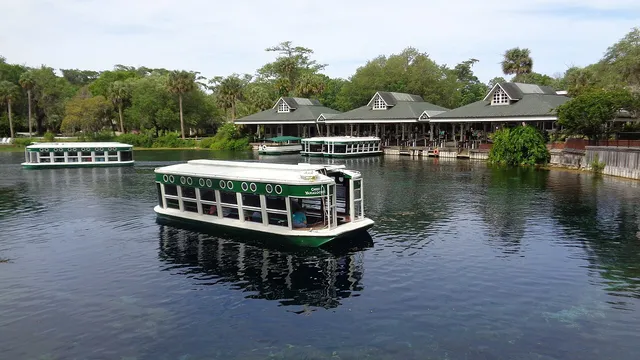
Silver Springs State Park in Ocala is the home of the glass bottom boat, invented here in the 1870s to peer into one of Florida's largest and clearest artesian springs. Glide over submerged limestone and underwater ruins while watching turtles, fish, gators, and wintering manatees drift below the hull. Paddle the spring fed Silver River afterward to spot wild rhesus macaques in the trees.

Edward Ball Wakulla Springs State Park Springs

Edward Ball Wakulla Springs State Park

Wakulla Springs, FL · Big Bend

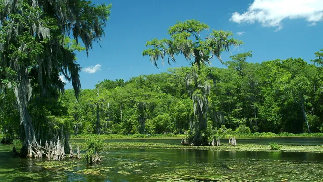
Edward Ball Wakulla Springs State Park near Tallahassee guards one of the largest and deepest freshwater springs on Earth, a sapphire pool 185 feet deep that feeds a wild, jungly river. Board a riverboat tour to glide past basking alligators, wading birds, and wintering manatees, or climb the diving platform for a plunge into the cool, clear water. The 1937 lodge, where Hollywood filmed early Tarzan pictures, anchors the visit year round.

Blue Spring State Park Springs

Blue Spring State Park

Orange City, FL · Central Florida

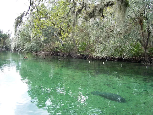
Blue Spring is Florida's premier manatee sanctuary, a first-magnitude spring that pumps out crystal-clear 72-degree water year-round into a short run off the St. Johns River near Orange City. From mid-November through March, hundreds of manatees crowd in to escape the cold, and a riverside boardwalk lets you watch them drift below. In warmer months the same spring becomes a favorite for swimming, snorkeling, and tubing.

Clearwater Beach Beaches

Clearwater Beach

Clearwater, FL · Tampa Bay

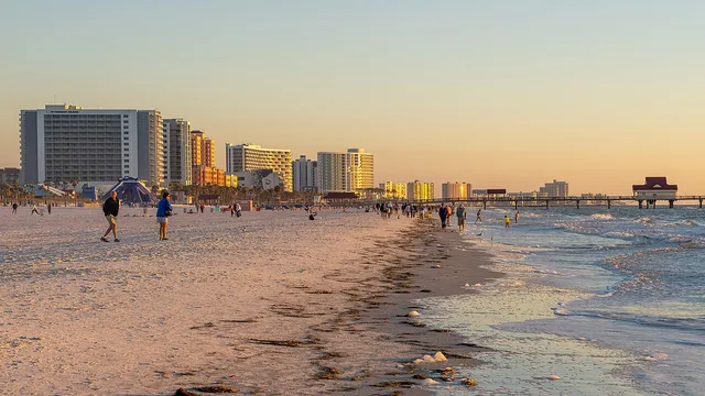
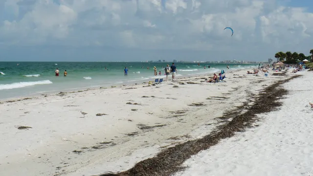
Clearwater's wide ribbon of ultra-fine white quartz sand meets calm, bath-warm Gulf water, with a walkable strip of cafes right behind it. Every evening the free Sunsets at Pier 60 festival fills the sand with buskers and makers before the sky goes pink. It is the easy do-everything Pinellas beach day: park once and stay through sunset.

Siesta Key Beach Beaches

Siesta Key Beach

Sarasota, FL · Tampa Bay

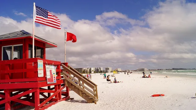
Siesta Key Beach near Sarasota runs on sand that is roughly 99 percent quartz, so fine and white it stays cool underfoot even on a hot afternoon and squeaks as you walk. Spread a towel on the wide flats, swim the calm turquoise Gulf shallows, then ride the free trolley into Siesta Key Village for dinner. Drumming circles draw crowds to the soft sand at sunset.

St. Pete Beach Beaches

St. Pete Beach

St. Pete Beach, FL · Tampa Bay

St. Pete Beach fronts the Gulf with a long ribbon of white sand and some of Florida's most reliable sunsets, all under the pink, 1928 silhouette of the Don CeSar hotel. Swim the warm shallows, walk the quieter sands down at Pass-a-Grille, or join a dolphin watching charter from Merry Pier. Stay through dusk, when the sky over the water turns to color.

Caladesi Island State Park Beaches

Caladesi Island State Park

Dunedin, FL · Tampa Bay

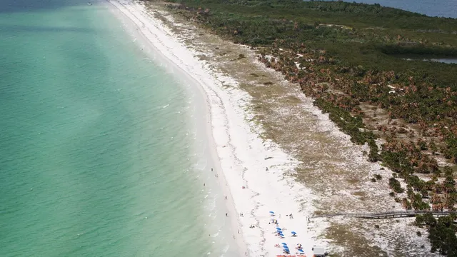
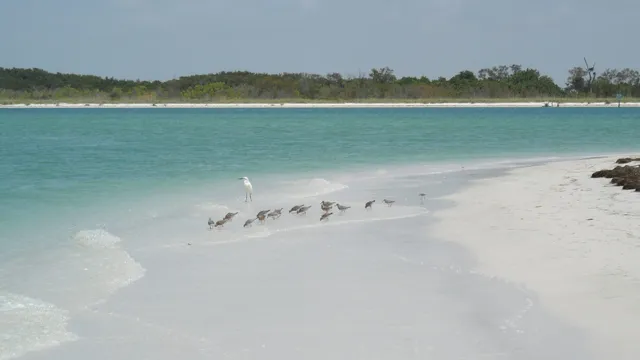
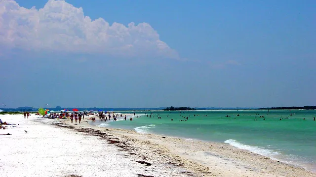
A roadless barrier island off Dunedin, reachable only by the ferry from Honeymoon Island or your own boat, which is exactly why its three miles of powder-white sand stay so quiet. Spread out on the wide Gulf beach, paddle the mangrove kayak trail, and work the shell-strewn flats most day-trippers skip. Just watch the last ferry back, or you are there for the night.

Bok Tower Gardens Gardens & wildlife

Bok Tower Gardens

Lake Wales, FL · Central Florida

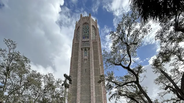
Bok Tower Gardens crowns Iron Mountain, one of the highest points on the Florida peninsula, with a 205-foot art deco and neo-Gothic Singing Tower rising above 50 acres of woodland gardens in Lake Wales. The tower's 60-bell carillon plays daily concerts, its sound carrying over a reflecting pool that mirrors the whole spire. Visit in late winter for peak camellia and azalea bloom.

Myakka River State Park Lakes & rivers

Myakka River State Park

Sarasota, FL · Tampa Bay

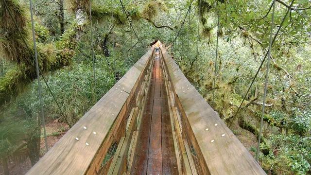
One of Florida's oldest and largest state parks, Myakka spreads 37,000 acres of wetlands, prairies, and hammocks along the slow Myakka River east of Sarasota. Climb the canopy walkway, the first public treetop trail in North America, suspended 25 feet up with a tower above the oaks, then board one of the giant airboats for an alligator-lined cruise on Upper Myakka Lake. Winter brings cooler air and crowds of wading birds.

Fort De Soto Park Beaches

Fort De Soto Park

Tierra Verde, FL · Tampa Bay

Fort De Soto Park spreads across five connected keys at the mouth of Tampa Bay, pairing nearly three miles of soft white-sand beach with a Spanish-American War coastal fort. Climb the old gun batteries, then cast off the Gulf Pier or paddle the canoe trail through mangroves. Ferries run from here to undeveloped Egmont Key and Shell Key, and the park has its own beach dog park.

Devil's Millhopper Geological State Park Canyons & deserts

Devil's Millhopper Geological State Park

Gainesville, FL · North Central Florida

Devil's Millhopper is a 120-foot-deep, 500-foot-wide sinkhole near Gainesville that hides a miniature rainforest where Florida almost never has one. A boardwalk and 132 steps descend past fern-draped limestone walls and trickling cascades to the cool, shaded bowl at the bottom. The seepage waterfalls run strongest in late winter and early spring, when the streams are at their fullest.

Tallulah Gorge State Park Lakes & rivers

Tallulah Gorge State Park

Tallulah Falls, GA · Northeast Georgia

Tallulah Gorge is one of the deepest canyons in the eastern United States, a two-mile chasm plunging nearly 1,000 feet through the north Georgia mountains. Hike the rim trails past a string of overlooks, then descend the metal staircase to a swaying suspension bridge that hangs 80 feet above the Tallulah River and its cascade of waterfalls. Grab one of the 100 free daily permits to reach the gorge floor.

Amicalola Falls State Park Lakes & rivers

Amicalola Falls State Park

Dawsonville, GA · North Georgia Mountains

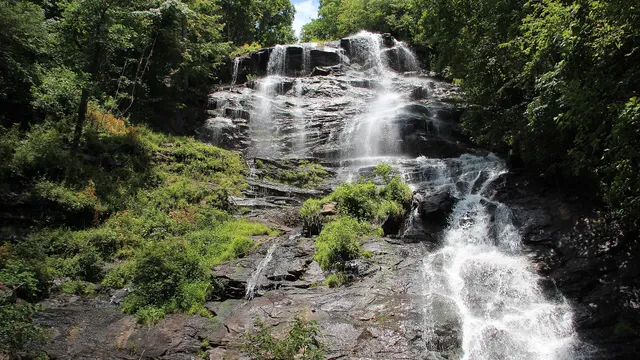
Amicalola Falls State Park near Dawsonville frames the tallest cascading waterfall in the Southeast, a 729-foot tumble of white water whose Cherokee name means tumbling waters. Climb the staircase trail alongside the cascade for a roaring close-up, or stroll the accessible path to the base. The park also marks the start of the 8.5-mile Approach Trail to Springer Mountain, the southern terminus of the Appalachian Trail.

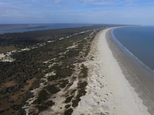
Cumberland Island National Seashore Beaches

Cumberland Island National Seashore

St. Marys, GA · Golden Isles

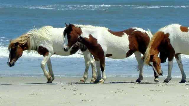
Cumberland Island is Georgia's largest barrier island, reachable only by ferry from St. Marys, where wild horses graze among the moss-draped oaks and tabby ruins of the Carnegie family's Dungeness estate. Beyond the historic district stretch more than 17 miles of undeveloped white-sand beach with almost no one on them. Spring and fall bring the mildest weather and the fewest bugs for hiking or biking the maritime forest.

Yellowstone National Park Volcanoes

Yellowstone National Park

West Yellowstone, MT, WY · Greater Yellowstone

America's first national park sprawls across nearly 3,500 square miles atop an active supervolcano, packing in more than half the world's geysers alongside canyons, waterfalls, and vast wildlife-rich valleys. The Old Faithful area is the iconic heart of the park, where the famous geyser erupts on a predictable schedule and boardwalks wind through steaming, rainbow-hued thermal basins. Plan two to three days minimum, because the distances are huge and bison, elk, bears, and wolves often slow the roads to a stop.

Yosemite National Park Mountains

Yosemite National Park

Mariposa, CA, CA · Sierra Nevada

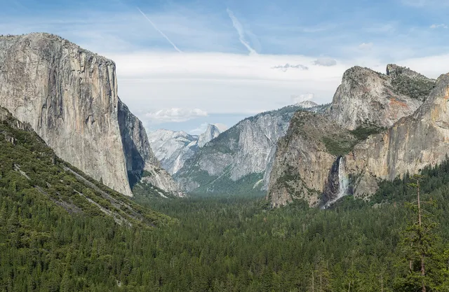
Yosemite is a Sierra Nevada showpiece where glacier-carved granite walls, thundering waterfalls, and ancient giant sequoias crowd into one valley floor. From the visitor hub in Yosemite Valley you can crane your neck at El Capitan and Half Dome, chase spring waterfall spray, or drive up to a viewpoint that frames the whole high country. It is one of the most scenic and worth-the-trip national parks in the country, though summer crowds and seasonal road closures reward visitors who plan ahead.

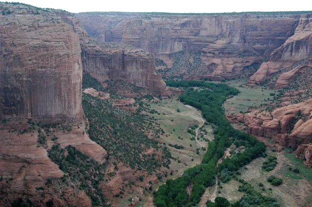
Grand Canyon National Park Canyons & deserts

Grand Canyon National Park

Tusayan, AZ · Grand Canyon

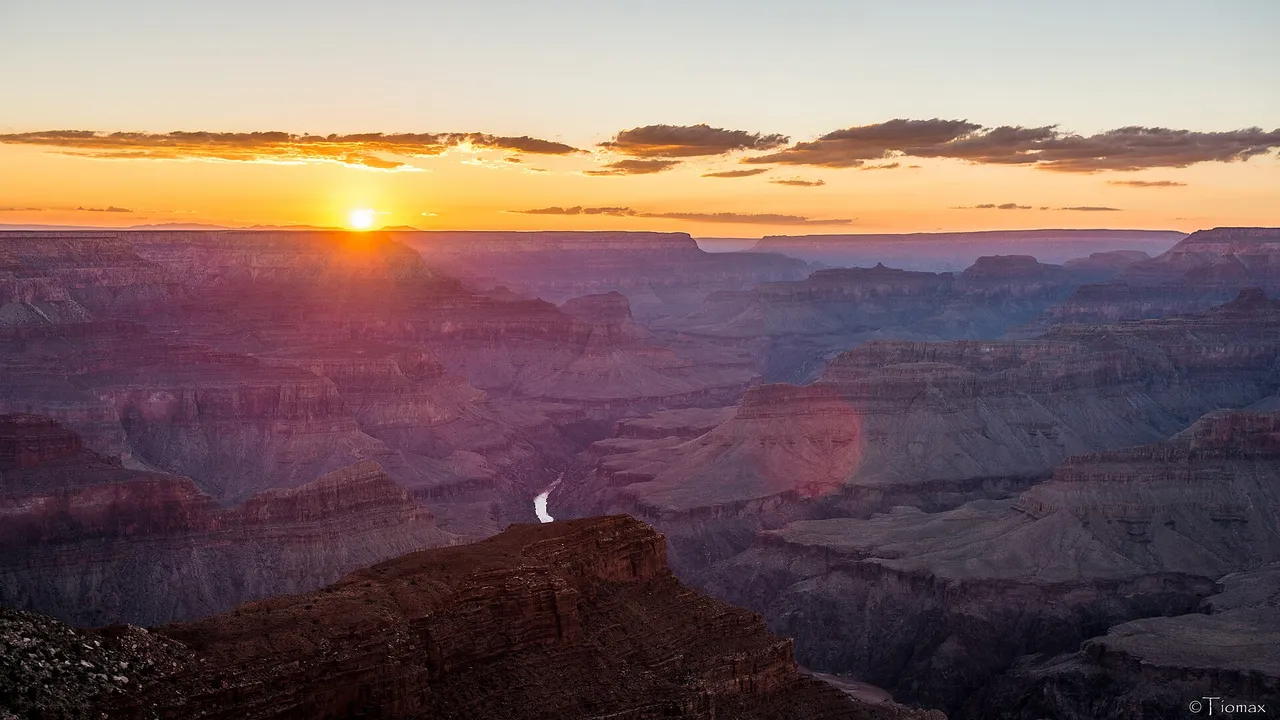
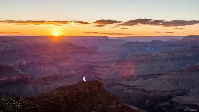
One of the world's great natural wonders, the Grand Canyon is a mile deep, up to 18 miles wide, and 277 river miles long, carved by the Colorado River over millions of years. The South Rim is open year round and packs the most accessible viewpoints, lodges, and trailheads, making it the side most visitors choose for a first trip. Sunrise and sunset set the layered red rock walls ablaze, and the sheer scale rewards anyone willing to make the journey.

Zion National Park Canyons & deserts

Zion National Park

Springdale, UT · Southern Utah

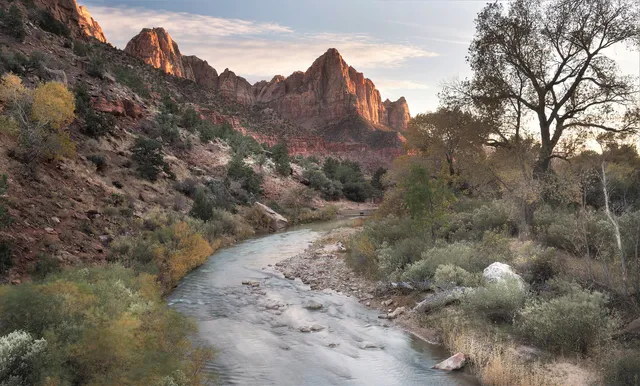
Zion National Park is a canyon wonderland in southwest Utah where the Virgin River has carved a deep gorge through towering walls of cream, pink, and red Navajo sandstone. Soaring cliffs, hanging gardens, and slot canyons make it one of the most dramatic and accessible parks in the country, with a free shuttle that carries visitors deep into Zion Canyon. It rewards both casual sightseers and serious adventurers, so it is well worth the trip for almost any traveler.

Great Smoky Mountains National Park Mountains

Great Smoky Mountains National Park

Gatlinburg, TN · Great Smoky Mountains

The most visited national park in the country, Great Smoky Mountains drapes the Tennessee, North Carolina border in blue, misty ridgelines, old growth forest, and some of the richest biodiversity in North America. Drive the Newfound Gap Road over the spine of the Appalachians, chase waterfalls on easy trails, and roll through Cades Cove at dawn for black bears, deer, and weathered pioneer cabins. Entry is free, and the park stays open year round, with spring wildflowers and fiery autumn color drawing the biggest crowds.

Acadia National Park Beaches

Acadia National Park

Bar Harbor, ME · Down East Maine

Acadia sprawls across Mount Desert Island where pink granite cliffs drop into the cold Atlantic, hardwood forests ring glacier-carved ponds, and a 27-mile Park Loop Road ties the highlights together. It is compact enough to see in a weekend yet packed with rocky coast, summit views, and historic carriage roads, making it one of the most rewarding parks in the Northeast. Start at the Hulls Cove Visitor Center near Bar Harbor for maps, the park film, and timed-entry details for Cadillac Mountain.

Rocky Mountain National Park Mountains

Rocky Mountain National Park

Estes Park, CO · Rocky Mountains

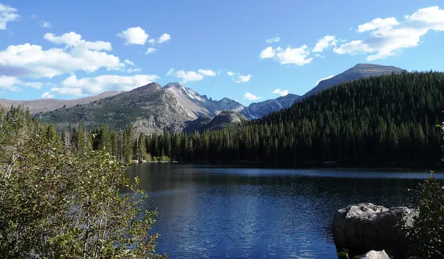
Rocky Mountain National Park packs more than 60 peaks above 12,000 feet into a single stretch of the Front Range, with alpine tundra, glacier-carved valleys, and elk grazing in open meadows. Trail Ridge Road climbs above 12,000 feet, making it the highest continuous paved road in the country and an easy way to reach the high country by car. With over 350 miles of trails, abundant wildlife, and dramatic scenery just 90 minutes from Denver, it is one of the most rewarding parks in the West to visit.

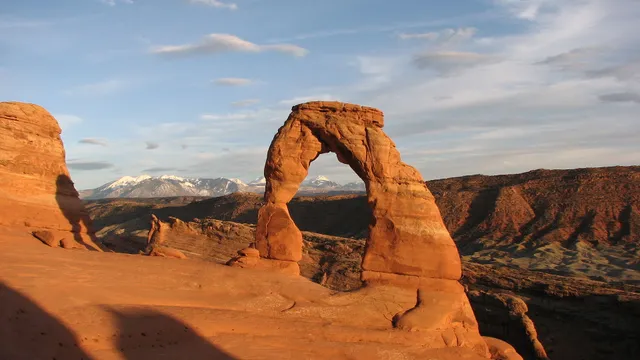
Arches National Park Canyons & deserts

Arches National Park

Moab, UT · Southern Utah

Arches National Park packs more than 2,000 natural sandstone arches into a compact, otherworldly landscape of red rock fins, balanced boulders, and soaring spires just north of Moab. A single scenic drive and short trails put icons like Delicate Arch and Landscape Arch within reach, making it one of the most rewarding national parks for a day visit. Go early or late to dodge midday crowds and catch the glowing light that sets the rock on fire.

Glacier National Park Mountains

Glacier National Park

West Glacier, MT, MT · Rocky Mountains

Straddling the Continental Divide in northern Montana, Glacier National Park packs more than a million acres of glacier-carved peaks, turquoise lakes, and alpine meadows into a single, jaw-dropping landscape. The famed Going-to-the-Sun Road threads 50 miles over the mountains, delivering some of the most dramatic driving views in the country, while a vast trail network puts hikers face to face with grizzlies, mountain goats, and the park's last remaining glaciers. It is a genuine bucket-list trip, well worth the journey for anyone chasing big mountain scenery.

Olympic National Park Mountains

Olympic National Park

Port Angeles, WA · Olympic Peninsula

Olympic National Park packs three wildly different worlds into one peninsula, with glacier-capped peaks, moss-draped temperate rainforests, and a rugged Pacific coastline of sea stacks and tide pools. From the Port Angeles visitor center you can drive up to Hurricane Ridge for sweeping mountain views or descend into the dripping green of the Hoh Rain Forest, all within a few hours. It is a genuine bucket-list trip for anyone who wants to see rainforest, mountains, and wild beach in a single day.

Shenandoah National Park Mountains

Shenandoah National Park

Front Royal, VA · Blue Ridge Mountains

Just 75 miles from Washington, D.C., Shenandoah strings 105 miles of Skyline Drive along the crest of the Blue Ridge Mountains, with more than 70 overlooks gazing out over the Shenandoah Valley and the rolling Virginia Piedmont. Beyond the road, over 500 miles of trails lead to waterfalls, granite summits, and quiet forests rich with deer, black bears, and wildflowers. It is a classic four-season escape, blazing with color in autumn and cool and green when the lowlands swelter in summer.

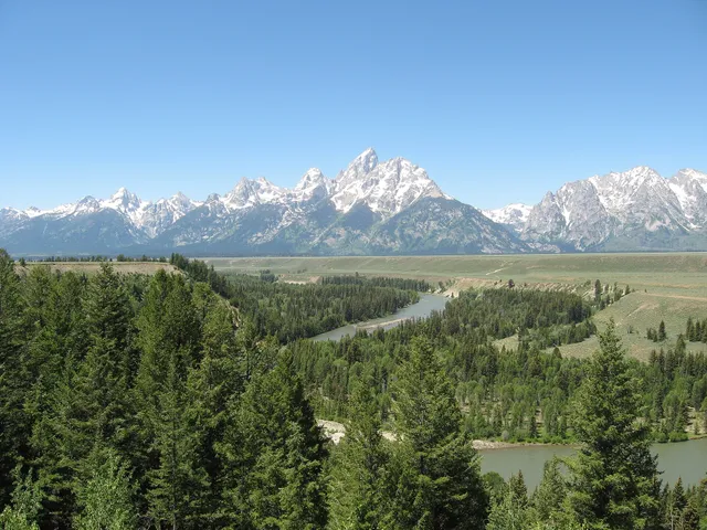
Grand Teton National Park Mountains

Grand Teton National Park

Jackson, WY · Rocky Mountains

Grand Teton National Park packs a wall of jagged, glacier carved peaks rising more than a mile straight up from the valley floor of Jackson Hole, with no foothills to soften the view. Cobalt alpine lakes, the winding Snake River, and abundant wildlife like moose, elk, bison, and bears spread out beneath the skyline, making it one of the most photographed mountain ranges in the country. It sits just south of Yellowstone, so many travelers pair the two, but the Tetons reward anyone who comes for the hiking, paddling, and sheer drama of the peaks alone.

Blue Ridge Parkway Mountains

Blue Ridge Parkway

Asheville, NC · Blue Ridge Mountains

The Blue Ridge Parkway winds 469 miles along the crests of the southern Appalachians, linking Shenandoah National Park in Virginia to the Great Smoky Mountains in North Carolina. There are no entrance fees and no rush, just slow two lane driving past overlooks, split rail fences, and blue layered ridges that fade to the horizon. Spring rhododendron, summer wildflowers, and a legendary fall color season make it one of the most scenic drives in America.

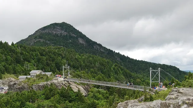
Grandfather Mountain Mountains

Grandfather Mountain

Linville, NC · Blue Ridge Mountains

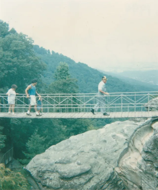
Grandfather Mountain is a privately run nature park in North Carolina's High Country, famous for the Mile High Swinging Bridge, a 228-foot suspension span that crosses an 80-foot chasm at an elevation of one mile. A winding two-mile scenic road climbs from the entrance gate to the summit parking area, where the bridge delivers 360-degree panoramic views of the Blue Ridge. With wildlife habitats, hiking trails, and a nature museum included with admission, it is an easy half-day stop that rewards the trip, weather permitting.

Linville Falls Lakes & rivers

Linville Falls

Linville Falls, NC · Blue Ridge Mountains

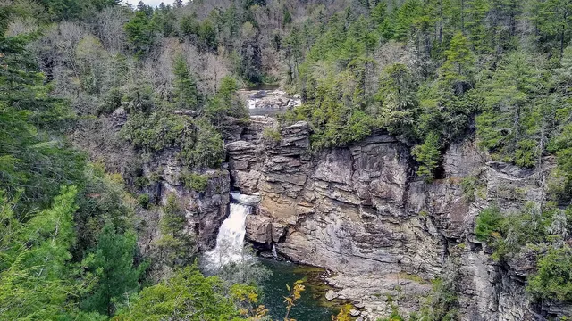
One of the most photographed waterfalls on the Blue Ridge Parkway, Linville Falls tumbles in dramatic tiers into the rugged depths of Linville Gorge, often called the Grand Canyon of the Southern Appalachians. From the visitor center near Milepost 316, well-maintained trails fan out to a series of overlooks, each framing the cascade and the gorge from a different angle. It is an easy stop for casual walkers yet rewarding enough for serious hikers who descend toward the plunge basin below.

Mount Mitchell State Park Mountains

Mount Mitchell State Park

Burnsville, NC · Blue Ridge Mountains

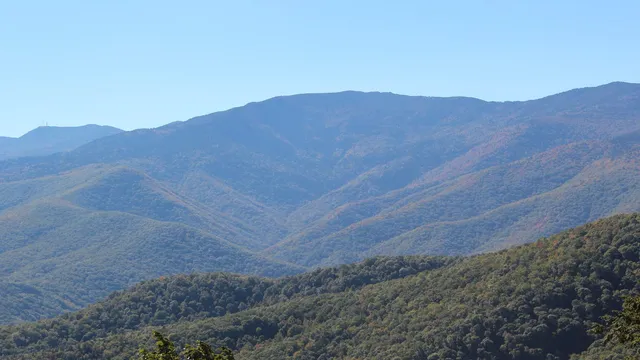
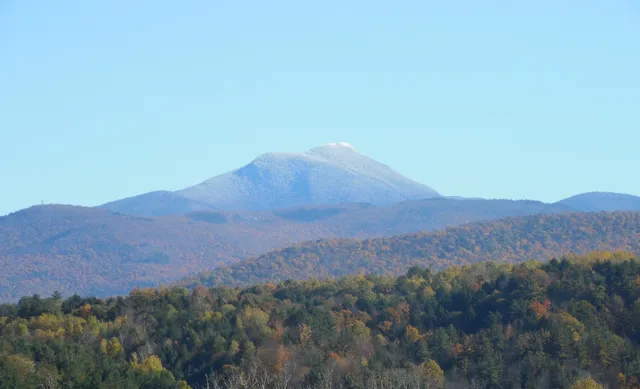
Mount Mitchell crowns the Black Mountains at 6,684 feet, the highest peak east of the Mississippi River, and a paved road carries you nearly to the top. A short walk reaches the summit observation deck, where on a clear day the view stretches across waves of blue ridges, while a fragrant Fraser fir forest gives the air a cool, almost Canadian feel. As the first state park in North Carolina, it pairs that easy summit access with serious trails, a seasonal restaurant, and a small natural history museum.

Maroon Bells Mountains

Maroon Bells

Aspen, CO · Rocky Mountains

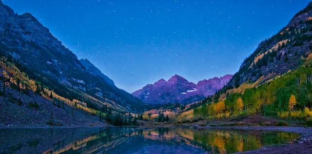
Two jagged 14,000 foot peaks of deep maroon mudstone rise above Maroon Lake, framing what is often called the most photographed scene in Colorado. The short, paved loop trails deliver postcard reflections within minutes of the parking area, while longer routes climb into the surrounding wilderness for those who want solitude. Plan ahead, because timed shuttle and parking reservations are required during the busy season from late spring through fall.

Garden of the Gods Canyons & deserts

Garden of the Gods

Colorado Springs, CO · Rocky Mountains

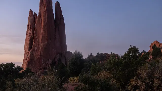
Garden of the Gods is a free public park where towering fins of red sandstone rise dramatically against the backdrop of Pikes Peak. Easy paved trails wind right up to the iconic formations, making the signature scenery accessible to almost anyone, while climbers, cyclists, and horseback riders find plenty to explore. The free Visitor and Nature Center across from the main entrance offers exhibits, guided walks, and the best first stop for orientation.

Hanalei Bay Beaches

Hanalei Bay

Hanalei, HI · Kauai

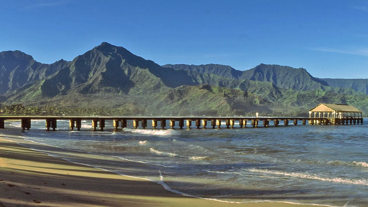
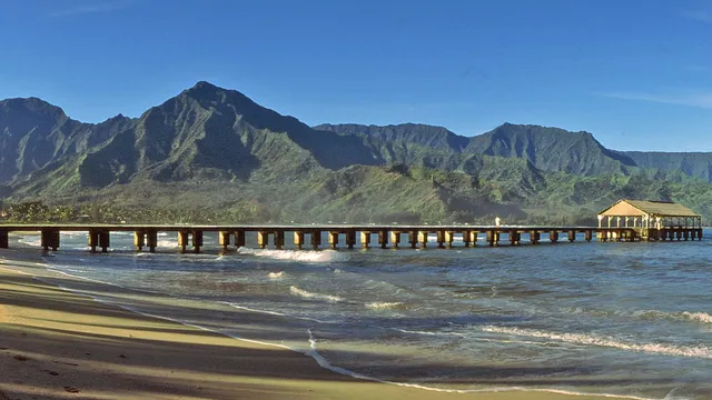
Hanalei Bay is a two mile crescent of golden sand on Kauai's north shore, framed by emerald mountains laced with waterfalls and anchored by the historic Hanalei Pier. Calm, swimmable water in summer gives way to powerful surf in winter, drawing surfers, paddleboarders and sunset watchers year round. It is widely considered one of the most beautiful beaches in Hawaii, and the easy stroll out onto the pier delivers the postcard view that makes the trip worth it.

Cannon Beach Beaches

Cannon Beach

Cannon Beach, OR · Oregon Coast

Cannon Beach is one of Oregon's most photographed stretches of coast, anchored by Haystack Rock, a 235-foot sea stack that rises straight out of the sand at the tide line. At low tide you can walk right up to its base to explore tide pools full of starfish and anemones, while tufted puffins, gulls, and cormorants nest on the rock above. The wide, walkable beach, the artsy downtown a few blocks inland, and the dramatic headlands of nearby Ecola State Park make it an easy and rewarding day trip about 80 miles west of Portland.

Coronado Beach Beaches

Coronado Beach

San Diego, CA · San Diego

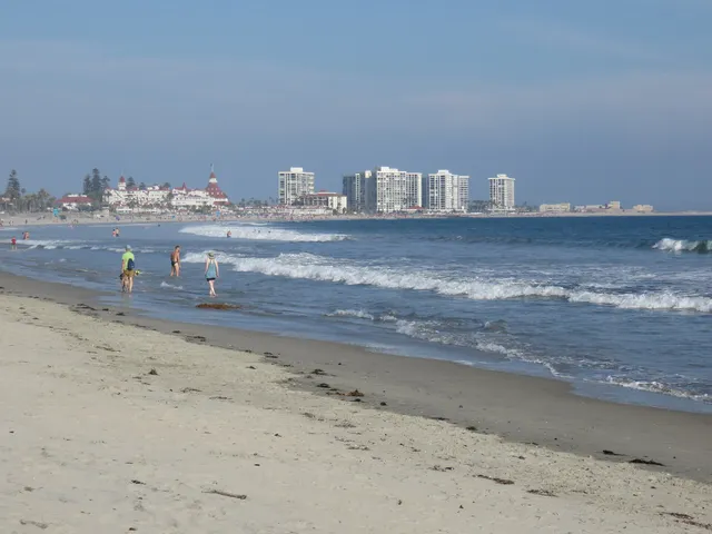
Coronado Central Beach is a mile and a half of wide, golden sand that glitters from flecks of mica, stretching beneath the turrets of the historic Hotel del Coronado just across the bay from San Diego. Regularly ranked among the best beaches in America, it offers gentle surf, year round lifeguards, and room to spread out for swimming, surfing, or a sunset stroll. With fire rings, volleyball courts, and the iconic red roofed hotel as a backdrop, it is an easy and worthwhile day trip for almost any traveler.

Cape Hatteras National Seashore Beaches

Cape Hatteras National Seashore

Buxton, NC · Outer Banks

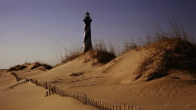
Cape Hatteras National Seashore stretches more than 70 miles down the Outer Banks barrier islands, offering wide undeveloped beaches, rolling dunes, and some of the best surf and shelling on the East Coast. Its centerpiece is the black and white spiral striped Cape Hatteras Lighthouse, the tallest brick lighthouse in the United States, which visitors can climb for sweeping views of where the Atlantic currents collide off the Graveyard of the Atlantic. With miles of uncrowded shoreline, world class fishing, and dependable wind, it rewards travelers looking for raw coastal wilderness rather than a built up resort strip.

Badlands National Park Canyons & deserts

Badlands National Park

Interior, SD · High Plains

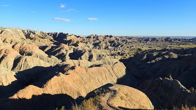
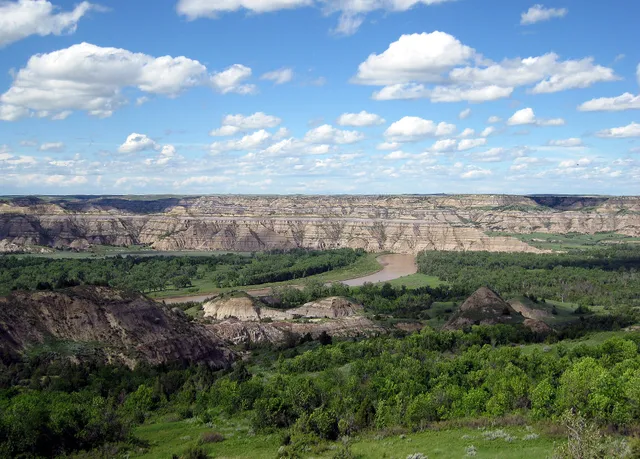
The Badlands rise from South Dakota's prairie as a maze of sharply eroded buttes, spires, and banded pinnacles, the layers stacked in stripes of rust, gold, and gray. Walk the boardwalk-and-scramble Door Trail straight into the formations near Interior, or drive the Badlands Loop Road for bighorn sheep, bison, and prairie dogs. The park also guards one of the world's richest fossil beds, where ancient horses and saber-toothed cats once roamed.

Big Bend National Park Canyons & deserts

Big Bend National Park

Terlingua, TX · Chihuahuan Desert, West Texas

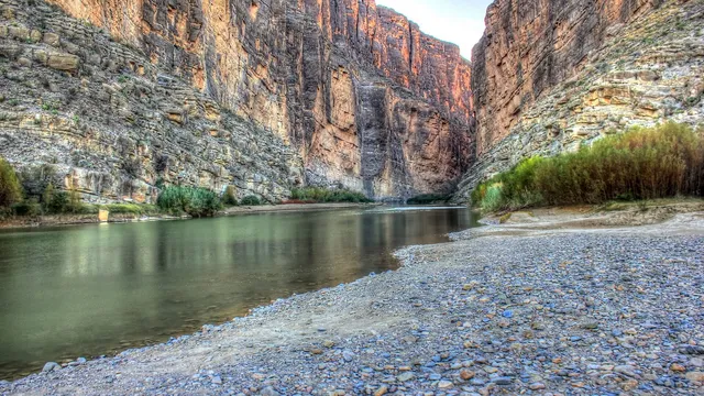
Big Bend is named for the sweeping curve where the Rio Grande turns north along the Texas-Mexico border, wrapping over 800,000 acres of Chihuahuan Desert, river canyons, and the entire Chisos mountain range. Walk the short Santa Elena Canyon trail beneath limestone walls that rise some 1,500 feet and narrow to a slot barely wide enough for the river. One of the most remote parks in the lower 48, it rewards visitors with vast solitude and famously dark night skies.

Biscayne National Park Lakes & rivers

Biscayne National Park

Homestead, FL · The Everglades

Just south of Miami, Biscayne is a national park you mostly explore by boat: about 95 percent of it is water, protecting the northern reaches of the only living coral barrier reef in the continental United States. Snorkel or dive the Maritime Heritage Trail, a chain of six shipwrecks spanning nearly a century, or paddle the mangrove shoreline. Boca Chita Key, with its 1930s ornamental lighthouse, makes the classic day trip across the turquoise bay.

Black Canyon of the Gunnison National Park Canyons & deserts

Black Canyon of the Gunnison National Park

Montrose, CO · Western Slope, Colorado

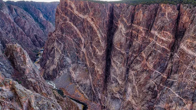
One of America's deepest, narrowest gorges, Black Canyon of the Gunnison drops as much as 2,722 feet through dark, lichen-stained walls so steep and shadowed that parts of the canyon floor see only minutes of sun a day. Stand at the South Rim's Painted Wall Overlook, where pink pegmatite stripes streak the tallest cliff in Colorado, then drive the South Rim Road between viewpoints near Montrose. Designated a Dark Sky Park, it hosts a summer astronomy festival.

Bryce Canyon National Park Canyons & deserts

Bryce Canyon National Park

Bryce Canyon City, UT · Southern Utah

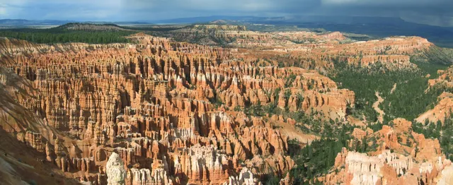
Bryce isn't really a canyon but a string of natural amphitheaters carved into Utah's high plateau, packed with orange hoodoos that catch fire at sunrise. Hike the Navajo Loop down among the spires past Thor's Hammer and Wall Street, or trace the rim past Inspiration and Sunset Points. At over 8,000 feet, this certified Dark Sky Park ranks among the best stargazing in the country.

Canyonlands National Park Canyons & deserts

Canyonlands National Park

Moab, UT · Southern Utah

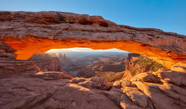
Carved where the Green and Colorado rivers meet, Canyonlands splinters into mesas, spires, and stacked canyons spread across four wild districts outside Moab. Most visitors head to Island in the Sky, where the half-mile walk to Mesa Arch frames a sunrise that ignites the underside of the stone above a thousand-foot drop. For solitude, the Needles offers redrock pinnacles and miles of backcountry trail.

Capitol Reef National Park Canyons & deserts

Capitol Reef National Park

Torrey, UT · Southern Utah

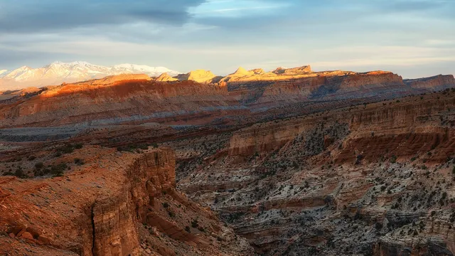
Capitol Reef wraps around the Waterpocket Fold, a nearly 100-mile wrinkle in the earth's crust where white Navajo sandstone domes stack above red cliffs near Torrey. Hike the moderate trail to Hickman Bridge, a 133-foot natural span, then drop into the historic Fruita district to pick apples and peaches from pioneer orchards and grab a pie at the Gifford House. Spring blossoms and fall harvest are the sweetest times to come.

Carlsbad Caverns National Park Caves

Carlsbad Caverns National Park

Carlsbad, NM · Guadalupe Mountains, Chihuahuan Desert

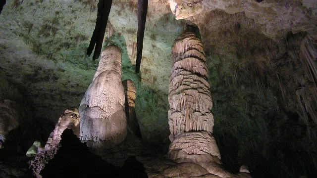
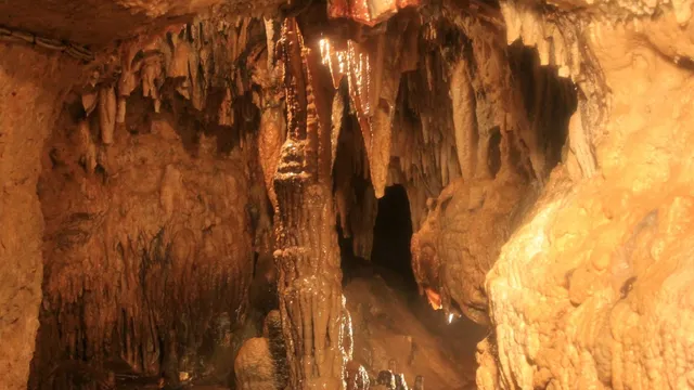
Carlsbad Caverns drops visitors into a hidden world beneath the New Mexico desert, where a self-guided trail winds through the Big Room, the largest single cave chamber in North America at over 8 acres. Stalagmites, soaring columns, and delicate formations fill the dim, cool dark. From spring through October, hundreds of thousands of Brazilian free-tailed bats spiral out of the natural entrance at dusk in one of the country's great wildlife spectacles.

Channel Islands National Park Lakes & rivers

Channel Islands National Park

Ventura, CA · Southern California Coast

Often called the American Galapagos, Channel Islands National Park spans five rugged, undeveloped islands off the Ventura coast, home to roughly 145 species found nowhere else on Earth, including the diminutive island fox. Boat out to Santa Cruz or Anacapa to kayak sea caves and kelp forests, or hike past Anacapa's iconic 40-foot Arch Rock. Reach it by ferry from Ventura Harbor, where the park's mainland visitor center sits on Spinnaker Drive.

Congaree National Park Forests

Congaree National Park

Hopkins, SC · Congaree River floodplain, central South Carolina

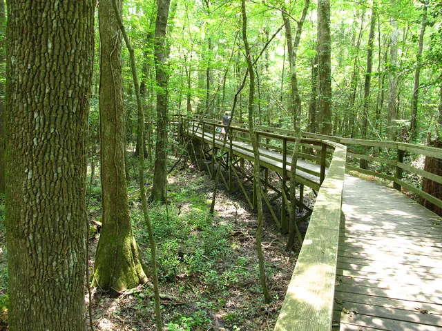
Congaree National Park protects the largest tract of old-growth bottomland hardwood forest left in the country, a floodplain of towering bald cypress and tupelo near Hopkins, South Carolina. Walk the 2.6-mile elevated Boardwalk Loop past cypress knees and trees over 500 years old, home to some of the tallest trees in the eastern U.S. For two weeks in late spring, the park's synchronous fireflies flash in unison, one of only a few places in North America where that happens.

Crater Lake National Park Lakes & rivers

Crater Lake National Park

Klamath Falls, OR · Cascade Range, Southern Oregon

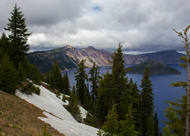
Crater Lake fills the collapsed caldera of Mount Mazama, a volcano that blew its top roughly 7,700 years ago, leaving the deepest lake in the United States at nearly 1,950 feet. Fed only by rain and snow, its water is so clear it glows an almost unreal sapphire blue, with Wizard Island, a cinder cone, rising near the western shore. Drive the 33-mile Rim Drive in summer or strap on skis when winter buries the road.

Cuyahoga Valley National Park Lakes & rivers

Cuyahoga Valley National Park

Peninsula, OH · Northeast Ohio

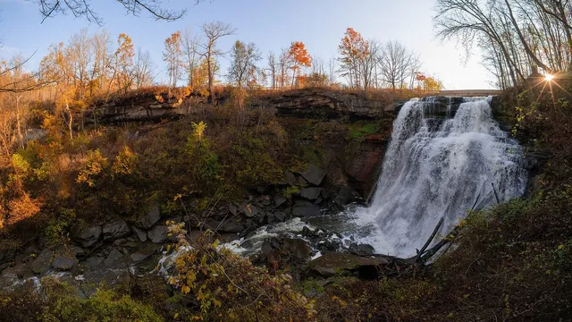
Ohio's only national park, Cuyahoga Valley follows the winding Cuyahoga River between Cleveland and Akron, threading waterfalls, wetlands, and old canal towns into one free-to-enter green corridor. Its centerpiece is 65-foot Brandywine Falls, reached by a short boardwalk near Peninsula, while the flat Ohio and Erie Canal Towpath Trail traces the route mules once walked towing canal boats. Ride the Cuyahoga Valley Scenic Railroad to hop between trailheads without driving.

Death Valley National Park Canyons & deserts

Death Valley National Park

Furnace Creek, CA · Mojave Desert

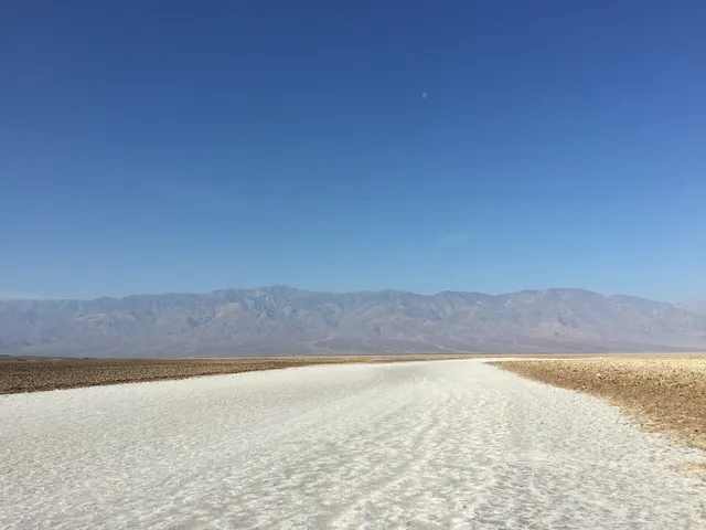
Death Valley National Park is the hottest, driest, and lowest national park in the country, a vast basin of salt flats, sculpted badlands, and dunes near Furnace Creek, California. Walk out onto the cracked white polygons of Badwater Basin at 282 feet below sea level, the lowest point in North America, then catch sunrise over the rippled ridges of Zabriskie Point. Come October through April, when the desert heat eases to comfortable hiking weather.

Denali National Park Mountains

Denali National Park

Denali Park, AK · Interior Alaska

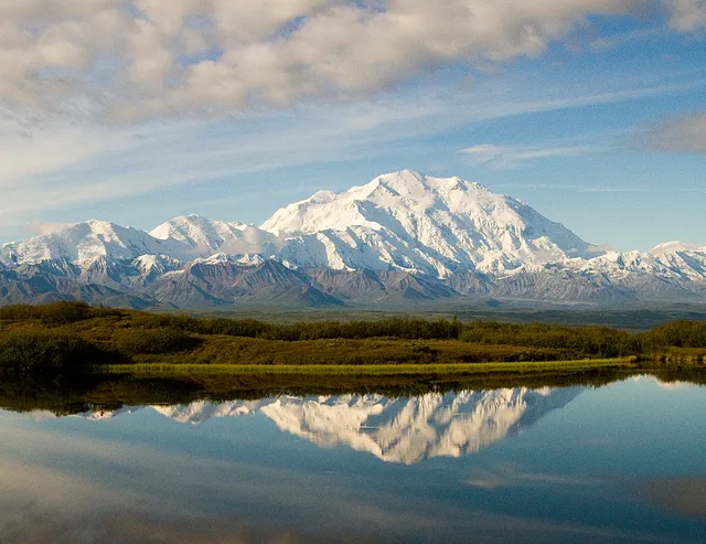
Denali National Park is built around Denali itself, the 20,310-foot giant that is the highest peak in North America, looming over six million acres of Alaskan tundra, taiga, and braided rivers. A single 92-mile road threads the wilderness, where park buses turn up grizzlies, caribou, moose, and Dall sheep against the backdrop of the Alaska Range. Visit between mid-May and early September, when the buses run and the mountain is most likely to show.

Gates of the Arctic National Park Mountains

Gates of the Arctic National Park

Bettles, AK · Brooks Range, Interior Alaska

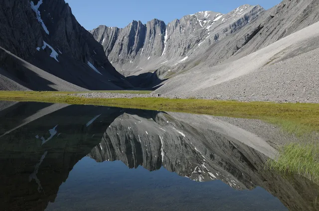
Gates of the Arctic is the least-visited and most uncompromising park in the system, 8.5 million roadless acres straddling the Brooks Range entirely above the Arctic Circle near Bettles, Alaska. There are no trails, no campgrounds, and no cell service, so you bush-plane in and route your own way past granite spires like the Arrigetch Peaks and along wild rivers such as the Alatna. Come in summer, when the Western Arctic caribou herd, some 225,000 strong, threads through the valleys.

Gateway Arch National Park Lakes & rivers

Gateway Arch National Park

St. Louis, MO · Gateway to the West, Missouri

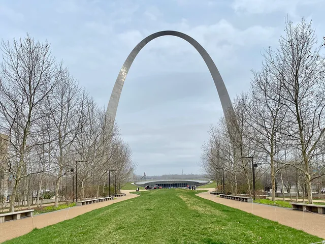
Gateway Arch is the most unusual national park in the country, a single 630-foot stainless-steel curve on the St. Louis riverfront that doubles as the nation's tallest monument. Ride the tram up inside one leg to an observation deck for a long look over the Mississippi River and the city, then walk the riverside grounds and the museum tracing America's westward expansion. At about 91 acres it is the smallest national park, easily seen in a day.

Glacier Bay National Park Mountains

Glacier Bay National Park

Gustavus, AK · Southeast Alaska

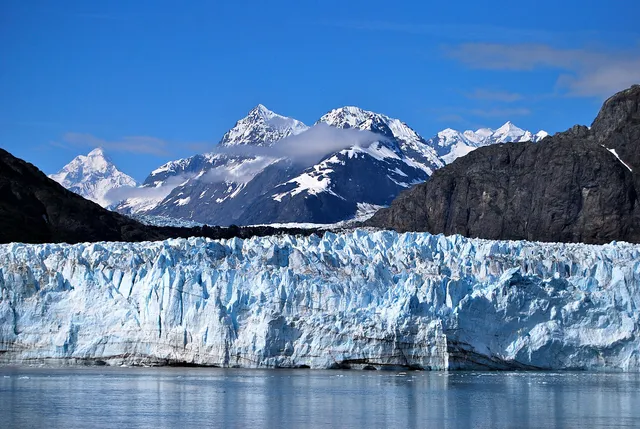
Glacier Bay is a living showcase of ice meeting the sea, a network of fjords near Gustavus where more than ten tidewater glaciers spill toward salt water. The headliner is Margerie Glacier at the head of Tarr Inlet, a mile-wide wall that calves house-sized slabs into the bay with a crack like thunder. More than 90 percent of visitors arrive by cruise ship, but summer kayakers and tour boats also catch the roughly 100 humpback whales that feed here.

Great Basin National Park Mountains

Great Basin National Park

Baker, NV · Eastern Nevada

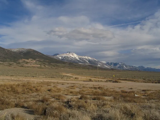
Great Basin packs an improbable range of worlds into one quiet corner of eastern Nevada near Baker, rising from sagebrush desert to 13,063-foot Wheeler Peak. Take the ranger-led tour through Lehman Caves, a marble cavern threaded with delicate shields and stalactites, then climb to the bristlecone pine grove where some trees have stood nearly 5,000 years. As an International Dark Sky Park, its nights deliver some of the blackest, most star-thick skies in the country.

Great Sand Dunes National Park Canyons & deserts

Great Sand Dunes National Park

Mosca, CO · San Luis Valley, Colorado

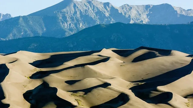
Great Sand Dunes National Park holds the tallest dunes in North America, a 30-square-mile sea of sand rising up to 750 feet against the jagged Sangre de Cristo Mountains near Mosca, Colorado. Climb the ridgeline to Star Dune or sandboard down the slopes, then cool off in seasonal Medano Creek at the dune base. Spring through early summer is prime, when snowmelt feeds the creek's wide, beachy flow.

Guadalupe Mountains National Park Mountains

Guadalupe Mountains National Park

Salt Flat, TX · West Texas / Chihuahuan Desert

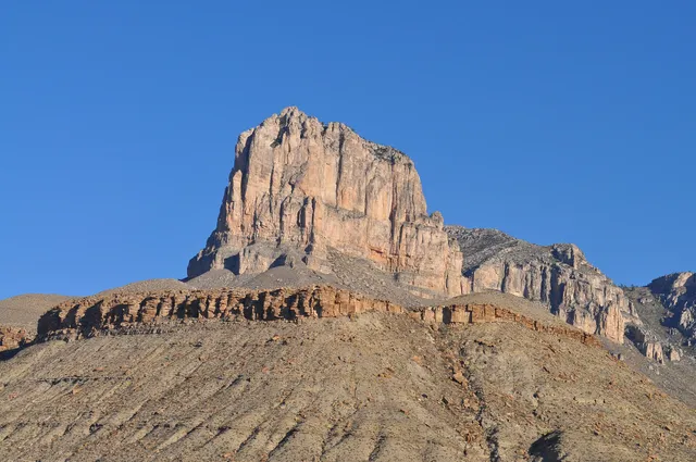
Guadalupe Mountains National Park rises from the West Texas desert as an exposed fossil reef from the Permian sea, crowned by Guadalupe Peak, the highest point in Texas at 8,751 feet. Hike the steep trail to that summit or stand beneath El Capitan, the sheer limestone prow that signals the range from miles away. In late October, McKittrick Canyon blazes with bigtooth maples, a rare burst of fall color in the desert.

Haleakala National Park Volcanoes

Haleakala National Park

Pukalani, HI · Maui, Hawaii

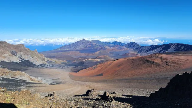
Haleakala National Park crowns Maui with a 10,023-foot summit whose name means house of the sun, and watching dawn break over its vast, cinder-cone-studded crater is the park's signature ritual (a reservation is required to enter before 7 a.m.). Hike the otherworldly Sliding Sands Trail down into the basin, or drop to the Kipahulu coast for waterfalls and bamboo forest. Pack warm layers; the summit is far colder than the beach below.

Hawaii Volcanoes National Park Volcanoes

Hawaii Volcanoes National Park

Volcano, HI · Big Island, Hawaii

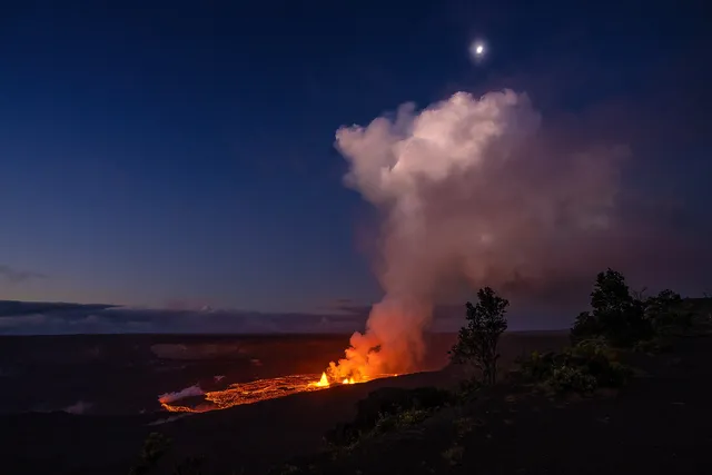
Hawaii Volcanoes National Park on the Big Island puts you on the slopes of two of the world's most active volcanoes, Kilauea and the massive Mauna Loa. Walk through the lush Nahuku lava tube, peer into the steaming Halemaumau crater, and follow Chain of Craters Road nearly 4,000 feet down to where old lava flows meet the sea. When Kilauea is erupting, the caldera glows red after dark.

Hot Springs National Park Volcanoes

Hot Springs National Park

Hot Springs, AR · Ouachita Mountains

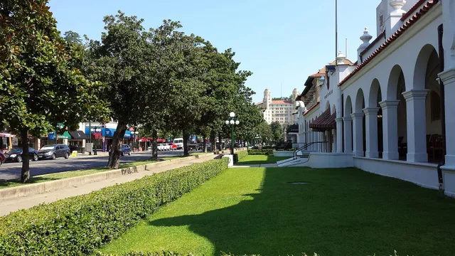
Hot Springs National Park threads through the city of Hot Springs, Arkansas, where 47 thermal springs send roughly 700,000 gallons of 143-degree water flowing up through the Ouachita Mountains each day. Stroll Bathhouse Row, the country's largest collection of early 20th-century bathhouses, and soak the old-fashioned way inside the marble-and-tile Buckstaff or Quapaw. Protected since 1832, it predates Yellowstone as a federal reservation.

Indiana Dunes National Park Canyons & deserts

Indiana Dunes National Park

Porter, IN · Northwest Indiana, Lake Michigan shore

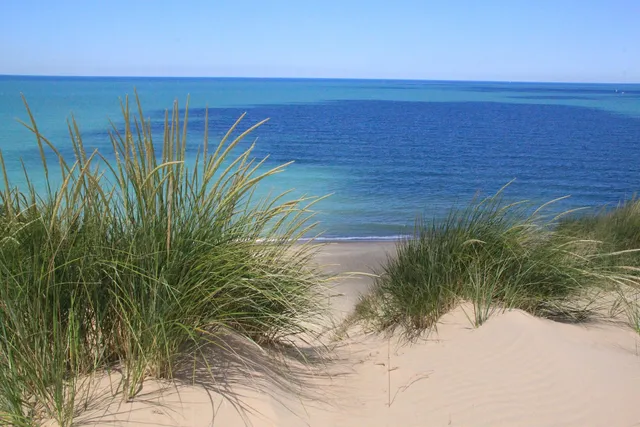
Indiana Dunes National Park packs roughly 15 miles of Lake Michigan shoreline and 15,000 acres of dunes, marsh, prairie, and woods into the industrial corner of Northwest Indiana. Climb the shifting sand of Mount Baldy, a 120-foot living dune that creeps inland a few feet each year, for views across the water to the distant Chicago skyline. One of the most biodiverse parks in the system, it rewards birders and beachgoers alike.

Isle Royale National Park Lakes & rivers

Isle Royale National Park

Houghton, MI · Lake Superior, Upper Peninsula

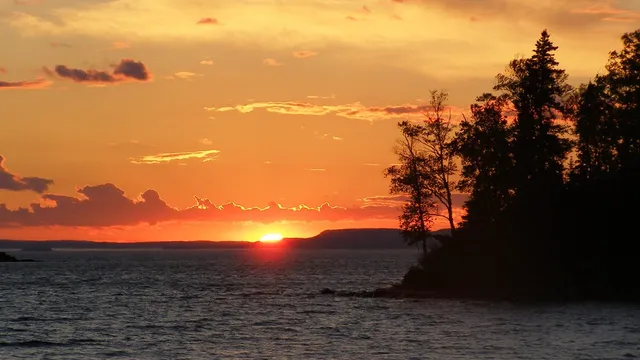
Isle Royale National Park is a remote, roadless archipelago in far western Lake Superior, reachable only by ferry or seaplane and almost entirely designated wilderness. Backpackers trace ridgeline trails like the Greenstone past inland lakes while paddlers thread the rocky coves of Rock Harbor. The island anchors the longest-running predator-prey study on Earth, tracking its wolves and moose since 1958.

Joshua Tree National Park Canyons & deserts

Joshua Tree National Park

Joshua Tree, CA · Mojave Desert

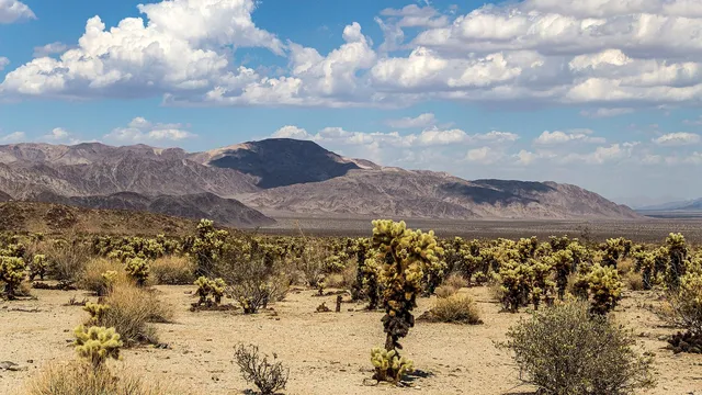
Joshua Tree National Park is where two California deserts collide, the high Mojave bristling with twisted Joshua trees and the lower Colorado giving way to spiny ocotillo and cholla. Scramble the wind-sculpted granite at Hidden Valley, then drive up to Keys View for a 5,000-foot panorama over the Coachella Valley and the San Andreas Fault. Spring wildflowers and famously dark night skies make it a draw year round.

Katmai National Park Volcanoes

Katmai National Park

King Salmon, AK · Alaska Peninsula

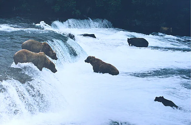
Katmai National Park on the Alaska Peninsula is famous for its brown bears, which gather at Brooks Falls each summer to snatch leaping salmon midair, the scene behind the wildly popular Fat Bear Week. The park was born from catastrophe: the 1912 Novarupta eruption, the largest of the 20th century, buried a valley in ash now called the Valley of Ten Thousand Smokes. Most visitors arrive by floatplane.

Kenai Fjords National Park Lakes & rivers

Kenai Fjords National Park

Seward, AK · Kenai Peninsula, Alaska

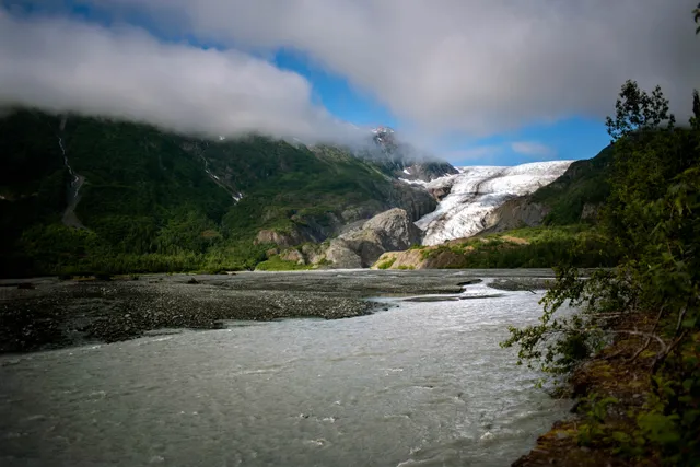
Kenai Fjords is where ice meets the sea, a 600,000-acre park outside Seward, Alaska where the 700-square-mile Harding Icefield feeds roughly 40 glaciers that grind down to the Gulf of Alaska. Exit Glacier is the one spot reachable by road, with trails leading right up to the receding ice or climbing 3,000 feet to an icefield overlook. Most visitors take a summer boat tour to watch tidewater glaciers calve and spot whales, sea otters, and puffins.

Kings Canyon National Park Canyons & deserts

Kings Canyon National Park

Fresno, CA · Sierra Nevada

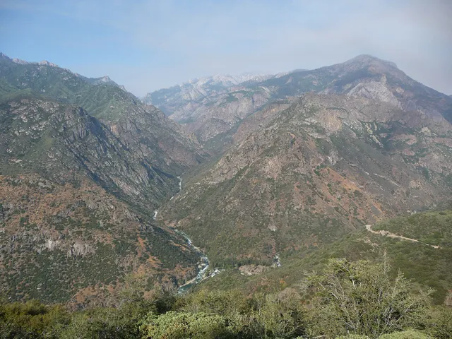
Kings Canyon plunges deeper than the Grand Canyon, with rock walls rising more than 8,000 feet above the roaring South Fork of the Kings River east of Fresno. The park also shelters giant sequoias, including the General Grant, the third-largest tree on Earth and the nation's official Christmas tree. Drive the dramatic Kings Canyon Scenic Byway down to Cedar Grove in summer, then hike the granite high country of the southern Sierra Nevada.

Kobuk Valley National Park Canyons & deserts

Kobuk Valley National Park

Kotzebue, AK · Northwest Arctic Alaska

One of the least-visited parks in the country, Kobuk Valley sits above the Arctic Circle with no roads, trails, or services, reachable only by bush plane or boat from Kotzebue. Its strangest feature is the Great Kobuk Sand Dunes, 25 square miles of rolling sand left by Ice Age glaciers, the largest active dune field in the Arctic. Each fall, hundreds of thousands of caribou ford the Kobuk River at Onion Portage in one of North America's great migrations.

Lake Clark National Park Volcanoes

Lake Clark National Park

Port Alsworth, AK · Southwest Alaska

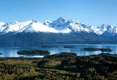
Lake Clark is a land of fire and ice where two active volcanoes, Redoubt and Iliamna, rise above 10,000 feet over turquoise glacial lakes and the Chigmit Mountains. The roadless park near Port Alsworth holds one of Alaska's densest brown bear populations, drawn to the coastal sedge flats and the salmon-rich waters that feed Bristol Bay. Fly in to watch bears graze the tidal meadows, paddle the 40-mile namesake lake, or hike the Tanalian trails for sweeping Aleutian Range views.

Lassen Volcanic National Park Volcanoes

Lassen Volcanic National Park

Mineral, CA · Southern Cascades, Northern California

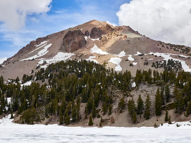
Lassen Volcanic National Park is a working showcase of every volcano type on earth, crowned by Lassen Peak, one of the largest plug-dome volcanoes in the world, which erupted as recently as 1915. Hike the 2.7-mile trail to Bumpass Hell, the park's largest hydrothermal basin, where boardwalks thread between roaring steam vents, boiling mud pots, and milky turquoise pools. Snow lingers into summer, so the high country near Mineral opens late and stays cool.

Mammoth Cave National Park Caves

Mammoth Cave National Park

Cave City, KY · Kentucky Cave Country

Mammoth Cave is the longest known cave system on Earth, with more than 426 mapped miles of passages winding through Kentucky limestone laid down hundreds of millions of years ago. Ranger-led tours drop visitors into a constant 54-degree underworld of vast rotundas, vertical shafts, and tight squeezes like Fat Man's Misery. The Historic Tour traces the same corridors people have walked since the early 1800s, past Broadway and the Bottomless Pit.

Mesa Verde National Park Canyons & deserts

Mesa Verde National Park

Cortez, CO · Four Corners, Southwest Colorado

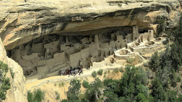
Mesa Verde preserves the cliff dwellings of the Ancestral Puebloans, who tucked entire stone villages into sandstone alcoves above the canyons of southwest Colorado some 800 years ago. The centerpiece is Cliff Palace, the largest cliff dwelling in North America, with roughly 150 rooms and 23 kivas reached on a ranger-led tour by ladder and footpath. Spring and fall bring the best weather and ticketed access near Cortez.

Mount Rainier National Park Mountains

Mount Rainier National Park

Ashford, WA · Cascade Range

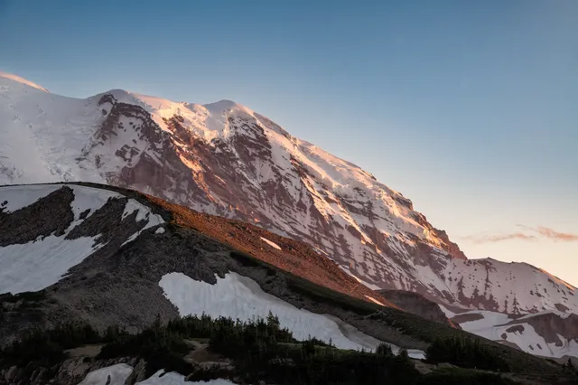
Mount Rainier is the most heavily glaciated peak in the contiguous United States, a 14,410-foot active volcano cloaked in more than two dozen glaciers and ringed by old-growth forest. From the Paradise area at 5,400 feet, subalpine meadows erupt with wildflowers in July and August beneath ice spilling off the summit. Serious hikers circle the whole mountain on the 93-mile Wonderland Trail.

New River Gorge National Park Canyons & deserts

New River Gorge National Park

Fayetteville, WV · Appalachian Mountains, West Virginia

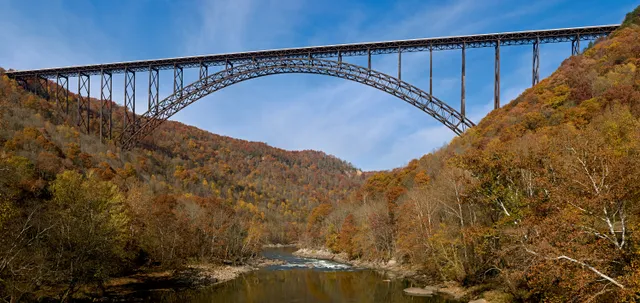
New River Gorge National Park follows one of the oldest rivers on the continent as it carves a deep, forested canyon through southern West Virginia near Fayetteville. The 876-foot New River Gorge Bridge arches over it all, framing the most photographed view in the state, while the river below delivers some of the East's best whitewater, including Class IV+ rapids on the Lower New. Spring and fall bring big water and blazing color to the rim trails.

North Cascades National Park Mountains

North Cascades National Park

Newhalem, WA · North Cascades, Washington

North Cascades National Park packs more than 300 glaciers into a wall of jagged, snow-streaked peaks, the most heavily glaciated park in the Lower 48. Pull off Highway 20 at the Diablo Lake overlook, where glacial rock flour turns the water a brilliant milky turquoise, then climb the Cascade Pass trail to alpine meadows beneath Sahale Arm. Summer and early fall offer the clearest access to this rugged corner of Washington near Newhalem.

Petrified Forest National Park Canyons & deserts

Petrified Forest National Park

Holbrook, AZ · Painted Desert, Northern Arizona

Petrified Forest is where an ancient forest turned to stone, with fallen logs near Holbrook, Arizona that have weathered into rainbow-banded quartz over 200 million years. Walk the Crystal Forest or Giant Logs trail to see fossilized trunks streaked with jasper and amethyst, then drive north into the candy-striped badlands of the Painted Desert. The roughly 28-mile park road links it all, and fall brings the clearest, mildest days.

Pinnacles National Park Canyons & deserts

Pinnacles National Park

Soledad, CA · Gabilan Range, Central California Coast

Pinnacles rises from the chaparral hills east of Soledad, California, a maze of spires and crags left by an ancient volcano that the San Andreas Fault dragged nearly 200 miles north. Scramble the High Peaks trail past towering rock and squeeze through the boulder-jammed Bear Gulch and Balconies talus caves. Look up and you may spot a California condor, one of the rare birds reintroduced here, riding the thermals on a wingspan near 10 feet.

Redwood National Park Forests

Redwood National Park

Orick, CA · Northern California Coast

Redwood National Park, stretching inland from the foggy coast near Orick, shelters the tallest trees on Earth, coast redwoods that soar past 300 feet in cathedral-quiet groves. Pick up a free permit at the Kuchel Visitor Center to hike into the legendary Tall Trees Grove, or wander among giants like Big Tree on the Prairie Creek trails. Cool ocean fog keeps the forest lush and green year round.

Saguaro National Park Canyons & deserts

Saguaro National Park

Tucson, AZ · Sonoran Desert

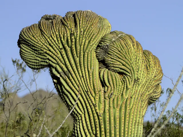
Saguaro National Park wraps around Tucson in two desert districts, protecting the country's densest forests of the giant saguaro, the towering candelabra cactus that can climb 50 feet and live two centuries. Walk the paved Cactus Garden Trail at the Red Hills Visitor Center or drive the unpaved Bajada Loop on the west side through thick cactus stands. Visit in cooler winter months, when the park doubles as a certified dark-sky place for stargazing.

Sequoia National Park Forests

Sequoia National Park

Three Rivers, CA · Sierra Nevada

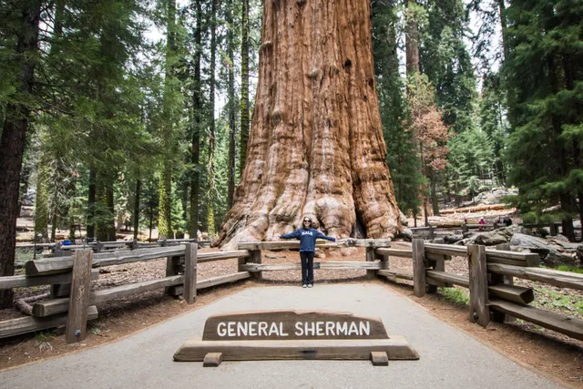
Sequoia National Park in California's southern Sierra Nevada shelters the giant sequoias, the most massive trees on Earth, including General Sherman, which holds the title by sheer volume. Walk the paved Congress Trail through the Giant Forest, then climb the 400 steps up Moro Rock for a sweeping view of the Great Western Divide. Summer parking near Sherman fills by mid-morning, so arrive early or ride the shuttle.

Theodore Roosevelt National Park Canyons & deserts

Theodore Roosevelt National Park

Medora, ND · North Dakota Badlands

Theodore Roosevelt National Park protects the rugged North Dakota badlands that shaped a future president, a sweep of striped buttes and prairie above the Little Missouri River near Medora. Drive the South Unit's 36-mile scenic loop and you will likely meet bison, prairie dog towns, and the park's wild horses right along the road. The quieter North Unit runs its byway out to Oxbow Overlook, where the river bends through the wilderness.

Virgin Islands National Park Beaches

Virgin Islands National Park

Cruz Bay, VI · St. John, U.S. Virgin Islands

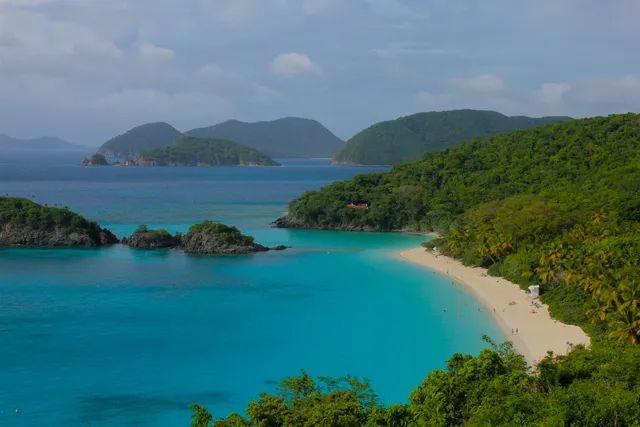
Virgin Islands National Park covers roughly two-thirds of St. John, wrapping powder-white Caribbean beaches in protected tropical forest just a ferry ride from Cruz Bay. Snorkel the marked underwater trail at Trunk Bay among coral, rays, and sea turtles, or hike the Reef Bay Trail past Taino petroglyphs to sugar-mill ruins. Come early; the small North Shore parking lots fill before noon.

Voyageurs National Park Lakes & rivers

Voyageurs National Park

International Falls, MN · Northern Minnesota

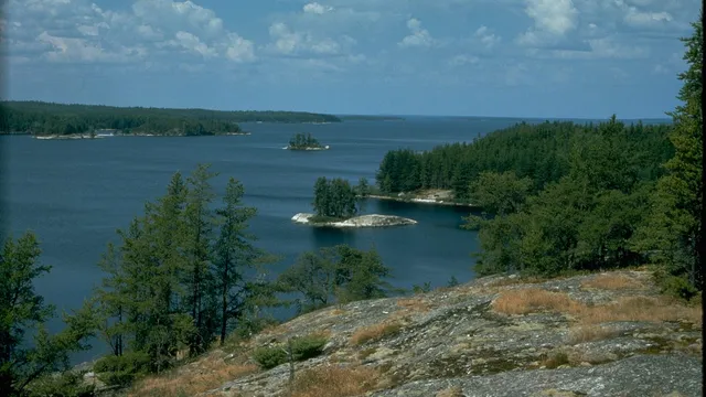
Voyageurs is a watery wilderness on the Minnesota-Canada border near International Falls, where four big lakes and countless islands are reached almost entirely by boat. Rent a houseboat or canoe to explore Rainy and Kabetogama Lakes, fish for walleye, and camp on a quiet shoreline once paddled by fur-trade voyageurs. As a certified Dark Sky park, it delivers brilliant stargazing, and winter visitors stand a real chance at the northern lights.

White Sands National Park Canyons & deserts

White Sands National Park

Alamogordo, NM · Tularosa Basin, Southern New Mexico

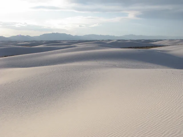
White Sands National Park near Alamogordo, New Mexico, protects the world's largest gypsum dune field, 275 square miles of blinding-white sand that stays cool underfoot even in the desert heat. Drive the eight-mile Dunes Drive into the heart of it, then sled the slopes on a waxed disc or hike the marked Alkali Flat Trail across an ancient lakebed. Time a ranger-led sunset stroll, when the dunes glow pink against the San Andres Mountains.

Wind Cave National Park Caves

Wind Cave National Park

Hot Springs, SD · Black Hills

Wind Cave protects one of the world's longest and most complex caves beneath the South Dakota prairie, named for the wind that whistles through its natural entrance as pressure shifts. Below ground it holds the planet's largest concentration of rare boxwork, a honeycomb of thin calcite fins. Above, a mixed-grass prairie shelters bison, elk, and prairie dogs at the edge of the Black Hills.

Wrangell-St. Elias National Park Mountains

Wrangell-St. Elias National Park

Copper Center, AK · Southcentral Alaska

Wrangell-St. Elias is the largest national park in the country, over 13 million acres of south-central Alaska where the Wrangell, St. Elias, Chugach, and eastern Alaska ranges converge. It holds nine of the sixteen highest peaks in the US and some of the continent's largest icefields, plus the red ruins of the Kennecott copper mill near McCarthy. Two rough roads and bush planes are the only ways in.

National Park of American Samoa Gardens & wildlife

National Park of American Samoa

Pago Pago, AS · Tutuila, American Samoa (South Pacific)

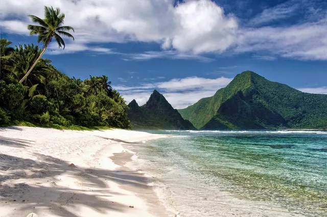
The National Park of American Samoa is the only U.S. national park south of the equator, spread across three volcanic islands of tropical rainforest, sea cliffs, and coral reef. Snorkel the warm lagoon off Ofu Beach, where reefs shelter hundreds of fish and coral species, or hike Tutuila's Mount Alava trail above Pago Pago Harbor. A homestay program lets visitors stay with Samoan families and share in fa'a Samoa, the Samoan way of life.

Big Cypress National Preserve Lakes & rivers

Big Cypress National Preserve

Ochopee, FL · The Everglades

Big Cypress is the wild, watery buffer that wraps the western edge of the Everglades, a vast freshwater swamp of dwarf cypress, pine islands, and sawgrass prairie just off the Tamiami Trail in Ochopee. Drive the 24-mile gravel Loop Road to spot alligators, wading birds, and the occasional river otter from your car, or wade in on a ranger-led swamp walk. The cooler dry season, December through April, brings the best wildlife and the fewest mosquitoes.

Ellie Schiller Homosassa Springs Wildlife State Park Springs

Ellie Schiller Homosassa Springs Wildlife State Park

Homosassa, FL · Nature Coast

Ellie Schiller Homosassa Springs Wildlife State Park wraps around the headwaters of the Homosassa River and is one of the only places you can watch West Indian manatees up close every single day of the year. Step into the floating Fish Bowl underwater observatory to stand eye-level with manatees and schools of fish, then follow the boardwalk past resident black bears, bobcats, alligators, and a Florida panther. Daily manatee programs run at 11 a.m. and 1 p.m.

Circle B Bar Reserve Gardens & wildlife

Circle B Bar Reserve

Lakeland, FL · Central Florida

Circle B Bar Reserve is a restored 1,300-acre floodplain on Lake Hancock just southeast of Lakeland, and one of Florida's best spots to see wild things up close. Walk Alligator Alley or Heron Hideout and you will pass basking gators, wading egrets and ospreys among the more than 200 bird species recorded here. Cooler dry-season mornings from November through March bring the heaviest bird traffic.

Paynes Prairie Preserve State Park Gardens & wildlife

Paynes Prairie Preserve State Park

Micanopy, FL · North Central Florida

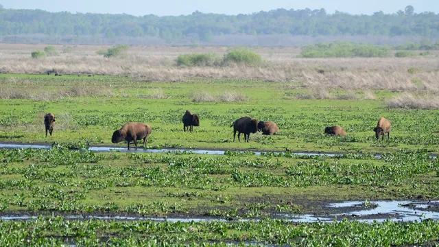
Paynes Prairie is a 22,000-acre basin of wet prairie and marsh south of Gainesville, the only place in Florida where wild bison and free-roaming horses share the same horizon. Climb the 50-foot observation tower for a sweep across the savanna, or walk the trails among alligators and nearly 300 bird species. Florida's first state preserve and a National Natural Landmark, it is most alive in the cooler, drier winter months.

National Key Deer Refuge Gardens & wildlife

National Key Deer Refuge

Big Pine Key, FL · Florida Keys

This Big Pine Key refuge protects the Key deer, the world's smallest deer and a creature found nowhere else, with full-grown bucks no taller than a German shepherd. The easiest viewing is at Blue Hole, the largest freshwater pond in the Keys, where an observation deck overlooks deer, turtles, and resident alligators. Come at dawn or dusk, when the tiny deer move out to browse.

Brasstown Bald Mountains

Brasstown Bald

Hiawassee, GA · North Georgia Mountains

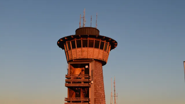
At 4,784 feet, Brasstown Bald is the highest point in Georgia, and its summit observation deck delivers a 360-degree view that on clear days reaches into four states. Ride the shuttle or hike the steep half-mile paved path from the parking lot to the tower, then explore the mountaintop museum of Appalachian natural and cultural history. Come in late October for some of the most vivid fall color in the Southeast.

Cloudland Canyon State Park Canyons & deserts

Cloudland Canyon State Park

Rising Fawn, GA · Northwest Georgia

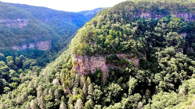
Carved into the western flank of Lookout Mountain, Cloudland Canyon drops 1,000 feet to a gorge where Daniel Creek tumbles over two sandstone cliffs. Hike the Waterfalls Trail down a long stairway to the base of 90-foot Hemlock Falls and 60-foot Cherokee Falls, or trace the 4.8-mile West Rim Loop along the canyon edge. Reserve a cliffside campsite or yurt to wake up above the gorge.

Cohutta Wilderness Forests

Cohutta Wilderness

Chatsworth, GA · North Georgia Mountains

The Cohutta Wilderness is the largest national forest wilderness in the eastern United States, nearly 37,000 roadless acres laced with more than 90 miles of trail and bisected by the wild Jacks and Conasauga Rivers. Backpack the Jacks River Trail through dozens of cold river crossings to the cascade of Jacks River Falls, or wade the gin-clear Conasauga to spot some of its 70-plus fish species. There are no facilities here, so come self-sufficient.

Anna Ruby Falls Lakes & rivers

Anna Ruby Falls

Helen, GA · North Georgia Mountains

A rare double waterfall where Curtis Creek plunges 153 feet beside York Creek's 50-foot drop, the twin cascades meeting at the base. A paved, shaded half-mile trail climbs from the Chattahoochee National Forest visitor center to a lower viewing deck framing both falls at once. Buy your day-use ticket at the center, then linger over the gift shop and creekside picnic spots.

Black Rock Mountain State Park Mountains

Black Rock Mountain State Park

Mountain City, GA · North Georgia Mountains

Georgia's highest state park sits at 3,640 feet astride the Eastern Continental Divide, where summit overlooks open 80-mile vistas across four states on a clear day. From the visitor center deck you can walk the 2.2-mile Tennessee Rock Trail loop to the divide's high point through northern hardwood forest. Come at dawn for layered ridge fog, or in October for some of north Georgia's best leaf color.

Carters Lake Lakes & rivers

Carters Lake

Oakman, GA · North Georgia Mountains

Backed up behind the tallest earthen dam east of the Mississippi, Carters Lake is the deepest reservoir in Georgia, plunging some 450 feet beneath sheer, undeveloped shoreline with almost no lakefront homes. Launch a boat or kayak from one of the Army Corps ramps to fish for spotted bass and walleye, then hike the bluff trails above the Coosawattee. Stop at the visitor center near the dam for maps and the overlook.

Fort Mountain State Park Mountains

Fort Mountain State Park

Chatsworth, GA · Northwest Georgia

This 3,712-acre park is named for a mysterious 855-foot stone wall snaking along its summit, an ancient ruin no archaeologist has fully explained. Walk the Old Fort Trail to the wall and the Civilian Conservation Corps stone fire tower, then cool off at the 17-acre mountain lake with its sandy swimming beach. Cottages, campsites, and miles of hiking and mountain-biking trails round out the stay.

Minnehaha Falls Lakes & rivers

Minnehaha Falls

Lakemont, GA · North Georgia Mountains

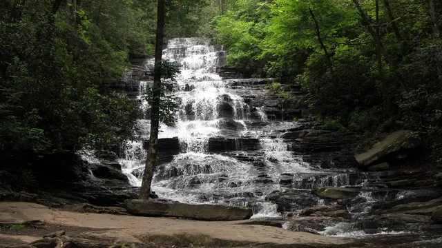
One of North Georgia's most photogenic waterfalls, Minnehaha tumbles roughly 100 feet down a wide, mossy staircase of rock above Lake Rabun. A short, easy 0.2-mile trail from Bear Gap Road delivers you to the base in minutes, making it a favorite stop for families and photographers. Pair it with a loop around Lake Rabun on the way in.

Springer Mountain Mountains

Springer Mountain

Ellijay, GA · North Georgia Mountains

Springer Mountain is the southern terminus of the Appalachian Trail, the spot where thousands of thru-hikers begin a 2,190-mile walk to Maine. Find the bronze AT plaque and the hiker logbook bolted to a rock at the 3,782-foot summit, reached by a short 0.9-mile climb from the Forest Service Road 42 parking area. It also anchors the start of the Benton MacKaye Trail, so two long-distance routes diverge from the same overlook.

Vogel State Park Mountains

Vogel State Park

Blairsville, GA · North Georgia Mountains

One of Georgia's two oldest state parks, Vogel sits at the foot of Blood Mountain where the Civilian Conservation Corps shaped its stonework in the 1930s. Rent a pedal boat on 20-acre Lake Trahlyta, swim off the mountain beach, or lace up for the moderate four-mile Bear Hair Gap loop. Stronger hikers can take on the strenuous 12.5-mile Coosa Backcountry Trail straight from the parking lot.

Lake Blue Ridge Lakes & rivers

Lake Blue Ridge

Blue Ridge, GA · North Georgia Mountains

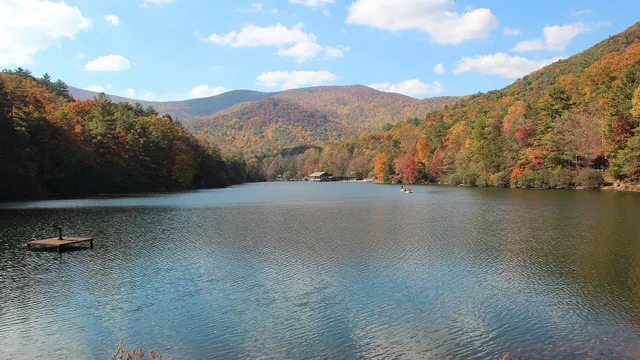
Lake Blue Ridge is a clear, deep mountain reservoir framed almost entirely by Chattahoochee National Forest, created when the Blue Ridge Dam closed on the Toccoa River in 1930. Launch a boat or rent a pontoon at the marina to explore 65 miles of largely undeveloped shoreline, or cast for bass and walleye in some of North Georgia's cleanest water. The Morganton Point recreation area adds a swim beach and lakeside campsites.

Raven Cliff Falls Lakes & rivers

Raven Cliff Falls

Helen, GA · North Georgia Mountains

One of the most unusual waterfalls in the Chattahoochee National Forest, Raven Cliff Falls pours out of a fissure split clean through a towering granite cliff nearly 90 feet high. The roughly 5-mile out-and-back trail follows Dodd Creek past a string of smaller cascades before reaching the grand finale. Bring 5 dollars per vehicle for the trailhead amenities fee and arrive early on fall weekends.

Dukes Creek Falls Lakes & rivers

Dukes Creek Falls

Helen, GA · North Georgia Mountains

A misty multi-tier waterfall dropping about 150 feet into a shaded gorge, Dukes Creek Falls is among the most rewarding short hikes near Helen. A well-graded 1.25-mile trail switchbacks down to wooden observation decks where the air turns cool from the spray, with an accessible deck just a tenth of a mile from the lot. A Forest Service day-use pass is required, and state park passes are not accepted.

Panther Creek Falls Lakes & rivers

Panther Creek Falls

Turnerville, GA · North Georgia Mountains

One of North Georgia's most beloved waterfalls, this 50-foot cascade fans across a broad rock face into a deep emerald pool ringed by a sandy beach. Earning it takes a roughly 7-mile round-trip along Panther Creek, threading laurel tunnels, creekside cliffs, and a few cable-assisted ledges before the gorge opens to the falls. Bring water and sturdy shoes; the trail is rated for intermediate and advanced hikers.

Sosebee Cove Forests

Sosebee Cove

Blairsville, GA · North Georgia Mountains

A hushed 175-acre cove forest that feels ancient, shading some of Georgia's largest yellow poplars and a state-champion yellow buckeye on a north-facing Blue Ridge slope. A short 0.3-mile double-loop trail, dedicated to legendary Forest Ranger Arthur Woody, winds past towering trunks and one of the South's richest spring wildflower displays of trillium, dutchman's breeches, and squirrel corn. Visit in April for peak bloom.

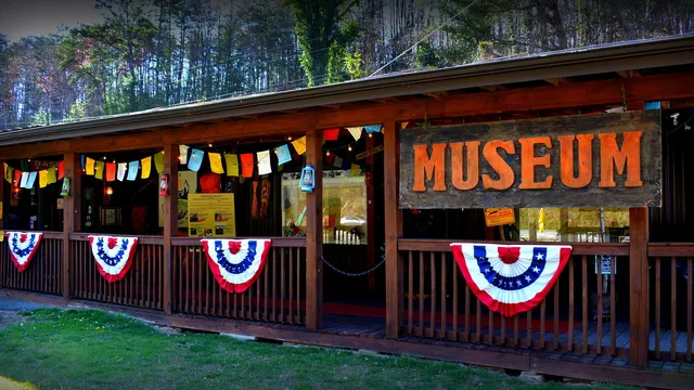
Expedition: Bigfoot, The Sasquatch Museum Attractions

Expedition: Bigfoot, The Sasquatch Museum

Cherry Log, GA · North Georgia Mountains

Tucked along Highway 515 between Blue Ridge and Ellijay, this 4,000-square-foot shrine to Sasquatch claims the largest permanent collection of Bigfoot artifacts anywhere, and it does not pretend to be neutral about whether the big guy is real. Founded in 2016 by Navy veteran and Bigfoot Field Researchers Organization member David Bakara and his wife Malinda, it packs in wall after wall of footprint and handprint casts, sighting maps, hair samples, and listening stations piping out genuine recorded grunts and howls. You can settle into the Sasquatch Theater for looping eyewitness footage, gawk at the world's only Bigfoot research and tech ATV the Bakaras once drove on Florida investigations, and find a cast of a rare Bigfoot butt-print laid out on red velvet. Cap it with the gift shop, where David sells footprint casting kits he assembles himself.

Babyland General Hospital Attractions

Babyland General Hospital

Cleveland, GA · North Georgia Mountains

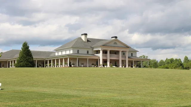
This columned white mansion is the official "birthplace" of the Cabbage Patch Kids, the soft-sculpture dolls Xavier Roberts dreamed up in these North Georgia hills. Time your visit for the hourly "delivery," when a Licensed Patch Nurse tends the Magic Crystal Tree, announces that a Mother Cabbage is in labor, doses her with "Imagicillin," and pulls a freshly born baby from the leaves while pink and blue BunnyBees decide the gender. You wander rooms full of dolls in incubators and adoption cribs, and yes, you can take one home with its own birth certificate. Admission is free, the staff play it gloriously straight, and the whole thing lands somewhere between sweet and wonderfully surreal.

Old Car City USA Attractions

Old Car City USA

White, GA · Northwest Georgia

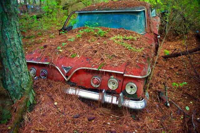
Billed as the world's largest classic-car junkyard, this 34-acre forest swallows more than 4,000 vehicles built in 1972 or earlier, most of them rusting hulks from the 1950s and 60s with saplings growing up through their hoods. What began as a 1931 general store turned into a salvage yard, and the family who still runs it now charges photographers a few dollars more than walkers because that is who really comes: this is a photo pilgrimage, with 6-plus miles of pine-needle trails winding past moss-furred Fords and the famous "two-ton flowerpot" Chevy. Plan on several hours, wear real shoes, and note it is open Tuesday through Saturday, roughly 9 to 4. Bring a camera and let the rust and roots do the rest.

Consolidated Gold Mine Attractions

Consolidated Gold Mine

Dahlonega, GA · North Georgia Mountains

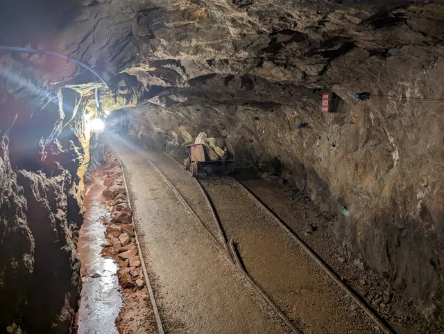
Two decades before California, Benjamin Parks stubbed his boot on a gold-flecked rock here in 1828 and touched off America's first major gold rush. Today you strap on a hard hat and descend 200 feet into a genuine hard-rock mine, the largest gold operation that ever ran east of the Mississippi, where guides who actually worked underground walk you past glittering quartz veins at a steady 60 degrees. The roughly 40-minute tour ends back in daylight with a pan, a trough, and an award-winning panner teaching you to swirl real Georgia dirt down to the flash of color. It is touristy in the best way, and the kids leave with vials of gold and a story about the rush that built the town.

Mercier Orchards Attractions

Mercier Orchards

Blue Ridge, GA · North Georgia Mountains

What started in 1943 as Bill and Adele Mercier's 27-acre roadside apple stand is now a fourth-generation, family and veteran-owned farm and the largest apple orchard in the Southeast. You come for the U-pick, where 40-plus apple varieties (plus strawberries, blueberries, blackberries, and peaches in season) ripen across the mountainsides, but you stay for the bakery's legendary fried apple pies, sold warm by the case. The on-site farm winery is the only orchard in Georgia that grows, presses, ferments, and cans its own hard cider, so a tasting flight closes the loop on everything growing outside. Add a cafe and a sprawling market of jams and ciders, and it is the busiest agritourism stop in North Georgia for good reason.

Foxfire Museum & Appalachian Heritage Center Attractions

Foxfire Museum & Appalachian Heritage Center

Mountain City, GA · North Georgia Mountains

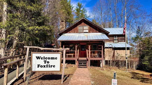
This is the rare museum that grew out of a 1966 high school English class, when Rabun County students named their student-run magazine "Foxfire" after the glow-in-the-dark fungus and started interviewing their grandparents about cabin-building, moonshine and mountain medicine. Book royalties bought the land in 1974, and today you walk a half-mile trail through an eight-acre village of more than 20 relocated and reconstructed log buildings furnished with artifacts of Appalachian life from 1820 to 1940. Time your visit for live demonstrations and you might catch a blacksmith at the forge, a weaver at the loom or old-time music drifting between the cabins. Perched just below Black Rock Mountain State Park, it pairs naturally with a drive up to the state's highest overlooks.

Angry Chair Brewing Breweries

Angry Chair Brewing

Tampa, FL · Tampa Bay

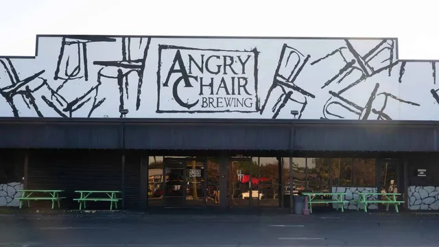
Thrillist crowned this Seminole Heights brewhouse the best in Florida, and the barrel-aged imperial stouts are why people sleep in the parking lot for a release. The taproom runs 24 taps under a sprawling mural of tumbling chairs, with green picnic tables out front and label art from the same hands that paint the cans. Come for a pastry stout aged in bourbon, cognac, or whiskey barrels, stay for the theme nights.

Green Bench Brewing Company Breweries

Green Bench Brewing Company

St. Petersburg, FL · Tampa Bay

The brewery that anchored St. Petersburg's EDGE District, named to VinePair's list of the best in America by a panel of beer pros. The lagers are the reason to come, crisp and built for Florida heat, while the foeders and barrels at sister Webb's City Cellar next door push mixed-culture ferments and wild blends. Pull up a chair in the biergarten under the painted brick mural and the string lights.

Cigar City Brewing Breweries

Cigar City Brewing

Tampa, FL · Tampa Bay

The brewery that put Tampa on the national craft map, pouring since 2009 from the West Spruce Street warehouse where founder Joey Redner first brewed Jai Alai IPA, the citrus-forward house beer now shipped across 39 states. The taproom keeps more than 20 lines flowing, and every March the cult Hunahpu's Day imperial stout draws beer hunters from across the country. Cigar City's stack of Great American Beer Festival medals backs up the reputation, but the real pull is drinking these beers steps from the tanks that made them.

BarrieHaus Beer Co. Breweries

BarrieHaus Beer Co.

Tampa, FL · Tampa Bay

Jim Barrie pours like the old country, brewing mostly German and Czech lagers and pulling them from imported side-pull faucets that crown each stein with a dense pillow of foam. The copper bartop and Ybor biergarten have earned two World Beer Cup gold medals, including one for the Family Tradition Vienna lager that anchors the menu. It is a lager house that takes the style seriously without making you feel like you have to.

Coppertail Brewing Co. Breweries

Coppertail Brewing Co.

Tampa, FL · Tampa Bay

Coppertail set up its tanks inside a 100-year-old Ybor City building that once canned olives and bottled mayonnaise, and the bar's foot rail is the old train track they unearthed during the build. The Free Dive IPA, a citrus-forward pour they tapped on opening day, has anchored the lineup ever since, with the Belgian-style Unholy Tripel waiting for a longer night. Take the brewery tour to see the production floor working behind the taproom.

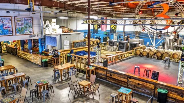
3 Daughters Brewing Breweries

3 Daughters Brewing

St. Petersburg, FL · Tampa Bay

Mike and Leigh Harting started brewing in 2013 to perfect a beer-battered fish recipe, then asked how many pints it would take to put their three daughters through college. The answer turned into one of Florida's largest independent breweries, an 18,000-square-foot warehouse where 42 rotating taps pour across three bars, the concrete one cast in a single piece with the floor. There are no TVs, just game tables built by the founders' grandfather, barrel-aging racks, live music, and the flagship Beach Blonde Ale.
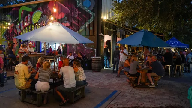
Dunedin Brewery Breweries

Dunedin Brewery

Dunedin, FL · Tampa Bay

Florida's oldest distributing microbrewery has been pouring on Douglas Avenue since 1995, and its string-lit biergarten still fills nightly under a mural that reads Keep Dunedin Weird. Pull up a picnic table for the Apricot Peach Ale, then drift inside, where two stages host touring acts and a Wednesday open jam in one of the area's most beloved live-music rooms.

Rapp Brewing Company Breweries

Rapp Brewing Company

Seminole, FL · Tampa Bay

Greg Rapp chases the styles most brewers skip, reviving German gose, grodziskie, and other near forgotten recipes that trace back to his great grandfather's brewery near Dresden. The 40 taps in this Seminole warehouse rotate through that obscure roster, and the salty, tart gose took Best of Show at the Florida Beer Championship. Order a flight under the lit medallion and taste a few centuries of brewing history you won't find anywhere else in Tampa Bay.

Bowman's Beach Beaches

Bowman's Beach

Sanibel, FL · Southwest Florida

Fifty acres of pale, shell-packed sand stretch wide and quiet here, reached only by a footbridge over Clam Bayou where manatees, herons, and the odd alligator drift below. The shelling is some of the finest on the Gulf, the low dunes run to sea grape and sea oats, and there isn't a resort in sight. Come at low tide with a mesh bag and the Sanibel stoop, and the shelling will keep you long after the day-trippers head back.

Dr. Julian G. Bruce St. George Island State Park Beaches

Dr. Julian G. Bruce St. George Island State Park

St. George Island, FL · Big Bend

Nine miles of undeveloped sand run the length of this Forgotten Coast barrier island, backed by rolling dunes and sea oats with the Gulf rolling in clear. Loggerheads nest on the dark summer beaches and close to three hundred bird species work the flats, while the unraked tideline turns up conchs, olives, and sand dollars. Drive out past the last house to the wild eastern end, where the dunes climb high and the footprints thin to plover tracks.

Cayo Costa State Park Beaches

Cayo Costa State Park

Boca Grande, FL · Southwest Florida

There is no bridge and no road, so you board a boat off Pine Island or Boca Grande and motor across the pass, usually trailed by dolphins, to nine miles of barrier island on the other side. Powder-white sand, sea oats bending on the low dunes, and a Gulf tide that keeps laying down fresh shells, sand dollars, and the occasional whole conch. Walk the tram path from the bay dock over to the Gulf and the beach mostly empties out, about as close as Florida gets to having a stretch of coast to yourself.

T.H. Stone Memorial St. Joseph Peninsula State Park Beaches

T.H. Stone Memorial St. Joseph Peninsula State Park

Port St. Joe, FL · Panhandle

Ten miles of sugar-white sand back up against the tallest dunes left standing in the Panhandle, and the wildness is the whole point: drive the gate at Cape San Blas, then walk a mile or two and the crowds thin to sea oats, snowy plovers, and the occasional sea turtle track. Shell the Gulf side at low tide or cross to the calm St. Joseph Bay flats, where whelks, sand dollars, and scallops turn up in the shallows. Go for the morning light on the dunes, stay for a sunset you will not share with a high-rise.

Pensacola Beach Beaches

Pensacola Beach

Pensacola Beach, FL · Panhandle

Pensacola Beach wears the Panhandle's sugar-white quartz sand and emerald water, with Casino Beach at its heart: a Gulf fishing pier, a boardwalk of bars and seafood shacks, and beachfront hotels a barefoot walk from the water. When you want the wild side, the Gulf Islands shoreline at Fort Pickens is right down the road, but here the draw is the easy, lively beach-town day.

Grayton Beach State Park Beaches

Grayton Beach State Park

Santa Rosa Beach, FL · Panhandle

Grayton Beach pairs sugar-white quartz sand with Western Lake, a coastal dune lake that pools right behind the dunes and breaks through to the Gulf after a hard rain. The state park keeps the whole stretch undeveloped, no high-rise wall behind the sand, just scrub oak, sea oats, and water that runs emerald in the afternoon light. It is the quiet edge of the 30A corridor, a short walk from the lot but a world from the resorts.

Tampa Bay Brewing Company Breweries

Tampa Bay Brewing Company

Tampa, FL · Tampa Bay

Tampa Bay Brewing Company has been brewing since 1995, which makes it one of Florida's oldest independent craft breweries, and the Westchase brewhouse is where the beer actually gets made. Order the Reef Donkey APA, the citrusy pale ale that took bronze at the 2014 Great American Beer Festival, and drink it a few feet from the fermentation tanks. This is the full production brewery and kitchen, so the patio fills up with people working through beer-infused plates and a couple dozen rotating taps.

Naples Beach Beaches

Naples Beach

Naples, FL · Southwest Florida

This broad sweep of soft white sand is the downtown Gulf beach that built Naples' reputation, where families spread out by day and everyone drifts toward the waterline at dusk to watch the sun drop into the Gulf, dolphins often working the surf just offshore. The landmark Naples Pier is closed while the city rebuilds it after Hurricane Ian, but the beach itself is as wide and easy as ever, with plenty of room to walk the shore. Best of all, Fifth Avenue South sits a few blocks back, so dinner and a cocktail are a barefoot walk from the sand.

Fort Myers Beach Beaches

Fort Myers Beach

Fort Myers Beach, FL · Southwest Florida

Seven miles of soft white sand run the length of Estero Island, and the busiest stretch is right at the foot of the bridge, where Times Square meets the water and the beach bars and shrimp shacks pick up where the sand ends. This is the Gulf Coast beach that earns its crowds: shallow warm water for wading, room to spread out a towel, and dinner a barefoot walk away. Hurricane Ian took the old fishing pier in 2022, and a longer one is on the way, with construction set to start in 2026 and open in 2027. The beach itself never went anywhere, wide open and as lively as ever.

Panama City Beach Beaches

Panama City Beach

Panama City Beach, FL · Panhandle

Twenty-seven miles of sugar-white sand and that startling green Gulf water, and almost all of it open to the public. The Russell-Fields City Pier runs 1,500 feet out over the waves at the foot of Pier Park, where the shops, the bars, and dinner are a barefoot walk back across the boardwalk. This is the Panhandle at full volume: the busiest, liveliest beach town on the coast, and it earns the crowd.

Anclote Key Preserve State Park Beaches

Anclote Key Preserve State Park

Tarpon Springs, FL · Tampa Bay

A barrier island three miles off the Tarpon Springs sponge docks, reachable only by boat or ferry, with no road, no high-rise, and no provisions waiting on the other side. Miles of white sand run unraked along the Gulf, heaped with shells and backed by ten-foot dunes and an 1887 lighthouse on the southern tip; bald eagles and oystercatchers work the shallows while you do your own packing in and out. Bring water, claim a primitive campsite, and let the surf be the only thing you hear after the last ferry leaves.

Fort Pickens, Gulf Islands National Seashore Beaches

Fort Pickens, Gulf Islands National Seashore

Pensacola Beach, FL · Panhandle

Seven-plus miles of white-quartz sand run undeveloped along Santa Rosa Island's western tip, with the 1834 brick fort the only thing breaking the line of dunes and sea oats. There is no resort strip here, just a long drive past the gate to walk-in shoreline where the Gulf turns over good shelling and the high-rises of Pensacola Beach stay a distant smudge to the east. Come for the quiet, the birds working the wrack line, and sand that squeaks underfoot.

Destin Public Beach Beaches

Destin Public Beach

Destin, FL · Panhandle

Destin's public accesses open onto the sugar-white quartz sand and jewel-green water that earn the Emerald Coast its name. James Lee Park is the easiest way in: a county boardwalk over the dunes, beach umbrellas packed shoulder to shoulder by midmorning, and a charter fleet trolling for redfish just off the sand. It is a beach that wears its crowds well, with a frozen drink and a fried-grouper sandwich a barefoot walk from your towel.

St. Vincent Island (National Wildlife Refuge) Beaches

St. Vincent Island (National Wildlife Refuge)

Apalachicola, FL · Big Bend

There are no roads, no resorts, and no way here but by boat: St. Vincent is 12,300 acres of wild barrier island where the Gulf rolls onto miles of empty white sand backed by cabbage palms and shifting dunes. Hire a shuttle across the quarter-mile cut from Indian Pass, then walk a shoreline littered with shells and leaning palm trunks, scanning the treeline for the 500-pound sambar deer that an experiment turned loose here a century ago. Nothing out here is staffed or stocked, so come self-sufficient, and the only footprints you are likely to cross will be a shorebird's.

Madeira Beach Beaches

Madeira Beach

Madeira Beach, FL · Tampa Bay

Madeira Beach is the kind of Gulf town where dinner is a barefoot walk from the sand, and the whole scene runs on John's Pass, the inlet a hurricane carved between here and Treasure Island in 1848. Wander the 1,100-foot wooden boardwalk past seafood shacks and tiki bars while the working fishing fleet, dolphin cruises and charter boats come and go beneath the drawbridge. When you have had your fill of the docks, the wide white-sand beach and its rows of umbrellas are a short stroll west.

Florida Caverns State Park Caves

Florida Caverns State Park

Marianna, FL · Panhandle

This is the one place in Florida where a ranger walks you underground, down lit limestone passages hung with stalactites, columns, and rippled flowstone that took a few hundred thousand years of dripping rainwater to build. The dry, air-filled caverns were carved out by hand by the Civilian Conservation Corps in the 1930s, and aboveground the Chipola River, the cool Blue Hole swimming spring, and shady floodplain trails round out the day. Book the guided cave tour ahead in summer, because the small group sizes fill fast and it is the only way in.

Falling Waters State Park Lakes & rivers

Falling Waters State Park

Chipley, FL · Panhandle

Florida's tallest waterfall isn't a roaring cascade. It's a 73-foot ribbon of stream that pours over a fern-lined limestone rim and vanishes straight down a cylindrical sink into a cave nobody has mapped to the end. A short boardwalk drops you to a platform below the rim, close enough to feel the mist, and the show only runs strong after recent rain, so a wet day here is the good day.

Fort Clinch State Park Beaches

Fort Clinch State Park

Fernandina Beach, FL · Northeast Florida

A red-brick Civil War fort sits at the northern tip of Amelia Island, its ramparts looking out over the channel where the Amelia River meets Cumberland Sound. Walk the granite sallyport into the courtyard on the first weekend of any month and costumed soldiers are drilling, cooking, and standing watch as if it were 1864. Past the walls, a long oak-shaded loop runs out to wide Atlantic beach where the hard sand gives up shark teeth and the fishing pier draws regulars at dawn.

Highlands Hammock State Park Forests

Highlands Hammock State Park

Sebring, FL · Central Florida

Four miles west of Sebring sits one of Florida's first state parks, where a boardwalk threads a bald cypress swamp past trees that were already ancient when the Spanish arrived. Walk the catwalk over black water where alligators drift and barred owls call, then drive the three-mile loop past oaks so broad it takes a few people holding hands to ring one. The Civilian Conservation Corps crews who cut these trails in the 1930s left behind a museum and a hushed, cathedral feel that still holds.

Gilchrist Blue Springs State Park Springs

Gilchrist Blue Springs State Park

High Springs, FL · North Central Florida

Gilchrist Blue pushes out about 44 million gallons a day at a steady 72 degrees, filling a wide bowl of green and blue water that you wade into from a sloping sand beach. Snorkelers drift over the boil while families ride tubes down the quarter-mile run where the spring empties into the tea-dark Santa Fe River. Come on a weekday morning before the swimming area fills and bring your own mask; there is no scuba here, just the slow float and the cold.

Fanning Springs State Park Springs

Fanning Springs State Park

Fanning Springs, FL · North Central Florida

Fanning Springs pours about 65 million gallons a day into a wide, 72-degree pool that runs a deep turquoise toward the boil and a pale aquamarine over the shallows. A swim platform and ladder drop you straight into water clear enough to count the limestone ledges, and a boardwalk carries the spring run out to the Suwannee River, where manatees move up on the coldest winter days. It once ran first-magnitude and now sits just under that line, which makes it an easy, uncrowded stop on a North Florida springs loop.

Alexander Springs Recreation Area Springs

Alexander Springs Recreation Area

Altoona, FL · North Central Florida

Alexander Springs sits deep in the Ocala National Forest, a first-magnitude spring that pushes about 70 million gallons a day up through a cluster of vents and into a wide, sand-bottomed pool that holds a steady 72 degrees all year. The southwest bank slopes in like a beach, so you can wade in from the shallows or snorkel out over the boil to watch fish hang in the current, and it is the one spot in the forest where divers can drop down to the vent. Rent a canoe and you can paddle Alexander Run downstream into the wilderness, past cypress knees and turtles, then work your way back to the swim beach.

Madison Blue Spring State Park Springs

Madison Blue Spring State Park

Lee, FL · Big Bend

Madison Blue rises in a round limestone bowl on the bank of the Withlacoochee River, about 82 feet across and holding a steady 72 degrees whether you show up in July or January. The water reads deep cobalt over the vent and shades to pale turquoise across the shelf, so a mask and snorkel turn up sunfish, catfish, and the dark mouth of a cave that technical divers have mapped for more than five miles underground. Float the short spring run to where the clear water meets the tea-colored river and you can watch the exact line where the two refuse to mix.

Manatee Springs State Park Springs

Manatee Springs State Park

Chiefland, FL · Nature Coast

Manatee Springs pushes around 100 million gallons a day up through the limestone, a first-magnitude boil that pools deep blue before running a quarter mile out to the Suwannee River. Float the spring on a hot afternoon and you can watch fish hang in the vent below you, then follow the 800-foot boardwalk under old cypress to where the clear water meets the dark river. Come in the cold months and the manatees that gave the spring its name move in, riding the steady 72-degree flow while the rest of Florida shivers.

Devil's Den Springs

Devil's Den

Williston, FL · North Central Florida

Devil's Den hides a whole spring underground: you climb down a wooden staircase into a collapsed cavern where a shaft of daylight lands on water that glows an unreal blue, held at a steady 72 degrees all year. Snorkelers and open-water divers share the pool by reservation only, finning past rock ledges that have given up Pleistocene bones of mastodons and saber-toothed cats. General swimming is not allowed, which keeps the place quiet and the water clear, so book ahead and bring a mask rather than a beach towel.

Ponce de Leon Springs State Park Springs

Ponce de Leon Springs State Park

Ponce de Leon, FL · Panhandle

Ponce de Leon Springs pushes about 14 million gallons a day up through two limestone vents, and you can watch them work from the surface before you ever get in. The water holds a steady 68 degrees year round and runs roughly 20 feet deep at the head, deep enough that snorkelers and divers trace the rock walls while everyone else floats the green spring run toward the woods. It is a small park in the Panhandle, the kind you build a slow afternoon around with a picnic table and a towel.

Troy Spring State Park Springs

Troy Spring State Park

Branford, FL · North Central Florida

Troy Spring pours out of a 70-foot limestone funnel and stays a steady 72 degrees no matter what August is doing above it, so the swim is more bracing than the Suwannee next door and the water reads blue near the surface, green over the rock. The pull here is the spring run, where the bones of the Madison still rest on the bottom; the steamboat was scuttled in 1863 to keep it from Union hands, and on a clear day you can pick out its frame from the boardwalk or float right over it with a mask. Certified open-water divers can drop into the basin, but most people come to swim the bowl and snorkel the wreck, which is plenty.

Vortex Spring Springs

Vortex Spring

Ponce de Leon, FL · Panhandle

Florida's largest dive park pushes out 28 million gallons a day at a steady 68 degrees, and you can see the limestone basin floor from the entry stairs before you ever put your face in. Spend the morning floating the lazy spring run, riding the rope swing, or just drifting over the submerged forest where divers descend toward the cavern mouth at 58 feet. Open-water snorkelers get the bright green water and the sloping shallows; certified cave divers head past the locked gate into a system that runs more than 1,600 feet back into the aquifer.

Cypress Spring Springs

Cypress Spring

Vernon, FL · Panhandle

Cypress Spring boils up at the end of a quarter-mile paddle down Holmes Creek, and you only reach it by canoe, kayak, or paddleboard from Cotton Landing. Roughly 65 million gallons a day rise through a circular basin that shades from pale green at the shallows to deep cobalt over the vent, clear enough on a calm day to watch your shadow on the sandy bottom 25 feet down. Tie up, snorkel the boil, swing off the rope on the north bank, and let the 68-degree water run you back toward the creek.

Salt Springs Recreation Area Springs

Salt Springs Recreation Area

Salt Springs, FL · North Central Florida

Salt Springs pushes 52 million gallons a day through four rocky vents in the heart of the Ocala National Forest, and the water carries a faint mineral salt you can taste. Wade in over the tumbled limestone and you will share the 74-degree pool with mullet and the occasional blue crab, which is why snorkelers come back. It is the kind of spring you settle into for an afternoon under the live oaks rather than rush through.

Wekiwa Springs State Park Springs

Wekiwa Springs State Park

Apopka, FL · Central Florida

Forty-two million gallons a day rise here at a steady 72 degrees, filling a kidney-shaped pool that fades from concrete-apron shallows to a 15-foot cavern at the boil. Most days you wade in with families and college kids from nearby Orlando, float over the limestone vents, then trade the swimming hole for a rented canoe and paddle Wekiwa Run where it braids into Rock Springs Run and the headwaters of the Wekiva River. Skip the scuba dreams (cave diving is off-limits) and come for the simplest version of a Florida spring: cold, clear, and yours from 8 a.m. to closing.

Juniper Springs Recreation Area Springs

Juniper Springs Recreation Area

Ocala, FL · North Central Florida

A 1935 stone millhouse and its slow-turning waterwheel still stand over the spring's edge, built by the Civilian Conservation Corps and now the backdrop to a 72-degree pool where you can watch sand boil up from the vents below your feet. From the swimming basin, the seven-mile Juniper Run threads a narrow, palm-shaded creek that paddlers regularly rank among the finest canoe runs in the country. Come early on a summer weekend; this stretch of the Ocala National Forest fills up, and the spring's clarity rewards anyone who gets there before the crowd.

De Leon Springs State Park Springs

De Leon Springs State Park

De Leon Springs, FL · Central Florida

De Leon Springs pushes out close to twenty million gallons a day, holding 72 degrees whether it's January or August, in a wide circular pool ringed by cypress and moss-draped oaks. The real reason people come is breakfast at the Old Spanish Sugar Mill, where you cook your own pancakes on a griddle built into the table, then walk down and swim off the meal in the spring. Come in winter and you may share the cove with manatees drifting in from the cold St. Johns to warm up.

Kelly Park Rock Springs Springs

Kelly Park Rock Springs

Apopka, FL · Central Florida

Rock Springs pushes about 26,000 gallons a minute of 68-degree water out of a cave at the head of Kelly Park, and the run it feeds is the whole point: you drop in at the boil and let the current walk you a quarter-mile downstream past limestone ledges and overhanging palms. The water glows that gemstone teal-green where the light hits the sand, and the float lasts roughly 25 minutes before a short paved walk back to do it again. Bring your own tube or float under five feet, get there early because the lot caps and fills by mid-morning, and plan to be wet all day.

Anastasia State Park Beaches

Anastasia State Park

St. Augustine, FL · Northeast Florida

Four miles of wide Atlantic beach back up against ancient dunes and the calm, kayak-friendly water of Salt Run, a short bridge from the oldest city in the country. Walk the maritime hammock trails to the Old Spanish Coquina Quarry, where workers cut the shellstone that built the Castillo de San Marcos in the 1670s. Surfers, windsurfers, and shorebirds share the sand, and the campground tucked under the live oaks puts you a few minutes from downtown St. Augustine.

Lovers Key State Park Beaches

Lovers Key State Park

Fort Myers Beach, FL · Southwest Florida

Two miles of quiet, sugar-white beach stretch across four barrier islands here, reached by a short tram from the parking lot or a walk over the bridge. Manatees and dolphins work the passes at either end, and the back-bay trails on Black Island are good for spotting roseate spoonbills, ospreys, and the occasional gopher tortoise. Rent a kayak to paddle the mangrove estuary, or just hunt shells on a shoreline that stays calm and uncrowded even in season.

Hillsborough River State Park Lakes & rivers

Hillsborough River State Park

Thonotosassa, FL · Tampa Bay

One of Florida's original state parks, carved out by the Civilian Conservation Corps in the 1930s, this is one of the few places in the state where the river actually has rapids. The Hillsborough drops over a limestone ledge into a frothing Class II run, and a 1936 CCC wire suspension footbridge still sways across the water above it. Beyond the rapids you get more than seven miles of shaded trails through cypress and oak hammock, canoe and kayak rentals on calmer stretches, and a weekend-staffed replica of Fort Foster from the Second Seminole War.

St. Andrews State Park Beaches

St. Andrews State Park

Panama City Beach, FL · Panhandle

Two long rock jetties reach out from the eastern tip of Panama City Beach and wrap the Gulf into a calm, waist-deep pool where the water glows emerald and kids can wade while snorkelers drift the rocks for fish and sea stars. Beyond the jetty stretch a wide white-sand Gulf beach, a quieter Grand Lagoon side with fishing piers and a concession, and trails through dunes, scrub, and pine flatwoods to old World War II gun mounts. Catch the shuttle across the pass to undeveloped Shell Island, or pitch a tent at one of the 60 pinewood campsites and stay for the sunrise.

Sebastian Inlet State Park Beaches

Sebastian Inlet State Park

Melbourne Beach, FL · Space Coast

Two long jetties run out into the Atlantic at the mouth of Sebastian Inlet, where the tide rips through and surfers line up at First Peak, the most reliable break on Florida's east coast. Anglers work the rocks for snook and Spanish mackerel while the calmer Indian River Lagoon side stays quiet enough for kayaks and wading birds. Two small museums sit inside the park, one telling the story of the 1715 Spanish treasure fleet that wrecked just offshore, the other the local fishing trade, and the campground stays open around the clock.

Bahia Honda State Park Beaches

Bahia Honda State Park

Big Pine Key, FL · Florida Keys

Three white-sand beaches share one narrow key here, with Calusa and Loggerhead facing the calm Gulf side and Sandspur stretching out toward the Atlantic, all of it fronting water clear enough to read the bottom from the surface. The old Bahia Honda Rail Bridge, a remnant of Henry Flagler's Overseas Railroad, arcs broken across the channel and frames nearly every photo people take from Calusa. The park runs daily snorkel boats out to Looe Key, a reef of elkhorn and star coral about seven miles offshore that many consider the best in the Keys.

Bill Baggs Cape Florida State Park Beaches

Bill Baggs Cape Florida State Park

Key Biscayne, FL · Miami

The 1825 Cape Florida Lighthouse anchors the southern tip of Key Biscayne, and you can climb its 109 steps to a wraparound balcony that looks out over Biscayne Bay and the open Atlantic. Below it runs more than a mile of soft sand backed by sea grapes and Australian pines, with calm water for swimming and a stretch of seawall where anglers cast at first light. A marker near the lighthouse tells the story of the roughly 300 Black Seminoles who sailed from this cape to the Bahamas in the early 1820s, making it a stop on the National Underground Railroad Network to Freedom.

Washington Oaks Gardens State Park Gardens & wildlife

Washington Oaks Gardens State Park

Palm Coast, FL · Northeast Florida

Louise Powis Young laid out these formal gardens in the 1930s on her winter estate, and the state has kept them in her hands' image: brick paths winding past reflecting ponds, rose beds, camellias, azaleas, and a citrus grove under a canopy of live oaks hung with Spanish moss. Cross A1A and the park's other face appears, a stretch of Atlantic shore where dark coquina rock ledges break the surf and fill with tide pools at low water. Between the two sits the Matanzas River, with short trails, fishing, and picnic tables under the hammock.

Jonathan Dickinson State Park Forests

Jonathan Dickinson State Park

Hobe Sound, FL · Treasure Coast

Climb the wooden tower atop Hobe Mountain, an 86-foot ancient dune that counts as the highest natural point in South Florida, and the sand pine scrub rolls out to the Atlantic in every direction. Down at the river, the Loxahatchee was Florida's first federally designated Wild and Scenic River, and you can paddle it upstream to Trapper Nelson's 1930s homestead deep in the cypress. Across 11,500 acres you get scrub jays, river-swamp boardwalks, and the Camp Murphy mountain-bike trails on old World War II Army roads.

John Pennekamp Coral Reef State Park Lakes & rivers

John Pennekamp Coral Reef State Park

Key Largo, FL · Florida Keys

The first undersea park in the country protects 70 nautical square miles of living coral reef off Key Largo, and the headline sight sits in 25 feet of water: Christ of the Abyss, a 9-foot bronze with arms raised toward the surface. Glass-bottom boats run for anyone staying dry, while snorkel and dive trips head out to Molasses Reef and the statue; back on shore there are mangrove kayak trails, a saltwater swimming lagoon, and short hammock walks at mile marker 102.5.

Honeymoon Island State Park Beaches

Honeymoon Island State Park

Dunedin, FL · Tampa Bay

Four miles of white Gulf sand wrap this barrier island off Dunedin, where the water runs pale green and shells pile up along the wilder north beach. Inland, the Osprey Trail winds through one of Florida's last virgin slash pine stands, with nesting ospreys overhead and gopher tortoises lumbering across the path. Catch the passenger ferry from the causeway to undeveloped Caladesi Island next door, or stay for a sunset that drops straight into the Gulf.

Providence Canyon State Park Canyons & deserts

Providence Canyon State Park

Lumpkin, GA · Southwest Georgia

Sixteen canyons cut into soft Coastal Plain soil here, their walls banded pink, orange, lavender and white from layers of clay and iron, all of it carved in barely 150 years by rainwater running off badly plowed cotton fields. The rim trail looks down into the gorges, then a path drops to the canyon floor where you wade a thin sheet of spring water past 150-foot sand walls. Come in July and August and the rare plumleaf azalea blooms orange-red along the rim, long after every other azalea in the South has gone quiet.

Sweetwater Creek State Park Lakes & rivers

Sweetwater Creek State Park

Lithia Springs, GA · Metro Atlanta

Less than a half-mile down the Red Trail, the five-story brick shell of the New Manchester textile mill rises straight out of the woods, its empty window rows looking onto the whitewater shoals of Sweetwater Creek where Union troops burned it in 1864. Past the ruins the path climbs to rocky bluffs above the rapids, and back at the trailhead the 215-acre George Sparks Reservoir keeps kayaks, canoes, and aquacycles moving all summer, fifteen miles from downtown Atlanta.

Stephen C. Foster State Park Lakes & rivers

Stephen C. Foster State Park

Fargo, GA · Southeast Georgia

The western gateway into the Okefenokee Swamp, where you trade your car for a canoe and paddle blackwater channels lined with cypress trees and Spanish moss. Roughly 12,000 American alligators live in the refuge, and the boat tours and rental kayaks put you out among them, the wading birds, and the trembling peat prairies the Okefenokee is named for. After dark the park turns into one of the only certified Dark Sky places in the South, so the Milky Way comes out over the water and the night programs run late.

Unicoi State Park Forests

Unicoi State Park

Helen, GA · North Georgia Mountains

A 53-acre lake sits at the center of this 1,050-acre park just north of Helen, ringed by hardwood ridges that turn red and gold every October and mirror back off the still water. You can paddle a kayak across Smith Creek's old millpond, cast for trout off the dock, ride 8 miles of mountain-bike singletrack, or follow the wooded trail that links the park straight to the twin cascades of Anna Ruby Falls. A lakeside lodge and a scatter of cottages and campsites mean you can stay long enough to catch the morning mist lift off the ridgeline.

Indian Springs State Park Springs

Indian Springs State Park

Flovilla, GA · Middle Georgia

One of the oldest state parks in the country, Indian Springs has drawn people to its sulfur-scented spring water since the Creek Nation gathered here, and you can still fill a cup at the stone springhouse the Civilian Conservation Corps built in the 1930s. Sandy Creek runs shallow over wide rock shelves below the dam, and 105-acre McIntosh Lake handles the fishing, paddling, and a stretch of summer swimming beach. A seasonal museum walks through the Creek history, the resort era, and the CCC, with cottages and a tent campground if you want to stay the night.

High Falls State Park Lakes & rivers

High Falls State Park

Jackson, GA · Middle Georgia

The Towaliga River fans out across a wide shelf of granite here and drops about 100 feet in a series of rushing cascades, the largest waterfall in middle Georgia and loudest after a good rain. Two short trails trace each bank past the stone ruins of an old powerhouse, remnants of the 1800s mill town that thrived on this water power before the railroad passed it by. Above the falls sits a quiet 650-acre lake where you can rent a kayak, drop a line for bass, or pitch a tent and stay the weekend.

F.D. Roosevelt State Park Forests

F.D. Roosevelt State Park

Pine Mountain, GA · Columbus

Georgia's largest state park sprawls across the Pine Mountain ridge, where FDR drove up from Warm Springs to picnic at Dowdell's Knob and look out over the valley he loved. The view from the Knob still opens the same way, 1,395 feet up at the range's high point, and a bronze Roosevelt sits at the overlook beside the stone grill the CCC built for him. The Pine Mountain Trail runs 23 miles through hardwood and pine to wildflower-edged streams, and the spring-fed Liberty Bell Pool, also CCC stonework, still cools swimmers all summer.

Red Top Mountain State Park Forests

Red Top Mountain State Park

Cartersville, GA · Northwest Georgia

A 1,776-acre peninsula leaning out into Lake Allatoona, Red Top takes its name from the iron-rich red clay that streaks its shoreline and once drew miners to dig the soil. More than 15 miles of trail thread the hardwood ridges, and the 4-mile Iron Hill loop runs flat and shaded for hikers and bikers along the water. When summer arrives, a sand swimming beach, boat ramps, and rental cottages fill up fast with Atlanta families forty minutes up I-75.

Crooked River State Park Lakes & rivers

Crooked River State Park

St. Marys, GA · Golden Isles

Salt marsh, pine flatwoods, and live oaks dripping with Spanish moss spread across 500 acres on the south bank of the tidal Crooked River. Four miles of trails carry you past gopher tortoise burrows, fiddler-crab flats, and a birding platform on the Sempervirens loop, where wood storks, ospreys, and painted buntings turn up through the seasons. It is also the closest base for the ferry to Cumberland Island, with cottages, riverside campsites, and guided kayak trips out into the marsh.

Panola Mountain State Park Mountains

Panola Mountain State Park

Stockbridge, GA · Metro Atlanta

Panola Mountain is the granite outcrop Stone Mountain might have been if it had stayed wild, a 100-acre dome of bare rock so fragile that the only way onto its summit is a ranger-led hike booked ahead of time. In spring, shallow rock pools blaze red with Diamorpha, a tiny succulent that lives nowhere but these weathered granite flats, and the lichen and yellow daisies fill in the rest. Down off the rock, paved and forested trails loop past two small lakes and a nature center, fifteen minutes from Atlanta but a different world entirely.

Skidaway Island State Park Forests

Skidaway Island State Park

Savannah, GA · Savannah

Six miles southeast of downtown Savannah, this 588-acre park sits right on Skidaway Narrows, where the Intracoastal Waterway threads past tidal creeks and spartina salt marsh. Its trails run through live-oak maritime forest out to boardwalks and an observation tower, and you can count on fiddler crabs scuttling the mudflats, egrets stalking the shallows, and deer slipping through the palmettos. Eighty-seven campsites plus cabins and yurts make it an easy basecamp for the Georgia coast.

Fort McAllister State Park Lakes & rivers

Fort McAllister State Park

Richmond Hill, GA · Savannah

The best-preserved earthwork fort the Confederacy left behind sits on a bluff where the Ogeechee River widens toward the sea, its grassy ramparts and Columbiad cannons shaded by live oaks dripping Spanish moss. Union ironclads shelled it seven times without breaking through; it finally fell in December 1864 when Sherman's infantry stormed the works in fifteen minutes and ended the March to the Sea. Today you walk the mounds and bombproofs, cast for redfish off the fishing pier, and camp among the marsh and oaks ten miles south of Savannah.

Disney's Animal Kingdom Attractions

Disney's Animal Kingdom

Lake Buena Vista, FL · Central Florida

Disney built a whole park around the idea that real animals could share a stage with imagined ones, and the 145-foot Tree of Life at its center carries hundreds of creatures carved into its trunk. Kilimanjaro Safaris rolls open-sided trucks across 110 acres where giraffes, lions, and elephants roam as they would on a savanna, while Pandora glows blue after dark with floating mountains lifted from the Avatar films. Come for the safari near opening when the animals are most active, and stay past sunset to watch the island light up.

EPCOT Attractions

EPCOT

Lake Buena Vista, FL · Central Florida

EPCOT is the Disney park built around a giant geodesic sphere, Spaceship Earth, that you can see rising over the trees long before you reach the gate. Past the front neighborhoods of pavilions devoted to technology and the natural world, the park opens onto World Showcase, a lagoon ringed by eleven country pavilions where you can eat your way from Mexico to Canada in an afternoon. It leans more toward food, fireworks over the water, and slow wandering than white-knuckle rides, which makes it the easiest of the Disney parks to simply stroll.

Universal Islands of Adventure Attractions

Universal Islands of Adventure

Orlando, FL · Central Florida

Eight themed islands fan out from a working lighthouse at Port of Entry, and the walk between them swings from comic-strip Toon Lagoon to the dinosaur jungle of Jurassic Park. The pull here is the detail: the snow-dusted rooftops of Hogsmeade with Hogwarts Castle rising over the village, and the green arc of the Incredible Hulk Coaster launching riders out over the lagoon. Spend a morning in one corner and you will still find painted signs, hidden jokes, and queue rooms built to be wandered rather than rushed.

Universal Studios Florida Attractions

Universal Studios Florida

Orlando, FL · Central Florida

The spinning silver globe out front has greeted Orlando vacationers since 1990, and once you walk through the arch the whole park reads like a backlot you can step into. Cobblestone London opens onto the brick alleys of Diagon Alley, a New York block bends around a corner into San Francisco, and Springfield's storefronts sit a short stroll from old Hollywood. It is built for people who want to ride inside the movies, not just look at them, with screens, coasters, and sets stacked one street over from the next.

Magic Kingdom Park Attractions

Magic Kingdom Park

Lake Buena Vista, FL · Central Florida

This is the park the castle belongs to, the one Walt Disney World built first, where Main Street, U.S.A. opens onto a long view of Cinderella Castle and its pink-and-blue spires. Six themed lands fan out from that central hub, from the riverboats and frontier rides of Liberty Square to the rockets and people-mover of Tomorrowland, with the Haunted Mansion, Pirates of the Caribbean, and a slow round on the Carousel of Progress among the rides that have run here for decades. Come at dusk and the castle turns into a screen for projections and fireworks over the rooftops of Main Street.

Disney's Hollywood Studios Attractions

Disney's Hollywood Studios

Lake Buena Vista, FL · Central Florida

Walt Disney built this Orlando park as a love letter to the movies, and the centerpiece still looks the part: a full-scale replica of Grauman's Chinese Theatre rising at the end of a palm-lined boulevard styled after 1930s Hollywood. The pink Hollywood Tower Hotel looms over Sunset Boulevard, the streets of Batuu bring Star Wars to walking-around life, and Toy Story Land shrinks you to the size of a green army man. It is the corner of Walt Disney World where the backlot fantasy of show business gets the run of an entire afternoon.

Universal Epic Universe Attractions

Universal Epic Universe

Orlando, FL · Central Florida

Universal's fourth Orlando park sends you through the towering Chronos portal into Celestial Park, a garden hub of dancing fountains that fans out to five themed worlds. Wander from the cobblestones of Super Nintendo World into the gothic gloom of Dark Universe, the dragon-keeps of How to Train Your Dragon's Isle of Berk, and the Parisian streets of the Wizarding World's Ministry of Magic. It is the most ambitious thing Universal has built here, and the kind of place where a single day never feels like enough.

SeaWorld Orlando Attractions

SeaWorld Orlando

Orlando, FL · Central Florida

SeaWorld Orlando wraps marine life and roller coasters into one 200-acre park, where you can watch beluga whales glide through the chilled water of Wild Arctic, stand inches from rays and sea turtles, then climb aboard the 200-foot hypercoaster Mako. The floorless Kraken and the flying Manta carve over the lagoons, while penguins waddle through the near-freezing Antarctica habitat. Conservation runs underneath it all, from rescued manatees to the rehabilitation work that brings injured animals back to the sea.

Discovery Cove Attractions

Discovery Cove

Orlando, FL · Central Florida

Unlike the rest of Orlando, this park caps how many people come through the gate each day, so the white-sand beaches and warm lagoons never feel like a theme park. You wade into chest-deep water to meet a bottlenose dolphin face to face, drift the heated tropical river past a free-flight aviary where toucans and parrots land on your arm, and snorkel the Grand Reef among rays and reef fish. Reservations are the whole idea here, and so is the room to breathe.

Busch Gardens Tampa Bay Attractions

Busch Gardens Tampa Bay

Tampa, FL · Tampa Bay

Busch Gardens wraps a working African animal park around some of the tallest, fastest roller coasters in the Southeast, so you can watch giraffes and zebras graze the Serengeti Plain in the morning and ride a dive coaster straight down a cliff after lunch. The grounds are themed as a tour of the continent, from the Moroccan bazaar at the gate to lion and hyena habitats along the Edge of Africa walk. Tucked just off Tampa, it pairs a serious zoo with a serious thrill park, which is a combination almost no other place in Florida tries.

Gatorland Attractions

Gatorland

Orlando, FL · Central Florida

Walk in through the giant aqua-and-white gator jaw on South Orange Blossom Trail and you have entered the roadside Florida that Owen Godwin started fattening up here in 1949. A boardwalk threads the breeding marsh past hundreds of bellowing alligators and a few rare white leucistic ones with pale blue eyes, while the train, the wading-bird rookery, and the daredevils on the zip line keep the place humming. It is part wildlife preserve, part old-school attraction, and the trainers who hand-feed the big bulls clearly love showing it off.

Kennedy Space Center Visitor Complex Attractions

Kennedy Space Center Visitor Complex

Merritt Island, FL · Space Coast

America's working spaceport doubles as a place you can walk right up to the hardware that left the planet. Stand beneath the real Space Shuttle Atlantis tilted as if mid-orbit, crane your neck under the 363-foot Saturn V laid out on its side, and stroll the open-air Rocket Garden where Mercury, Gemini and Apollo boosters stand against the Space Coast sky. Bus tours carry you out past the launch pads and the colossal Vehicle Assembly Building, close to where rockets still fly today.

Legoland Florida Resort Attractions

Legoland Florida Resort

Winter Haven, FL · Central Florida

Florida's first theme park grew up here as Cypress Gardens, and Lego bricks moved into the old grounds without paving over them. Kids steer their own boats, earn Lego driving licenses, and walk through Miniland USA, where the New York skyline and the Las Vegas Strip stand a few feet tall in plastic studs. Between the rides, the original botanical gardens still wind along the lakeshore, shaded by a banyan tree that has been spreading since 1939.

Clearwater Marine Aquarium Attractions

Clearwater Marine Aquarium

Clearwater, FL · Tampa Bay

A working marine hospital on the Clearwater Beach waterfront, where rescued dolphins, sea turtles, manatees, and river otters recover in pools you can watch up close. It opened in 1972 inside a former water treatment plant, and its tailless dolphin Winter, who swam with a prosthetic tail, drew the world here through the Dolphin Tale films. The work is the rescue, rehabilitation, and release of injured sea life, so what you see is a real animal hospital rather than a show.

ZooTampa at Lowry Park Attractions

ZooTampa at Lowry Park

Tampa, FL · Tampa Bay

A 63-acre zoo in north Tampa that runs the only nonprofit hospital in the world built just for sick, injured, and orphaned wild manatees, with viewing pools where you can watch the rescues recover before they head back to Florida waters. Asian elephants, Malayan tigers, and Bornean orangutans anchor the geographic exhibits, while a walk-through free-flight aviary puts you eye to eye with hornbills and toucans. Florida's own panthers, red wolves, and roseate spoonbills round out a collection that leans hard into wildlife the state is actually fighting to save.

Jacksonville Zoo and Gardens Attractions

Jacksonville Zoo and Gardens

Jacksonville, FL · Northeast Florida

On the banks of the Trout River north of downtown Jacksonville, 122 acres run together as zoo and botanical garden, so a stroller and a serious plant person both leave happy. Walk the Plains of East Africa for white rhino and giraffe you can hand-feed, then watch jaguars swim glass-side in Range of the Jaguar and Malayan tigers prowl the catwalks of Land of the Tiger. Save time for the gardens themselves, where Savanna Blooms and the bamboo plantings of the Asian section make the walk between exhibits the quiet payoff.

Naples Zoo at Caribbean Gardens Attractions

Naples Zoo at Caribbean Gardens

Naples, FL · Southwest Florida

A botanist named Henry Nehrling started planting this place in 1919, and the zoo still threads its paths through his century-old tropical trees and the lakes a later owner carved out of the grounds. Board the catamaran on Lake Victoria and you drift past islands where lemurs, gibbons, and apes lounge in the open, then walk on to find Florida panthers, lions, and giraffes you can hand a leaf to. It is a small zoo grown into an old garden, shaded and unhurried in a way the bigger parks rarely manage.

Brevard Zoo Attractions

Brevard Zoo

Melbourne, FL · Space Coast

Brevard Zoo lets you paddle a kayak past white rhinos and giraffe in its Expedition Africa wetland, the only place in the country where you can. Hand a leaf up to a giraffe from the feeding deck, walk through a free-flight aviary thick with lorikeets and cockatiels, or clip into the TreeTop Trek ropes course and cross above the alligators. Built and largely funded by the community since 1994, it spreads more than 900 animals across 75 acres of Space Coast scrub and lagoon.

The Florida Aquarium Attractions

The Florida Aquarium

Tampa, FL · Tampa Bay

Downtown Tampa's aquarium walks you from Florida's freshwater springs out to the open ocean, with alligators and river otters along the Wetlands Trail and a 500,000-gallon Coral Reef tank where sand tiger sharks and stingrays glide past the glass. The African penguin colony and the touch-friendly Stingray Beach tend to pull the biggest crowds at feeding time. From the Channelside dock you can board a Wild Dolphin Cruise to look for the bottlenose dolphins that live out in Tampa Bay.

Mote Marine Laboratory and Aquarium Attractions

Mote Marine Laboratory and Aquarium

Sarasota, FL · Tampa Bay

Mote traces its roots to Dr. Eugenie Clark, the marine biologist known as the Shark Lady, and that legacy runs through the Science Education Aquarium at University Town Center. Stand beneath the 400,000-gallon Gulf Coast habitat and watch sharks, rays, and sea turtles glide overhead, then meet manatees, a giant Pacific octopus, and Humboldt penguins across galleries that double as a working research lab. Touch tanks, daily feedings, and behind-the-glass conservation stories make it as much a field station as an aquarium.

St. Augustine Alligator Farm Zoological Park Attractions

St. Augustine Alligator Farm Zoological Park

St. Augustine, FL · Northeast Florida

Open since 1893, this is one of Florida's oldest attractions, and in 1993 it became the first place anywhere to display every living species of crocodilian, all 24 of them, from dwarf caimans to gharials. Maximo, a saltwater crocodile north of 15 feet and well past 1,000 pounds, holds court in his own pool while a boardwalk carries you over alligators basking below. Come spring, the canopy above those gator pools fills with a wild rookery of nesting egrets, herons, wood storks, and roseate spoonbills, which raise their chicks where no raccoon dares climb down.

Edison and Ford Winter Estates Attractions

Edison and Ford Winter Estates

Fort Myers, FL · Southwest Florida

Thomas Edison built his winter home here on the Caloosahatchee River in the 1880s, and Henry Ford later bought the bungalow next door so the two friends could tinker side by side. The grounds hold the laboratory where Edison tested thousands of plants searching for a homegrown source of rubber, alongside a botanic garden Mina Edison filled with orchids and a moonlight garden meant to be walked at dusk. Out front spreads a banyan tree planted in 1925 from a sapling the size of a walking stick, now a grove of aerial roots covering most of an acre.

The Dali Museum Attractions

The Dali Museum

St. Petersburg, FL · Tampa Bay

A free-form geodesic bubble of 1,062 glass triangles, called the Enigma, erupts from an eighteen-inch concrete block built to ride out a hurricane, and it rises about seventy-five feet over the downtown St. Petersburg waterfront. Inside, a helical staircase spirals upward in a nod to Dali's fixation on the double helix, leading to the largest collection of his work outside Europe. The walls hold the late wall-sized masterworks, among them The Hallucinogenic Toreador and The Discovery of America by Christopher Columbus, paintings you stand back from to take in whole.

Henry B. Plant Museum Attractions

Henry B. Plant Museum

Tampa, FL · Tampa Bay

Six silver minarets crowned with crescent moons rise over Tampa's riverfront, the unmistakable signature of the 1891 Tampa Bay Hotel that railroad man Henry Plant built to lure Gilded Age travelers south. Inside the south wing, restored guest rooms and parlors hold the actual furnishings Plant shipped back from Europe and Asia, alongside the original electric lights and the elevator that still runs. Theodore Roosevelt and his Rough Riders camped on these grounds before sailing for Cuba, and a walk under the horseshoe arches and along the long veranda makes it easy to picture why.

Norton Museum of Art Attractions

Norton Museum of Art

West Palm Beach, FL · Palm Beaches

Florida's oldest art museum sits a few blocks off the Intracoastal, where a Foster + Partners redesign wrapped the original 1941 galleries in a low aluminum canopy and kept the old banyan tree growing right out front. Inside you'll find Cezanne and O'Keeffe alongside a deep run of Chinese jades and bronzes, a photography wing, and contemporary work by the likes of Cindy Sherman and Kara Walker. Spend the morning with the European paintings, then drift out to the sculpture garden and the glass-walled Great Hall before lunch in the restaurant off the lobby.

The Ringling Attractions

The Ringling

Sarasota, FL · Tampa Bay

John Ringling built his fortune on the circus and spent it on Italy, and you can read that whole story across one bayfront estate. Ca' d'Zan, the Venetian Gothic mansion he and Mable raised on Sarasota Bay, anchors grounds that also hold an art museum full of Old Master paintings (the Rubens canvases are enormous) and a circus museum where the Howard Bros. miniature recreates a full big-top show in tiny detail. Walk the rose garden, find the old banyan trees, and end at the water where the gilded tower throws its reflection.

Vizcaya Museum and Gardens Attractions

Vizcaya Museum and Gardens

Miami, FL · Miami

James Deering built this Italian Renaissance villa on Biscayne Bay in the 1910s and filled its seventy-some rooms with European antiques, then set it behind ten acres of formal gardens where clipped hedges, fountains, and a grotto step down toward the water. Out in the bay sits the Stone Barge, a carved limestone breakwater that doubles as a sculpture and frames the view from the east terrace. Wander the maze garden and the casino on the mound, then follow the shaded native hammock trails that ring the estate.

Lightner Museum Attractions

Lightner Museum

St. Augustine, FL · Northeast Florida

Henry Flagler built the Alcazar in 1888 to pamper railroad-era winter guests, and the Gilded Age never quite left: behind the twin red-domed towers sit three floors of Tiffany glass, mechanical music machines, and Victorian curiosities Otto Lightner spent a lifetime collecting. The old indoor swimming pool, once the largest in the country, is now Cafe Alcazar, where you eat lunch on the tiled floor of the deep end. Wander the palm-shaded courtyard and you start to see why the building is half the exhibit.

Perez Art Museum Miami Attractions

Perez Art Museum Miami

Miami, FL · Miami

Herzog and de Meuron wrapped this Biscayne Bay museum in a slatted canopy where Patrick Blanc's hanging garden columns spill down the pillars and broad terraces catch the breeze off the water. Inside, the collection leans into the art of the Americas and the wider Atlantic Rim, with deep holdings of contemporary Cuban and Caribbean work that you rarely see gathered in one place. Settle into one of the white hammocks on the veranda before you go, looking out over the bay and the downtown skyline.

Phillip and Patricia Frost Museum of Science Attractions

Phillip and Patricia Frost Museum of Science

Miami, FL · Miami

Three glass towers, a planetarium, and a 500,000-gallon aquarium sit together on Biscayne Bay, and the whole place is built to be walked up through. Stand under the cone-shaped Gulf Stream tank and a 31-foot round window opens overhead, so hammerhead sharks and devil rays glide across the light while mahi-mahi school past. Upstairs the dome runs the night sky in 8K, the River of Grass exhibit traces the Everglades, and a rooftop terrace looks straight across the water to downtown.

Flagler Museum Attractions

Flagler Museum

Palm Beach, FL · Palm Beaches

Henry Flagler built this 75-room white palace as a 1902 wedding gift for his wife Mary Lily, and the Beaux-Arts mansion still anchors the island the railroad baron's money put on the map. Behind the colonnade you walk through a marble-columned Grand Hall, gilded salons, and a music room with a working pipe organ, then out to the pavilion where his private railcar No. 91 sits gleaming. It is the clearest window in Florida into the Gilded Age that built Palm Beach, kept much as the Flaglers left it.

St. Augustine Historic District Attractions

St. Augustine Historic District

St. Augustine, FL · Northeast Florida

Founded by the Spanish in 1565, St. Augustine is the oldest continuously occupied European settlement in the United States, and its historic district is where that long history is still underfoot. The coquina-walled Castillo de San Marcos guards the waterfront, pedestrian-only St. George Street threads past colonial-era buildings and the old city gates, and Henry Flagler's Gilded Age hotels turned Spanish Renaissance towers now anchor the skyline. It is a compact, walkable quarter where four and a half centuries of Spanish, British, and American chapters sit side by side.

Coral Castle Attractions

Coral Castle

Homestead, FL · The Everglades

One man, Edward Leedskalnin, spent 28 years quarrying and carving more than 1,100 tons of oolite limestone here by lamplight, alone, never letting anyone watch how he moved stones heavier than a car. The result is a stone garden of the strange and the tender: a nine-ton gate balanced so finely a child can swing it open with one hand, a Polaris telescope aimed at the North Star, a heart-shaped table, and a row of rocking chairs cut from solid rock. He built it for a fiancee who left him the night before their wedding, and the whole place still reads like a quiet argument that love is worth a lifetime of stone.

Castillo de San Marcos National Monument Attractions

Castillo de San Marcos National Monument

St. Augustine, FL · Northeast Florida

Spain started this star fort in 1672, and 350 years later it still guards Matanzas Bay at the edge of St. Augustine. The walls are coquina, a soft shell stone that swallowed cannonballs instead of shattering, which is part of why the fort was never taken by force. Walk the gun deck for the bay view, drop into the cool vaulted rooms below, and time it for a cannon firing when the rangers run one.

Chihuly Collection Attractions

Chihuly Collection

St. Petersburg, FL · Tampa Bay

Dale Chihuly's glass turns architecture into a path you walk through, twelve rooms shaped by architect Albert Alfonso so each series gets its own light. The Ruby Red Icicle Chandelier was built for this building, and the finale, Mille Fiori, fills a room with a thousand glass flowers, sea creatures, and reeds rising from the floor. Your ticket also covers a live glassblowing demonstration across the street at the Morean Glass Studio and Hotshop, where the heat and breath behind the work are on full display.

Everglades Airboat Tours Attractions

Everglades Airboat Tours

Everglades City, FL · The Everglades

Out of Everglades City, an airboat trades the highway for a maze of mangrove tunnels and open sawgrass, the fan behind you pushing the flat hull across water only inches deep. Captains cut the engine where alligators sun on the banks and wading birds work the shallows, then open it up again down channels too tight and too shallow for any other boat. It is the closest you get to the Ten Thousand Islands backcountry without a paddle in your hands.

Ernest Hemingway Home and Museum Attractions

Ernest Hemingway Home and Museum

Key West, FL · Florida Keys

Ernest Hemingway lived and wrote in this 1851 limestone house from 1931 to 1939, turning out To Have and Have Not and the Kilimanjaro stories in the studio out back. The descendants of his six-toed cats still nap on the porches and under the furniture, dozens of them, named for old movie stars in the writer's own tradition. Wander the shuttered French Colonial rooms, find the penny Pauline pressed into the deck of the saltwater pool, and the place feels less like a museum than a house someone just stepped out of.

Fairchild Tropical Botanic Garden Gardens & wildlife

Fairchild Tropical Botanic Garden

Coral Gables, FL · Miami

Eighty-three acres of palms, cycads, and flowering trees spread across the edge of Biscayne Bay, with royal palms lining the long reflecting channel of the Bailey Palm Glade and a two-acre rainforest where waterfalls run beneath the canopy. The Wings of the Tropics conservatory keeps hundreds of butterflies in the air year round, while the edible garden grows fruit you will not find at the grocery store, from durian to dozens of mango varieties. Founded in 1938 around the collections of plant explorer David Fairchild, it remains a working research garden as much as a place to wander a quiet morning.

Sunken Gardens Gardens & wildlife

Sunken Gardens

St. Petersburg, FL · Tampa Bay

A plumber named George Turner drained a shallow lake here in 1903 and planted what grew into four acres of dense subtropical jungle, sunk well below street level so the city seems to disappear once you step down into it. Brick paths wind past cascading waterfalls, koi ponds, and a flock of Chilean flamingos descended from birds that have lived here since the 1950s, under a canopy of royal palms and century-old plantings. It is one of Florida's oldest roadside attractions, a survivor from the era of hand-painted highway signs that the city of St. Petersburg now keeps as a living museum.

Morikami Museum and Japanese Gardens Gardens & wildlife

Morikami Museum and Japanese Gardens

Delray Beach, FL · Palm Beaches

George Morikami farmed pineapples here as the last of the Yamato Colony, and willed the land to the county so Florida would remember the Japanese families who settled it. Today his gift is Roji-en, six gardens drawn from a thousand years of Japanese design, where a path winds past koi ponds and bonsai to a museum holding thousands of artifacts. Pause at the tea house, watch the carp surface beneath the pines, and the South Florida heat falls away.

Wynwood Walls Attractions

Wynwood Walls

Miami, FL · Miami

Tony Goldman turned a cluster of windowless warehouse facades into an open-air canvas in 2009, and the courtyard has been repainted by artists from dozens of countries ever since. Shepard Fairey's portraits, Kenny Scharf's cartoon faces, and walls that change between visits make the steel WYNWOOD WALLS gate worth lining up for. Bring a camera and plan to wander the surrounding blocks, where the murals spill far past the official lot.

Canaveral National Seashore Beaches

Canaveral National Seashore

Titusville, FL · Space Coast

Twenty-four miles of barrier-island sand run unbroken here with not a single condo, snack bar, or resort wall in sight, just dunes stitched with sea oats, the Atlantic on one side and the still water of Mosquito Lagoon on the other. Park at a numbered lot, walk ten minutes past the last umbrella, and you can have a whole stretch of empty shoreline to yourself, the kind of solitude where sea turtles nest in summer and shorebirds outnumber people. On a clear morning you can look south down the beach and see the rocket gantries of Kennedy Space Center rising over the wild dune line, the only thing on the horizon for miles.

Little Talbot Island State Park Beaches

Little Talbot Island State Park

Jacksonville, FL · Northeast Florida

One of the last undeveloped barrier islands in Northeast Florida, Little Talbot puts five miles of open Atlantic sand between you and the nearest building. Sea oats hold the dune line and the Dune Ridge Trail loops back through maritime forest and salt marsh, where river otters, marsh rabbits, and migrating shorebirds outnumber the people. Come for a low-tide walk where the only tracks in the sand might be your own, and surfers and kayakers have the place largely to themselves.

Big Talbot Island State Park Beaches

Big Talbot Island State Park

Jacksonville, FL · Northeast Florida

One of the last undeveloped barrier islands left in Florida, Big Talbot trades resort towers and boardwalks for raw shoreline. Follow the Black Rock Trail through coastal hammock and you arrive at Boneyard Beach, where salt-bleached skeletons of live oak and cedar lie toppled across the sand below an eroding bluff, the dark hardpan rock shelving into Nassau Sound. Come at low tide with a camera and patience, and you may have a mile of empty Atlantic coast to yourself.

John D. MacArthur Beach State Park Beaches

John D. MacArthur Beach State Park

North Palm Beach, FL · Palm Beaches

Cross the long boardwalk over the Lake Worth Lagoon and the maritime hammock drops you onto nearly two miles of wild Atlantic sand with no resort wall behind it, just dunes knitted with sea grape and weathered driftwood. The Anastasia coquina rock reef sits close to shore, so the same warm water that washes up whole, unbroken shells turns into shallow snorkeling on a calm low tide. It is a working refuge for nesting sea turtles and wading birds, the kind of beach where you walk a few minutes north and have the surf to yourself.

Blowing Rocks Preserve Beaches

Blowing Rocks Preserve

Hobe Sound, FL · Treasure Coast

On the Atlantic side of Jupiter Island, the largest limestone outcropping on Florida's east coast runs jagged along the sand, a 125,000-year-old wall of coquina shot through with holes and fossil shells. When the seas run rough at high tide, waves drive up through those holes and plumes of saltwater fan fifty feet into the air, the show that earned the place its name. The Nature Conservancy has kept all 73 acres wild since 1969, so you trade beach umbrellas and condos for a hammock trail, dune grass, and a stretch of empty shore where loggerheads still come ashore to nest.

Bathtub Reef Beach Beaches

Bathtub Reef Beach

Stuart, FL · Treasure Coast

At the wild south tip of Hutchinson Island, where the road runs out near the St. Lucie Inlet, an offshore Sabellariid worm reef arcs across the shallows like a low stone wall, built grain by grain by tube-dwelling sea worms. At low tide it tames the Atlantic into a calm, clear lagoon over honeycombed reef rock, with sea oats nodding on the rebuilt dunes and more than 500 marine creatures, sea turtles among them, working the water just offshore. Come early for the solitude: rust-dark rock, a splashing reef line, and a wide empty horizon with no resort wall in sight.

Hobe Sound National Wildlife Refuge Beaches

Hobe Sound National Wildlife Refuge

Hobe Sound, FL · Treasure Coast

This is the longest unbroken stretch of wild Atlantic shoreline left in southeast Florida: more than three miles of coarse, shell-flecked sand on Jupiter Island with no condos, no shops, and no lifeguards behind it, just a wall of sea oats and scrub holding the dunes. A single small lot, a boardwalk over the dune, and the open run of beach and sky are the whole of it, and on a warm Saturday you might share all those miles with a handful of surfers and a fisherman or two. From May into October it becomes one of the busiest sea turtle nesting beaches in the Southeast, the morning sand crossed with the slow tractor-tread of loggerheads that hauled out in the dark.

Archie Carr National Wildlife Refuge Beaches

Archie Carr National Wildlife Refuge

Melbourne Beach, FL · Space Coast

This is the wild Atlantic that A1A development never reached: twenty undeveloped miles of dune and dark sand running south from Melbourne Beach toward Wabasso, with no resort wall, no boardwalk strip, just sea oats, coastal scrub, and the open ocean. It is the most important loggerhead nesting beach in the Western Hemisphere, so on a summer dawn the sand is crossed with the tractor-tread tracks of mother turtles that hauled out overnight to lay. Park at the Barrier Island Center, walk the dune crossover, and you will likely have a long stretch of empty shoreline to yourself, the kind of quiet Florida beach that feels like a place rather than a parking lot.

South Beach Beaches

South Beach

Miami Beach, FL · Miami

South Beach is the loud, bright heart of Miami Beach, where pale sand runs for miles past candy-colored Art Deco lifeguard towers and the Atlantic rolls in warm and easy. Ocean Drive hums a block off the sand with cafes, neon, and a steady parade of skaters, joggers, and sunbathers, and the boardwalk lets you walk it all the way from the inlet to the Setai. Come for the people-watching as much as the swim: this is the busiest, most famous stretch of beach in Florida, and it wears the crowds well.

Cocoa Beach Beaches

Cocoa Beach

Cocoa Beach, FL · Space Coast

This is the Space Coast at full volume: a wide stretch of Atlantic sand where the 800-foot Cocoa Beach Pier juts into the waves, its tiki bars and live music drawing crowds straight off the boardwalk. The surf here is the gentle, rideable kind that turned a local kid named Kelly Slater into an eleven-time world champion, and the flagship Ron Jon Surf Shop two miles up A1A keeps the boards moving 24 hours a day. Come for sunrise over the breakers, stay for a sunset beer over the pilings, and time a clear evening right and you might catch a rocket arc up over the water from the launch pads just to the north.

Jacksonville Beach Beaches

Jacksonville Beach

Jacksonville Beach, FL · Northeast Florida

This is the busy, salt-and-sunscreen heart of the Jacksonville Beaches, where a long concrete fishing pier juts into the Atlantic and surfers line up for the steady shore break beneath it. Wide hard-packed sand runs for miles, the SeaWalk Pavilion hosts free concerts and the Friday-night Deck the Chairs lights, and the bars and taco joints of the Beaches Town Center are a short walk back from the dunes. Come for a loud, easy beach day: paddle out, walk the pier for the pelicans and the anglers, then chase the sunset glow off the water with a cold drink in hand.

Fort Lauderdale Beach Beaches

Fort Lauderdale Beach

Fort Lauderdale, FL · Miami

This is the Florida beach you picture when someone says spring break: two miles of soft Atlantic sand running straight up against the neon and patio bars of A1A. The signature white wave wall and brick promenade hug the shore from Las Olas to Sunrise, packed with skaters, joggers, and people watching the surf roll in off the warm Atlantic. Rent a chair, grab a frozen drink across the street, and settle into the kind of loud, sun-soaked beach day this town has been famous for since the 1960s.

New Smyrna Beach Beaches

New Smyrna Beach

New Smyrna Beach, FL · Space Coast

Thirteen miles of hard-packed Atlantic sand you can actually drive your car onto, with one of the most consistent surf breaks on the East Coast peeling just offshore. Flagler Avenue runs straight down to the water, spilling its galleries, raw bars, and live music onto the dunes, so the day moves easily from a dawn longboard session to fish tacos and a cold one by sunset. Surfer and National Geographic have both named it one of the world's top surf towns, and on a warm weekend the wide beach fills with boards, umbrellas, and trucks parked right at the tideline.

Daytona Beach Beaches

Daytona Beach

Daytona Beach, FL · Space Coast

This is the beach that put the cars on the sand: 23 miles of hard-packed Atlantic shoreline you can actually drive onto, anchored by the 1925 Main Street Pier jutting a thousand feet into the surf. The boardwalk behind it runs on a loop of fried dough, the Coquina clock tower, and a Ferris wheel turning over the dunes, while surfers work the breaks off the pilings. Come for the wide-open sand and the crowds, stay for the kind of summer-night noise that earned it the nickname World's Most Famous Beach.

Hollywood Beach Beaches

Hollywood Beach

Hollywood, FL · Miami

Hollywood Beach is where South Florida puts on a show: a brick-paved Broadwalk runs 2.5 miles along the sand, lined with palms, pastel Art Deco hotels, oceanfront cafes, and a constant parade of cyclists, joggers, and skaters. The wide golden beach drops straight into warm Atlantic surf, and the crowds pull toward the bandshell, the rental beach cruisers, and the ice cream and key lime stands within steps of the water. Come for a lively, easygoing beach town that earns its spot on America's best-boardwalk lists and stays busy from sunrise jog to live music after dark.

Delray Beach Beaches

Delray Beach

Delray Beach, FL · Palm Beaches

Two miles of soft, wide sand run straight off the east end of Atlantic Avenue, so you can walk from a downtown lunch into the surf in about five minutes. Lifeguard towers, beach volleyball, and rented cabanas keep the public stretch busy from sunrise swimmers to sunset crowds, with warm Atlantic water and an easy break that suits boogie boards and first-time surfers. When you have had enough sun, Atlantic Avenue waits a block back with its sidewalk cafes, galleries, and a nightlife that runs late.

St. Augustine Beach Beaches

St. Augustine Beach

St. Augustine Beach, FL · Northeast Florida

Anastasia Island's main beach runs wide and walkable below the 1,300-foot St. Johns County Ocean Pier, the kind of beach town where you can drive onto the sand, cast a line, or paddle out to the steady pier-break swells that draw Northeast Florida's surfers. Wednesday mornings the pier park fills with 60-some farmers market vendors, and summer nights bring the free Music by the Sea concerts and a splash park for the kids. It is the lively, easygoing counterpart to the old fort and cobblestones a few miles north, with surf shops, beachfront bars, and shrimp baskets within a barefoot walk of the water.

Lake Worth Beach Beaches

Lake Worth Beach

Lake Worth Beach, FL · Palm Beaches

The William O. Lockhart Municipal Pier reaches almost a thousand feet over the Atlantic here, and the sandbars it kicks up give Lake Worth Beach the most reliable surf in South Florida, so you will find longboarders trading waves while families spread out on the wide white sand. Behind the beach the 1920s-style Casino Building anchors a boardwalk of taco counters, an ice cream window, and a saltwater pool, all a short walk from the funky galleries and Friday street parties downtown. Pay the pier toll to walk out past the anglers for the long view back at the surf, the swimmers, and the crowd.

National Naval Aviation Museum Attractions

National Naval Aviation Museum

Pensacola, FL · Panhandle

Four Blue Angels Skyhawks hang in tight diamond formation above the seven-story glass atrium, and that is just the front door of one of the largest aviation museums on earth. More than 150 restored aircraft fill the floor, from a Curtiss flying boat that first crossed the Atlantic to Vietnam-era fighters and the jet that flew President George W. Bush, all of it on the home base of the Blue Angels at NAS Pensacola. Admission is free, parking is free, and on most Tuesday and Wednesday mornings from spring through fall you can catch the real Blue Angels practicing overhead.

Smathers Beach Beaches

Smathers Beach

Key West, FL · Florida Keys

Smathers Beach runs a half mile along South Roosevelt Boulevard, a ribbon of imported Bahamian sand that the city trucks back in every time a storm hauls it off. The water sits calm and clear because the only living coral reef in North America breaks the swell seven miles offshore, so the shallows stay warm and easy for swimming, paddleboarding, or talking a vendor into a jet ski. It is the rare beach where you can watch the sun come up over the Atlantic and set behind the palms from the same patch of sand.

Destin / Henderson Beach State Park Beaches

Destin / Henderson Beach State Park

Destin, FL · Panhandle

Right in the thick of Destin's high-rises sits a 6,000-foot stretch of coast the developers never got to, where 30-foot dunes feathered with sea oats roll down to sand so white and fine it squeaks underfoot. The quartz here washed down from the Appalachians over thousands of years, and against it the Gulf turns that improbable Destin emerald, shading from pale jade in the shallows to deep green where the bottom drops away. Walk the quarter-mile boardwalk out from the campground, stake a claim on the open beach, and you get the sugar sand and clear water without a condo wall at your back.

United States Capitol Attractions

United States Capitol

Washington, DC · Capitol Hill

The white dome that crowns Capitol Hill is the working home of Congress, and you can walk right in. Free guided tours leave from the underground Capitol Visitor Center and lead you up into the Rotunda, where the soaring frescoed ceiling and the marble statues of National Statuary Hall reward a long look up. Book a timed pass ahead, save time for the east front steps, and you have a front-row seat to the building where the country's arguments get made.

Library of Congress Attractions

Library of Congress

Washington, DC · Capitol Hill

The world's largest library hides one of the most jaw-dropping rooms in Washington behind a Beaux-Arts facade across from the Capitol. Climb to the second-floor overlook and you are staring down into the Main Reading Room, a domed octagon ringed with marble columns and reader tables fanning out under a 160-foot ceiling, while the Great Hall below holds a 1455 Gutenberg Bible and Thomas Jefferson's own surviving library. Admission is free, though the Thomas Jefferson Building now runs on free timed-entry passes, so reserve one before you go.

Lincoln Memorial Attractions

Lincoln Memorial

Washington, DC · National Mall

Anchoring the west end of the National Mall, this marble temple frames Daniel Chester French's 19-foot seated Lincoln, who gazes out past the Reflecting Pool toward the Washington Monument. Climb the steps and you stand where Martin Luther King Jr. delivered "I Have a Dream," with the Gettysburg Address and Second Inaugural carved into the side chambers. It is free and open around the clock, and the view back down the Mall at dusk is the one people remember.

National Gallery of Art Attractions

National Gallery of Art

Washington, DC · National Mall

One of the great free museums anywhere, sitting right on the Mall in a pink-marble palace with a domed rotunda you could mistake for the Pantheon. Inside hang Leonardo da Vinci's Ginevra de' Benci, the only Leonardo painting in the Americas, alongside rooms of Vermeer, Rembrandt, Monet, and Van Gogh, plus a glass-tunnel walk over to I.M. Pei's sharp-angled East Building. Out back, the Sculpture Garden trades its summer fountain for a winter ice rink, and admission never costs a cent.

National Museum of African American History and Culture Attractions

National Museum of African American History and Culture

Washington, DC · National Mall

Sheathed in a three-tiered bronze corona that catches the light differently every hour, the Smithsonian's African American history museum rises on the National Mall in sightline of the Washington Monument. Start at the bottom of the History Galleries, where ramps carry you up out of the dark of slavery through Reconstruction, Jim Crow, and the civil rights years into the music, sports, and art on the upper floors. Admission is free, though same-day and advance timed-entry passes go fast, so reserve before you go.

Smithsonian National Air and Space Museum Attractions

Smithsonian National Air and Space Museum

Washington, DC · National Mall

This is the place where the actual machines of flight hang overhead: Charles Lindbergh's Spirit of St. Louis, the Wright brothers' 1903 Flyer, and the Apollo 11 command module Columbia that carried three astronauts to the Moon and back. A phased reopening is rolling out all-new galleries and a renovated planetarium for the building's 50th anniversary on the Mall. Admission is free, though you should grab a free timed-entry pass online before you go.

Smithsonian National Museum of Natural History Attractions

Smithsonian National Museum of Natural History

Washington, DC · National Mall

The big domed limestone hall on the north side of the Mall is where the Hope Diamond glints behind glass, a 45-foot ocean hall is anchored by a life-size right whale overhead, and the Deep Time fossil hall walks you from the first cells to the last mammoths. Start in the rotunda under the African bush elephant, then pick your rabbit hole: gems and minerals, the live butterfly pavilion, or a wall of insects you can hold. Admission is free, no timed pass needed, and you can lose a whole afternoon without spending a dime.

Tidal Basin Attractions

Tidal Basin

Washington, DC · National Mall

The most photographed water in Washington, a man-made inlet ringed by roughly 3,000 Yoshino cherry trees that Tokyo gifted the city in 1912 and that erupt into pink for about two weeks every spring. A flat 2.1-mile loop strings together the Jefferson, FDR, and Martin Luther King Jr. memorials, and from mid-March you can rent a pedal boat and drift out under the blossoms. Walking the basin is free and open year-round, with peak bloom and the National Cherry Blossom Festival turning late March into the busiest, prettiest weeks on the Mall.

The White House Attractions

The White House

Washington, DC · Downtown

The most famous address in America has sat at 1600 Pennsylvania Avenue since John Adams moved in back in 1800, and the columned North Portico with its fountain and seasonal flower beds is the view everyone knows. Self-guided tours of the State Floor are free, though they run on the government's schedule and have to be requested months ahead through your member of Congress. If a tour ticket doesn't come together, the White House Visitor Center a few blocks south fills the gap with artifacts, films, and a close look at the rooms you would otherwise only glimpse from the fence line.

Washington Monument Attractions

Washington Monument

Washington, DC · National Mall

At 555 feet, this marble obelisk is the tallest thing in the capital, and the eye keeps finding it from every corner of the Mall. Completed in 1888, it wears a faint color seam about a third of the way up, where construction stalled for two decades and the new marble came from a different quarry. A timed-entry elevator carries you to the 500-foot observation level for a clean look out over the Lincoln Memorial, the Capitol, and the Tidal Basin; entry is free, though you will want to grab a same-day ticket at the lodge by morning or reserve ahead online.

Vietnam Veterans Memorial Attractions

Vietnam Veterans Memorial

Washington, DC · National Mall

Maya Lin's black granite wall descends into the earth and rises again, carved with more than 58,000 names in the order they were lost. Walk the slope and the polished stone hands your own reflection back to you, set among the names and the trees behind you. It is open day and night, free to all, and a few steps west of the Lincoln Memorial on the National Mall.

National Archives Museum Attractions

National Archives Museum

Washington, DC · Downtown

Behind the 72 Corinthian columns of John Russell Pope's 1935 temple on Constitution Avenue, the Rotunda for the Charters of Freedom holds the actual Declaration of Independence, Constitution, and Bill of Rights under dim amber light. You walk right up to the cases at your own pace, then wind through the Public Vaults and rotating exhibits drawn from billions of records the nation has kept. Admission is free, though a $1 timed-entry pass online saves you the line.

Smithsonian National Museum of American History Attractions

Smithsonian National Museum of American History

Washington, DC · National Mall

This is the museum that keeps the country's actual stuff: the giant Star-Spangled Banner that flew over Fort McHenry, Dorothy's ruby slippers, Julia Child's whole kitchen, and the gowns of every First Lady. It is the rare place where pop culture, invention, and the heavy moments of American history share a roof, so you can go from a 1960 lunch-counter sit-in to Kermit the Frog in a single afternoon. Admission is free, it is open daily on the National Mall, and you could spend an hour or a whole day and still leave with things unseen.

Martin Luther King, Jr. Memorial Attractions

Martin Luther King, Jr. Memorial

Washington, DC · National Mall

Dr. King steps forward from a split block of granite here on the northwest rim of the Tidal Basin, carved as if emerging from the rock itself. The line that named the memorial runs along the stone: out of the mountain of despair, a stone of hope, drawn from the 1963 speech he gave a short walk away at the Lincoln Memorial. A 450-foot inscription wall gathers fourteen of his quotations on justice, democracy, hope, and love, and the whole memorial sits open and free, with the Washington Monument framed across the cherry trees and the Jefferson Memorial reflected over the water.

Smithsonian National Portrait Gallery Attractions

Smithsonian National Portrait Gallery

Washington, DC · Downtown

This is the one museum where you can stand face to face with every American president, from Gilbert Stuart's George Washington to Kehinde Wiley's leafy, blue-suited Barack Obama, all under one roof and all free. It fills the columned Old Patent Office Building, a Greek Revival landmark that once served as a Civil War hospital where Walt Whitman tended the wounded, and the collection runs well past the Oval Office into civil-rights leaders, ballplayers, jazz singers, and the faces that shaped the country. Save time for the Kogod Courtyard, a glass-canopied indoor plaza where the light pools across the floor and a coffee tastes earned.

World War II Memorial Attractions

World War II Memorial

Washington, DC · National Mall

Set between the Lincoln Memorial and the Washington Monument, this is the National Mall's grand open-air tribute to the 16 million Americans who served in World War II. A ring of 56 granite pillars, one for each state and territory, wraps around the oval Rainbow Pool, with Atlantic and Pacific arches anchoring each end and a Freedom Wall of 4,048 gold stars marking the fallen. It is free, open 24 hours a day, and best at dusk when the fountains catch the last light and the whole plaza quiets down.

United States Botanic Garden Attractions

United States Botanic Garden

Washington, DC · National Mall

Tucked at the foot of the Capitol, this living museum of plants is one of the oldest botanic gardens in the country, and stepping into its great glass Conservatory feels like trading the National Mall for a jungle, a desert, and a room of orchids all in one afternoon. Wander the steamy Tropics under a soaring iron canopy, find the carnivorous plants and a rare corpse flower that draws a crowd when it blooms, then head outside to the Bartholdi Fountain and the native gardens. Best of all, admission is free, no tickets required, so it is an easy, year-round detour between the museums.

Georgetown Attractions

Georgetown

Washington, DC · Georgetown & Northwest

Older than the capital it sits beside, Georgetown is the cobblestone-and-Federal-rowhouse quarter where M Street and Wisconsin Avenue cross under a gold-domed bank, and the shopping, the people-watching, and the history all happen at once. Wander down to the C&O Canal towpath or the Potomac waterfront, then climb the brick sidewalks past the homes of JFK and Julia Child toward Georgetown University's spires. There is no admission and no gate; the whole neighborhood is the attraction, free to walk any day you like.

Supreme Court of the United States Attractions

Supreme Court of the United States

Washington, DC · Capitol Hill

The highest court in the country sits behind sixteen marble columns at the top of a wide flight of steps, with "Equal Justice Under Law" carved into the pediment overhead and two seated Fraser statues flanking the entrance. Admission is free and the building is open to the public on weekdays, where you can walk the Great Hall, peek into the courtroom, and catch a courtroom lecture when the justices are not in session. Come on an argument morning if you want to try for one of the limited first-come seats, or just climb the steps for one of the best vantage points on Capitol Hill.

Ford's Theatre Attractions

Ford's Theatre

Washington, DC · Downtown

The red brick on Tenth Street looks ordinary until you remember what happened in the box above the stage on an April night in 1865. Inside, the restored auditorium still hosts live plays, while the museum below traces Lincoln's last hours and the manhunt that followed, and the Petersen House across the street preserves the room where he died. Timed-entry tickets are free, though they go fast, so reserve a day ahead.

Smithsonian National Zoo Attractions

Smithsonian National Zoo

Washington, DC · Georgetown & Northwest

Spread across 163 wooded acres in Rock Creek Park, the National Zoo is the rare big-city zoo where admission is free and the headliners are giant pandas. Bao Li and Qing Bao arrived from China in late 2024 and now hold court along Asia Trail, a few steps from red pandas, sloth bears, and clouded leopards. Come for the pandas, then climb the hill to the Great Cats, the elephant barn, and the Amazonia rainforest dome; entry passes are free but required, so reserve a timed slot before you go.

Washington National Cathedral Attractions

Washington National Cathedral

Washington, DC · Georgetown & Northwest

Perched on Mount Saint Alban above Northwest Washington, this is the sixth-largest cathedral on earth and a full-bore feat of 14th-century English Gothic, built stone on stone over 83 years with no steel holding it up. Inside, 215 stained-glass windows pour color down the nave, including the Space Window with a sliver of moon rock set in the glass, and outside the towers hide more than a hundred carved grotesques, among them a Darth Vader sculpted from a kid's design contest. Worship and quiet prayer are always free; daytime sightseeing runs a timed ticket, and it is well worth climbing toward the tower gallery for the long view back over the city.

Guana River Beach Beaches

Guana River Beach

Ponte Vedra Beach, FL · Northeast Florida

Between Ponte Vedra Beach and St. Augustine, A1A runs past one of the longest stretches of undeveloped Atlantic shore left in Florida, and Guana is the heart of it. Park along the highway, climb a weathered dune walkover through 30-foot dunes, and drop onto miles of coquina sand where the only footprints are usually your own and the surf does most of the talking. Behind the dunes sits the freshwater Guana River, held back by the old dam where the trails begin, so you can trade the empty ocean beach for quiet marsh paths whenever you want a change of view.

Thomas Jefferson Memorial Attractions

Thomas Jefferson Memorial

Washington, DC · National Mall

Set on the south bank of the Tidal Basin, this white-marble rotunda answers the Lincoln and Washington memorials across the water with a low dome and a ring of columns built in the neoclassical style Jefferson himself loved. Step inside and a 19-foot bronze of the third president stands under the dome, encircled by his own words carved into the walls, from the Declaration to his thoughts on liberty. It is free and open 24 hours, and in late March the cherry trees lining the basin bloom right up to its steps, which is when the reflection across the water is at its best.

Lauderdale-by-the-Sea Beaches

Lauderdale-by-the-Sea

Lauderdale-by-the-Sea, FL · Palm Beaches

This is the rare South Florida beach town you can walk end to end in flip-flops, where Anglin's Pier juts off the sand at the foot of Commercial Boulevard and the whole place orbits a short, sunny strip of cafes like the Aruba Beach Cafe. Drop your towel among the umbrellas and you are a hundred yards from the first ledge of a three-tier coral reef, close enough that snorkelers and shore divers just wade in from the beach instead of chartering a boat. Come morning the sand fills with sunbathers and the surf rolls in clear over the rocks, and by lunch the SeaSide tables are loud with people who walked over barefoot.

Vero Beach Beaches

Vero Beach

Vero Beach, FL · Treasure Coast

This is the Treasure Coast at its most easygoing: a barrier-island beach town where Ocean Drive's low-slung shops and cafes sit a sandal's walk from the wide Atlantic sand. The 450-foot boardwalk at Humiston Beach spills families onto soft swimmable surf with lifeguards on the flags, and the dune-backed shoreline is part of one of the busiest loggerhead and green sea-turtle nesting coasts in the hemisphere. Come for the kite-flying afternoons and the gentle waves; stay for the Saturday farmers market and a slow stroll back up the strip.

Pompano Beach Beaches

Pompano Beach

Pompano Beach, FL · Palm Beaches

Pompano Beach is the wide, busy stretch where the Fisher Family Pier juts nearly 900 feet into the Atlantic and curls into the shape of a pompano fish at its tip, with a cutout eye you can peer through to spot what is swimming below. At its foot sits the Fishing Village, a packed beachfront strip of raw bars, taco joints, and the Pier 6 rooftop where you sip a cocktail over the surf line. The sand runs broad and lively under the lifeguard towers, the kind of beach where everyone shows up and the waves keep rolling in.

Pfeiffer Beach Beaches

Pfeiffer Beach

Big Sur, CA · Big Sur

Down a narrow two-mile lane off Highway 1, Pfeiffer Beach hides one of the West Coast's great payoffs: Keyhole Arch, a sea-carved rock that, for a few short weeks around the winter solstice, lines up with the setting sun and sends a blade of orange light straight through the opening. The sand here runs streaked with violet and rose, manganese garnet washed down from the cliffs and brightest just after winter rain. Come for the arch at low tide and golden hour, stay for the wind, the booming surf, and a stretch of coast that earns every bit of the drive.

Ruby Beach Beaches

Ruby Beach

Olympic National Park, WA · Olympic Coast

Ruby Beach is the postcard of the wild Washington coast, where Highway 101 drops you onto dark sand stained faintly red by garnet crystals and scattered with bleached driftwood logs the size of telephone poles. Sea stacks rise straight out of the surf, with tree-crowned Abbey Island anchoring the view and tide pools full of starfish and anemones appearing when the water pulls back. Come an hour before sundown, climb over the driftwood, and watch the Pacific light up behind the stacks for one of the best sunsets in the country.

Sleeping Bear Dunes Beaches

Sleeping Bear Dunes

Empire / Glen Arbor, MI · Lake Michigan

This is the rare beach where you arrive by climbing: perched dunes rise 450 feet straight off the water, and from the Lake Michigan Overlook the shoreline drops away in a single dizzying sweep of sand into water that runs from pale turquoise to deep open-lake blue. Down at the bottom the beaches are wide, quiet, and freshwater-cold, with the Manitou Islands floating on the horizon and a 35-mile stretch of Lake Michigan coast to wander. Come for the dune climb and the overlook, stay for the kind of Great Lakes shoreline that makes people forget they are nowhere near an ocean.

Lanikai Beach Beaches

Lanikai Beach

Kailua, Oahu, HI · Oahu Windward Coast

Lanikai means heavenly sea, and the half-mile of powder-soft sand here earns the name, fronting water so clear you can count your toes in the shallows. The twin Mokulua islands sit just offshore, close enough to paddle a kayak out to the public beach on the larger one, and the sunrise over them is the reason people set their alarms. There is no parking lot, no snack bar, and no lifeguard tower, just a string of quiet residential lanes and the kind of beach that keeps landing on best-in-the-country lists.

Coast Guard Beach Beaches

Coast Guard Beach

Eastham, Cape Cod, MA · Cape Cod National Seashore

Coast Guard Beach is the Outer Cape at its wildest, a long barrier strand backed by grass-topped dunes that the Atlantic carves and reshapes every winter. The old white Coast Guard station still stands watch on the bluff above, and the only way down is a shuttle from the Little Creek lot, which keeps the crowds honest and the sand wide. National Geographic once called it the best family beach in the country, but it earns its place on a best-of-the-US list for the cold clean surf, the seals offshore, and sunrises that turn the whole shoreline pink.

Driftwood Beach Beaches

Driftwood Beach

Jekyll Island, GA · Georgia Coast / Golden Isles

On the north end of Jekyll Island, a maritime forest meets the rising Atlantic, and decades of erosion have turned the result into a beach unlike any other in the country: hundreds of weathered oaks and pines lie bleached and rooted in the sand, branches reaching toward the water like a boneyard of giants. Because the shore faces due east, photographers come before dawn to watch the sun climb straight through the bare limbs, and the same trees glow again at blue hour over the wet, mirror-flat sand. Walk in from Clam Creek or one of the pull-offs along North Beachview Drive, go at low tide, and you get a quiet, otherworldly stretch that earns its place on any best-of-the-country list.

Hapuna Beach Beaches

Hapuna Beach

Waimea, HI · Big Island Kohala Coast

Hapuna is the Big Island's biggest stretch of white sand, half a mile of it sloping into water that turns from turquoise in the shallows to deep blue where the bottom drops away. Dr. Beach has twice crowned it the best beach in America, and on a calm summer morning it is easy to see why: the sand is broad and soft, the swimming is open and clear, and the rocky points at either end are good for a snorkel. Winter swell can stack up shorebreak that humbles bodysurfers, so it pays to read the water, but the sunsets over the Kohala Coast are a sure thing year round.

Race Point Beach Beaches

Race Point Beach

Provincetown, Cape Cod, MA · Cape Cod National Seashore

Where Cape Cod finally runs out of land, the dunes give way to three miles of pale sand facing open Atlantic, and the water just offshore drops deep enough that humpbacks and even right whales surface within sight of the towel line. Because the beach points west off the tip, it is one of the only stretches on the Cape where you watch the sun sink straight into the sea, often right behind the 1876 Race Point Light. Come for the surfcasters at dawn, the seals hauled out on the bars, and a horizon with nothing on it but water.

Main Beach Beaches

Main Beach

East Hampton, NY · Long Island / The Hamptons

Main Beach is the one the rankings keep coming back to: a wide ribbon of grainy quartz sand backed by towering dunes and the old wood-shingle pavilion that has watched over the surf since the turn of the last century. The water runs clean and clear blue, the Atlantic rolls in with real surf, and lifeguards work the stretch from 10 to 5 all summer. Come early, because the Lot 1 spaces out front go fast and the village makes you earn them, but the payoff is a swimming beach that regularly lands in Dr. Beach's national top ten.

Ka'anapali Beach Beaches

Ka'anapali Beach

Lahaina, Maui, HI · Maui West Coast

Three miles of soft golden sand runs the length of West Maui's old resort row, where the swimming stays calm behind the reef and the snorkeling turns serious the moment you reach Pu'u Keka'a, the lava headland everyone calls Black Rock. Green sea turtles graze the shallows there, and most evenings a cliff diver lights the torches and leaps from the rock at sunset, a nod to the spot Hawaiians once believed was a leaping-off point for souls. A flat oceanfront path links the hotels and Whalers Village, so you can swim at dawn, snorkel the rock by midday, and still catch the sky going pink over the West Maui Mountains.

Waimea Bay Beaches

Waimea Bay

Haleiwa, Oahu, HI · Oahu North Shore

In summer the bay goes glassy and turquoise, calm enough to snorkel the rocks for green sea turtles or climb the big jump rock on the left side and leap into deep blue water. Come winter the swell flips a switch and the same cove throws 30-foot faces, drawing the world's best to the surf that gave big-wave riding its start and to the rare days the Eddie Aikau contest actually runs. It is two beaches in one bay, and both are worth the drive up the North Shore.

Cape May Beaches

Cape May

Cape May, NJ · Jersey Shore

The nation's oldest seaside resort wears its age beautifully, with a row of gingerbread Victorian mansions standing watch over the sand along Beach Avenue. Spend the morning hunting Cape May diamonds at Sunset Beach, where the ribs of a sunken concrete ship break the surf, then walk the promenade to the lighthouse at the peninsula's southern tip. By evening the whole town turns toward the water for a sunset that earned this stretch of the Jersey shore its name.

Pictured Rocks / Twelvemile Beach Beaches

Pictured Rocks / Twelvemile Beach

Munising, Upper Peninsula, MI · Lake Superior

Twelvemile Beach earns its name with a single golden sweep of sand running unbroken along Lake Superior, backed by a wall of white birch and pine instead of parking lots or condos. The water stays clear and cold enough to keep the crowds thin, so most days you share the shoreline with a handful of hikers off the North Country Trail and the occasional bald eagle. Sleep in the bluff-top campground, walk down the stairs at dawn, and the whole horizon is yours before the sun clears the trees.

Ogunquit Beach Beaches

Ogunquit Beach

Ogunquit, ME · Southern Maine Coast

Ogunquit Beach is a three-mile barrier spit with two waterfronts to choose from in a single afternoon. On the ocean side you get cool Atlantic surf and soft white sand that runs flat for hundreds of feet at low tide; turn around and the Ogunquit River slides along the back of the dunes, calm and sun-warmed, where kids drift the channel on tubes. Walk the mile-plus Marginal Way from Perkins Cove to reach it, and you understand why the Abenaki called this stretch the beautiful place by the sea, and why it keeps landing on best-of lists as New England's lone entry.

Assateague Island Beaches

Assateague Island

Berlin, MD · Mid-Atlantic Barrier Islands

This is the rare American beach where wild horses walk the surf line, and they have the run of all 37 miles of undeveloped barrier sand. Drive in off Route 611 past the fee station and the Atlantic opens up wide and empty, with shifting dunes, low waves for swimming, and bands of free-roaming Assateague ponies that ignore the people entirely. Come to body-surf and beachcomb by day, then stay to camp right behind the dunes, where the night sky is dark enough to see the Milky Way over the water.

El Matador State Beach Beaches

El Matador State Beach

Malibu, CA · Malibu

A steep staircase drops off the Pacific Coast Highway to a pocket of sand where wave-carved sea stacks and a natural rock arch rise straight out of the surf. Time it for low tide and you can wander into the sea caves at the base of the bluff; time it for the hour before sunset and the whole cove turns gold, which is why photographers crowd the arch most evenings. It is small, the parking lot fills fast, and there are no lifeguards or facilities, but few stretches of California coast pack this much drama into one short walk down.

Biltmore Estate Attractions

Biltmore Estate

Asheville, NC · Western North Carolina

George Vanderbilt's 250-room French Renaissance château sits on 8,000 acres just south of Asheville, the largest privately owned home in America and still owned by his descendants. You can wander the limestone halls past the banquet hall's pipe organ and the indoor pool, then spend the afternoon in Frederick Law Olmsted's gardens, the conservatory, and the working winery. Time a visit for spring tulips or the Christmas candlelight tours, and the Blue Ridge ridgelines frame the whole estate from the front lawn.

Looking Glass Falls Lakes & rivers

Looking Glass Falls

Brevard, NC · Western North Carolina

One of the most photographed waterfalls in the Blue Ridge, Looking Glass Falls drops a clean 60 feet over a rounded granite face just steps from US-276 in Pisgah National Forest. A short stairway leads down to the plunge pool, where the spray cools the air on a summer afternoon and the rock takes on a mirror sheen after rain. It runs year-round and turns to ice columns in a hard freeze, so the view rewards a stop in any season.

Cades Cove Mountains

Cades Cove

Townsend, TN · Great Smoky Mountains

A wide green valley ringed by the hazed blue ridges of the Smokies, reached by an 11-mile one-way loop that the herds of deer and the occasional black bear treat as their own. John Oliver's 1820s log cabin and three plain white pioneer churches still stand in the meadows where families farmed for more than a century. Come at first light, before the cars stack up, when fog is still lifting off the grass and the mountains are doing exactly what the name promises.

DuPont State Recreational Forest Lakes & rivers

DuPont State Recreational Forest

Cedar Mountain, NC · Western North Carolina

Four waterfalls drop down the Little River inside this 10,400-acre forest between Brevard and Hendersonville, and the easy 2.2-mile loop past High, Triple, and Hooker Falls is the one nearly everyone walks first. Triple Falls is the showpiece, a tiered cascade with a flat rock ledge you can stand on, and you may recognize it from The Hunger Games and The Last of the Mohicans. Past the headline falls, more than 100 miles of old logging roads and singletrack open up for hikers, mountain bikers, and horses, with quieter Bridal Veil Falls waiting at the end of a longer walk.

Craggy Gardens Mountains

Craggy Gardens

Asheville, NC · Western North Carolina

Fourteen miles up the Blue Ridge Parkway from Asheville, the road climbs past 5,500 feet to a windswept heath bald where gnarled Catawba rhododendron blanket the slopes in deep purple-pink every mid-June. Walk the short Craggy Gardens Trail through tunnels of twisted branches to the open flats, or take the 0.7-mile climb up Craggy Pinnacle for a 360-degree view of ridge stacked behind blue-hazed ridge. The 1952 stone-and-timber visitor center at milepost 364 marks the turnoff, and the high elevation keeps it cool and cloud-wrapped when Asheville swelters below.

Mount Pisgah Mountains

Mount Pisgah

Canton, NC · Western North Carolina

Mount Pisgah's pyramid rises straight off the Blue Ridge Parkway at Milepost 408, its summit pinned by a broadcast tower you can spot from miles down the road. The 1.3-mile trail to the top climbs hard and rocky through the last stretch, then opens onto an observation deck where Cold Mountain, the Shining Rock Wilderness, and the haze-blue ridges toward the Smokies all line up at once. Down at the gap, the Pisgah Inn serves dinner with the same long view, and the campground makes it easy to stay for sunrise.

Max Patch Mountains

Max Patch

Hot Springs, NC · Western North Carolina

Max Patch is a grassy bald at 4,629 feet where the Appalachian Trail crosses an open summit with nothing between you and the sky. Cleared for cattle grazing in the 1800s and never reforested, the meadow now gives 360-degree views of ridge after ridge fading into Blue Ridge haze, with the Great Smokies to the southwest and Mount Mitchell to the east. Pack a blanket and time it for sunset, but know the rules protect the place: no camping or fires, dogs leashed, and the gate closes an hour after sundown.

Asheville Attractions

Asheville

Asheville, NC · Western North Carolina

Tucked into a valley where the Blue Ridge ranges fold in from every side, Asheville pairs a walkable downtown of art-deco towers and a copper-domed City Hall with the highest peaks east of the Rockies right out the back door. Spend a morning on the galleries and biscuit counters of the historic core, then drive ten minutes to the Blue Ridge Parkway for the layered, blue-hazed ridgelines that gave the mountains their name. The 250-room Biltmore Estate, the kilns and studios of the River Arts District, and one of the South's deepest benches of breweries fill the days between hikes.

Boone Attractions

Boone

Boone, NC · High Country

The unofficial capital of North Carolina's High Country, Boone sits a mile high in the Blue Ridge, which means summers stay cool while the rest of the South swelters and fall lights the ridgelines on fire. King Street anchors a real downtown of outfitters, indie coffee, and a 40-foot climbing wall, with Appalachian State giving the whole town a young, walkable pulse. Hike up to Howard's Knob for the view that says it all: the town tucked in its green valley, blue-hazed mountains stacking to the horizon, and the Blue Ridge Parkway just minutes away.

Blowing Rock Attractions

Blowing Rock

Blowing Rock, NC · High Country

North Carolina's oldest travel attraction has been charging admission for the view since 1933, and the view earns it: a gargoyle of weathered gneiss juts out over Johns River Gorge, with the blue-hazed ridges of Grandfather Mountain and the Pisgah backcountry stacking up to the horizon. The walled gorge funnels wind back up the cliff with such force that snow has been seen falling upside down and a tossed glove tends to come back to you, the quirk behind a Cherokee legend the staff still tell. Stone steps, garden paths, and an observation tower fill the half hour it takes to walk it, an easy first stop before you point the car down the Blue Ridge Parkway.

Clingmans Dome Mountains

Clingmans Dome

Bryson City, TN · Great Smoky Mountains

At 6,643 feet, this is the highest point in Tennessee and in all of the Great Smoky Mountains, and the half-mile paved climb from the parking lot earns you a 360-degree sweep from a spiral observation tower that looks like it spun up out of the spruce-fir forest. On a clear day the blue-hazed ridges stack to the horizon for a hundred miles; on a hazy one the fog rolls through the silvery Fraser firs and you understand where the Smokies got their name. Bring a layer, since it runs ten to twenty degrees cooler up here than down in Bryson City, and time it for sunset if you can.

Linville Gorge Wilderness Lakes & rivers

Linville Gorge Wilderness

Morganton, NC · Western North Carolina

Locals call it the Grand Canyon of the Southern Appalachians, and the nickname earns itself: the Linville River drops nearly 2,000 feet through a forested chasm walled by Table Rock, Hawksbill, and Shortoff Mountain. Pull off the gravel road to Wiseman's View and the whole gorge opens below you, ridge after ridge fading into blue haze, with rapids glinting at the bottom. There are no railings or paved loops here past the overlooks, just one of the rawest stretches of wilderness east of the Mississippi.

Roan Mountain Mountains

Roan Mountain

Bakersville, NC · High Country

Park at Carvers Gap on the North Carolina-Tennessee line and walk straight up onto the balds, the longest run of open grassy summit in the Appalachians. The Appalachian Trail threads north over Round Bald, Jane Bald, and Grassy Ridge, with the blue-hazed ranges falling away on both sides and nothing but wind and sky overhead. Come the third week of June and the slopes flush purple-pink with wild Catawba rhododendron, the largest natural display of its kind anywhere.

Chimney Rock State Park Attractions

Chimney Rock State Park

Chimney Rock, NC · Blue Ridge Mountains

Chimney Rock is a 315-foot gneiss spire standing over Hickory Nut Gorge, reached by an elevator blasted up through the cliff or a stairway of 499 steps to the flag at the top. From the summit the view runs 75 miles down the gorge to Lake Lure and across layer after layer of blue-hazed Blue Ridge peaks. A trail along the cliff base leads to 404-foot Hickory Nut Falls, the cascade where the final scenes of The Last of the Mohicans were filmed.

Padre Island National Seashore Beaches

Padre Island National Seashore

Corpus Christi, TX · Texas Gulf Coast

This is the longest stretch of undeveloped barrier island left in the world, seventy miles of Gulf shore where the paved road ends and the beach simply keeps going. Drive past the last access point and you trade lifeguards and boardwalks for shelling at the tide line, wildflowers in the dunes, and the kind of solitude that is hard to find on an American coast anymore. Come in summer and you can watch park biologists release Kemp's ridley sea-turtle hatchlings, the most endangered sea turtle in the world, scrambling down the sand toward the surf.

Hunting Island State Park Beaches

Hunting Island State Park

Hunting Island, SC · South Carolina Lowcountry

A wild semitropical barrier island a short drive east of Beaufort, where the Atlantic keeps rewriting the shoreline. Walk the boneyard beach of bleached, weathered driftwood, then follow the trail back through a maritime forest of palmettos and live oaks to the black-and-white 1875 Hunting Island Lighthouse. It is the most-visited state park in South Carolina, and the climb up the tower earns you the whole sweep of the Lowcountry coast.

Telluride Attractions

Telluride

Telluride, CO · San Juan Mountains

Telluride sits at the dead-end of a glacial box canyon, a former silver-mining camp boxed in on three sides by 13,000-foot San Juan peaks with Bridal Veil Falls, Colorado's tallest free-falling waterfall, spilling 365 feet over the rim at the head of the valley. The free gondola climbs from the brick-and-clapboard storefronts of Colorado Avenue over the ridge to Mountain Village, and in summer the trails up to Bear Creek and Bridal Veil trade the ski runs for wildflowers. It is a town you reach on one road in and the same road out, which is part of why the Bluegrass and Film festivals feel like the whole place has shown up.

Million Dollar Highway Mountains

Million Dollar Highway

Ouray to Silverton, CO · San Juan Mountains

The twelve miles of US 550 south of Ouray climb the Uncompahgre Gorge to the 11,018-foot summit of Red Mountain Pass, hugging cliffs carved straight into the rock with no guardrail between you and the drop. Hairpin switchbacks open onto the rust-red slopes of Red Mountain and a wall of snow-streaked San Juan peaks, the old mining country that gave the route its name. Go slow, pull off at the overlooks, and save it for a clear day from late spring through fall when the high passes are open.

Jenny Lake Lakes & rivers

Jenny Lake

Moose, WY · Jackson Hole

A glacier carved this 256-foot-deep lake at the foot of Cascade Canyon about 12,000 years ago, and the Teton Range still rises straight off its far shore: Teewinot, Mount St. John, and the Grand itself crowding the water. Take the shuttle boat across instead of walking the 7.1-mile loop and you cut straight to the Hidden Falls and Inspiration Point trail, where the canyon opens up behind you. It is the most photographed view in Grand Teton for a reason, and the parking lots off Teton Park Road fill early, so come at first light when the peaks are mirrored and the crowds are still asleep.

Pikes Peak Mountains

Pikes Peak

Colorado Springs, CO · Front Range

Rising 14,115 feet over Colorado Springs, Pikes Peak is the fourteener that put a phrase in everyone's mouth: Katharine Lee Bates wrote America the Beautiful after taking in the view from the top in 1893. You can reach the summit three ways, by the cog railway out of Manitou Springs, by the 19-mile toll highway with its switchbacks and famous June hill climb, or on foot up the long grind of Barr Trail. However you get there, the rite of passage is a fresh doughnut at the summit house, where the high-altitude recipe is the only one that comes out right at 14,000 feet.

Going-to-the-Sun Road Mountains

Going-to-the-Sun Road

West Glacier, MT · Glacier Country

Fifty miles of two-lane road runs the spine of Glacier National Park, climbing from the cedar forests along Lake McDonald to Logan Pass at 6,646 feet on the Continental Divide. The drive was blasted straight into the cliffs of the Garden Wall in the 1930s, so you ride a narrow ledge past Bird Woman Falls, the Weeping Wall, and the hairpin called the Loop. Go early when the road opens for the season, watch for mountain goats at the pass, and pull off at Saint Mary Lake on the east side for the long view down the valley.

Aspen Attractions

Aspen

Aspen, CO · Aspen / Roaring Fork

Tucked into the Roaring Fork Valley at 7,900 feet, Aspen runs on two clocks: powder mornings on four mountains in winter, and a slower summer of wildflower hikes, Aspen Music Festival concerts, and patio lunches where the conversation outlasts the meal. The brick storefronts on a walkable downtown grid trace back to silver-rush money, and a few minutes out of town the Maroon Bells and the aspen groves of Castle Creek give you the postcard the whole place is named for. Come for the skiing or the music, but stay for the way the light hits those golden hillsides in late September.

Mount Blue Sky Mountains

Mount Blue Sky

Idaho Springs, CO · Front Range

Renamed from Mount Evans in 2023, this 14,266-foot Front Range giant lets you drive nearly to the top. The Mount Blue Sky Scenic Byway climbs 28 paved miles from Idaho Springs past Echo Lake and Summit Lake, the highest paved road in North America, gaining over 7,000 feet to a turnaround just below the peak. Mountain goats pick across the tundra, ancient bristlecone pines twist along the slopes, and on a clear morning the plains roll out a hundred miles east.

Ouray Attractions

Ouray

Ouray, CO · San Juan Mountains

Ouray sits at 7,792 feet on the floor of a box canyon, wedged so tightly between the San Juan peaks that the town earned the nickname Switzerland of America. The main street is a row of 1880s mining-boom buildings, the Wright Opera House and the Beaumont Hotel among them, with red-rock walls climbing straight up behind the rooftops. It is the northern gateway to the Million Dollar Highway, a soak in the town hot springs, and the trailhead for Box Canyon Falls, where Canyon Creek drops 285 feet into a quartzite slot.

Lake McDonald Lakes & rivers

Lake McDonald

West Glacier, MT · Glacier Country

Ten miles long and the biggest lake in Glacier National Park, Lake McDonald sits at the western foot of Going-to-the-Sun Road, where the water goes glass-still at dawn and hands back a perfect copy of the snow-streaked peaks above it. Wade in along the Apgar shoreline and the real prize is underfoot: a scatter of smooth pebbles in deep reds, greens, and slate-blues, colored by the iron in stone the glaciers ground down ages ago. Rent a kayak, ride the historic wooden tour boat DeSmet, or just stand on the gravel and watch the larch turn gold in October.

Jackson Hole Attractions

Jackson Hole

Jackson, WY · Jackson Hole

Jackson Hole is the 55-mile valley where the Teton Range erupts straight off the sagebrush flats with no foothills to soften the rise, so the Grand Teton hits 13,775 feet barely a dozen miles from the town of Jackson. Pull off at the Snake River Overlook for the same bend Ansel Adams framed in 1942, watch the elk gather on the National Elk Refuge through winter, or ride the aerial tram up Rendezvous Mountain for a 4,139-foot climb to coffee and a waffle at the top. The four elk-antler arches on Jackson Town Square mark the human-scaled end of it, with cowboy bars and the start of the road into Grand Teton and Yellowstone just north.

San Juan Skyway Mountains

San Juan Skyway

Durango, CO · San Juan Mountains

This 236-mile loop out of Durango stitches together the most dramatic corner of the San Juans, climbing over Red Mountain Pass on the white-knuckle Million Dollar Highway between Silverton and Ouray before swinging through Telluride and the old mining towns of Rico and Dolores. Come the third week of September the aspens turn the whole drive gold, and the valleys go so saturated you half doubt your own eyes. Give it a full day at least, longer if you want to stop for the hot springs in Ouray and the cliff dwellings near Mancos.

Beartooth Highway Mountains

Beartooth Highway

Red Lodge, MT · Beartooth / Absaroka

US 212 climbs out of Red Lodge in a series of switchbacks and tops out near 11,000 feet on the Beartooth Plateau, where the trees give up and the world turns to tundra, granite, and dozens of cold alpine lakes. Charles Kuralt called it the most beautiful drive in America, and the views off the East Summit pullouts make the case fast. It only runs from roughly mid-May to mid-October, so check the gate before you point the car toward Cooke City and Yellowstone's northeast corner.

Sawtooth National Recreation Area Mountains

Sawtooth National Recreation Area

Stanley, ID · Sawtooth Mountains

More than 700,000 acres of central Idaho high country fan out around the old mining town of Stanley, where the Sawtooth, White Cloud, Boulder, and Smoky ranges throw up some 40 peaks above 10,000 feet. The serrated granite spires give the range its name, and they stand reflected in Redfish Lake, a glacier-carved sheet of cold blue water that fills with boats and swimmers all summer. Over 300 alpine lakes and the headwaters of the Salmon River, the River of No Return, hide along 700 miles of trail, with the Sawtooth Scenic Byway threading the whole basin past the dock at Redfish.

Independence Pass Mountains

Independence Pass

Aspen, CO · Aspen / Roaring Fork

At 12,095 feet, Independence Pass is the highest paved crossing of the Continental Divide in North America, and the drive up CO-82 from Aspen earns every switchback. The road climbs past treeline into open tundra, where a short paved path leads to an overlook with the glacier-carved peaks of the Sawatch Range laid out in every direction. It is only open late May through early November, snow willing, so catch it while the wildflowers are out and the alpine ponds are still holding the sky.

Mabry Mill Attractions

Mabry Mill

Meadows of Dan, VA · Virginia Blue Ridge

At Blue Ridge Parkway milepost 176, Ed Mabry's water-powered gristmill stands mirrored in its still millpond, the overshot wheel and wooden flume doubled in the dark water. It is the most-photographed spot on the whole Parkway, and in autumn the red maples behind it make it almost unfair. Come for the old-time crafts demonstrations along the trail, and stay for the buckwheat pancakes at the restaurant next door.

McAfee Knob Mountains

McAfee Knob

Catawba, VA · Roanoke

The cantilevered rock ledge that juts straight out over the Catawba Valley near Roanoke, a stone diving board with nothing but open air beneath your boots. It is the most photographed spot on the entire Appalachian Trail, and the walk out earns it: a roughly 8-mile round trip up Catawba Mountain to the lip. Time it for sunrise or the last light and the ridgelines stack up blue all the way to the horizon.

Natural Bridge Attractions

Natural Bridge

Natural Bridge, VA · Shenandoah Valley

Cedar Creek spent untold millennia carving this 215-foot limestone arch, leaving a span so improbable that a young surveyor named George Washington reportedly scaled the wall to leave his initials, and Thomas Jefferson thought it worth buying outright in 1774. Today it anchors a Virginia state park where a riverside trail leads you under the soaring stone and on toward Cedar Creek's falls and the saltpeter cave beyond. Stand directly beneath the arch and the scale rearranges your sense of what water and time can do.

Peaks of Otter Mountains

Peaks of Otter

Bedford, VA · Virginia Blue Ridge

Three Blue Ridge summits, Sharp Top, Flat Top, and Harkening Hill, ring the still water of Abbott Lake at Parkway milepost 85.6, with the old Peaks of Otter Lodge sitting right on the shore above Bedford. Sharp Top is the one everyone wants: a steep rocky scramble to the near-bald summit, or a National Park shuttle van that carries you most of the way up to the boulders and the long view back toward the lodge. Walk the flat mile of lake loop first, then climb, then come back down to a porch rocker and the peaks doubled in the water.

Kartchner Caverns State Park Caves

Kartchner Caverns State Park

Benson, AZ · Sonoran Desert

Hidden under the Whetstone Mountains until cavers found it in 1974, Kartchner is a living cave where water still drips calcite onto formations that have been growing for 50,000 years. The Throne Room holds Kubla Khan, a 58-foot column that is the tallest in Arizona, alongside one of the world's longest soda-straw stalactites at 21 feet. You walk in through misting airlock doors that keep the air at 99 percent humidity, and cameras stay outside so the rooms of flowstone, draperies, and brushite moonmilk keep forming in the dark.

Natural Bridge Caverns Caves

Natural Bridge Caverns

San Antonio, TX · Texas Hill Country

Four college students went looking for passages off a sinkhole in 1960 and broke through into the largest commercial cavern in Texas, named for the 60-foot limestone bridge arching over its mouth. The Discovery Tour drops 180 feet into rooms hung with 6-foot soda straws, sheets of cave bacon, and chandeliers and columns that climb past 40 feet, with an underground stream still feeding the formations grain by grain. Book the 9am Lantern Tour to walk it the way the discoverers did, lit only by the swing of a handheld flame.

Ape Cave Lava Tube Caves

Ape Cave Lava Tube

Cougar, WA · Mount St. Helens

Roughly 2,000 years ago a river of basalt poured off the south flank of Mount St. Helens, crusted over, and drained out the bottom, leaving behind the longest continuous lava tube in the continental United States. You descend a steel staircase into a cool, dark passage that runs about 2.5 miles, headlamp catching ripples frozen into the walls and lavacicles hanging from the ceiling where molten rock once dripped. The lower route is an easy walk to the Meatball, a boulder wedged overhead in the tube, while the upper route asks you to scramble over rubble and haul yourself up an eight-foot lava wall, and the cave holds a steady 42 degrees no matter the season.

Luray Caverns Caves

Luray Caverns

Luray, VA · Shenandoah Valley

Discovered in 1878 and lit ever since, Luray Caverns runs cathedral-deep under the Shenandoah Valley, where 50-foot columns and the rippling stone drapery of Saracen's Tent rise out of a steady 54-degree dark. The showpiece is Dream Lake, a pool only twenty inches deep that sits so still it mirrors the stalactites overhead into a perfect double, so you genuinely cannot tell water from stone. Then there is the Great Stalacpipe Organ, the world's largest musical instrument, which taps tuned formations across three and a half acres of chamber to fill the cave with sound.

Blanchard Springs Caverns Caves

Blanchard Springs Caverns

Mountain View, AR · Ozark National Forest

The only show cave the U.S. Forest Service runs, and it earns the title: 366 feet down, past 686 stair steps on the Discovery Trail, a stream rises cold and clear at a steady 58 degrees and threads through chambers the size of cathedrals. The Giant Flowstone is the showstopper, 164 feet of golden calcite spilling like frozen water into a still green pool, while soda straws, rimstone dams, and the white-draped Ghost Room fill out the half-mile Dripstone tour. Bring a layer, take the lantern-lit walk slow, and watch a living cave still build itself one drip at a time.

Jewel Cave National Monument Caves

Jewel Cave National Monument

Custer, SD · Black Hills

Jewel Cave earns its name underground, where calcite crystals known as nailhead and dogtooth spar glitter across walls that wind on for more than 220 mapped miles, making this the second longest cave in the United States and a place geologists are still actively surveying. The lit Scenic Tour drops you in by elevator to a half mile loop past draped flowstone, delicate boxwork, and ribbons of formation the rangers call cave bacon, while the Historic Lantern Tour hands you a real lantern and walks the rough, early passages the way the first explorers saw them. It is a working scientific frontier dressed as a sightseeing stop, a quiet 13 miles west of Custer in the Black Hills.

Howe Caverns Caves

Howe Caverns

Howes Cave, NY · Mohawk Valley

Ride an elevator six stories down and you land in the largest show cave in the Northeast, where a lantern-lit path runs a mile and a quarter past banded rose-and-cream limestone, the towering Titan's Temple chamber, and formations the old guides named the Bridal Altar and the Sentinels. The walk traces the River Styx, the underground stream that carved all of this over millions of years, before it opens onto the Lake of Venus. There you trade your feet for a flat-bottomed boat and glide across water so still it mirrors the rock overhead, the quiet payoff that makes the trip out to Howes Cave worth it.

Lehman Caves (Great Basin National Park) Caves

Lehman Caves (Great Basin National Park)

Baker, NV · Great Basin

Tucked into the base of Nevada's Snake Range, Lehman Caves packs more than two miles of marble passage with one of the densest concentrations of cave decoration anywhere in the country. The walls drip with stalactites, columns, and cave bacon, but the real signature is the shields: over 300 of these rare parasol-shaped formations, crowned by the famous Parachute Shield trailing its fringe of skinny stalactites. Rangers lead small lantern and Grand Palace tours year-round through rooms like the Gothic Palace and the Music Room, where the air holds a steady 50 degrees and the formations are still quietly growing.

Oregon Caves National Monument Caves

Oregon Caves National Monument

Cave Junction, OR · Siskiyou Mountains

Twenty miles up a mountain road from Cave Junction, the Marble Halls of Oregon are one of only a handful of caves in the country carved from marble rather than limestone, and the rangers still lead you through by the glow of handheld candlelight on the seasonal tour. The half-mile route climbs past the massive Ghost Room, the soda-straw stalactites and drapery of Paradise Lost, and the underground stream the old guides named the River Styx, with calcite columns and flowstone that took hundreds of thousands of years to form. It is a tight, hands-on cave with low ceilings and 500 steps, not a paved walk-through, which is exactly why it stays one of the West's most memorable underground hours.

Crystal Cave (Sequoia National Park) Caves

Crystal Cave (Sequoia National Park)

Three Rivers, CA · Sierra Nevada

Behind a wrought-iron spider-web gate the Civilian Conservation Corps forged in 1940, Crystal Cave opens into a marble cavern an underground stream carved and is still polishing smooth. The lantern-and-walking tour, the only way in, winds a half-mile loop past stalactites, draperies, soda straws, and rimstone dams, with whole walls of marble worn to a sheen by the water. It is the single cave open to the public out of more than 240 mapped in the park, holding a steady 48 degrees while the Sierra bakes overhead.

Cave of the Mounds Caves

Cave of the Mounds

Blue Mounds, WI · Driftless Area

Twenty miles west of Madison, a routine 1939 quarry blast tore open a hidden room and revealed what locals now call the jewel box of the Midwest. The walls drip with stalactites, soda straws, and helictites stained red and brown by iron, with cool blues and grays where manganese took hold, all of it mirrored in still pools that sit dead calm on the cave floor. Take the year-round guided walk through chambers two stories tall, or come for a lantern tour and find your way through the dark the way the first explorers did in the year it was found.

Marengo Cave Caves

Marengo Cave

Marengo, IN · Indiana Cave Country

Two schoolchildren stumbled into Marengo Cave on a September afternoon in 1883, and tours have run almost without pause ever since, which makes this one of the oldest show caves in the country. The reason it became a National Natural Landmark is the sheer density of the decoration: the Crystal Palace and Queen's Palace chambers are packed wall to wall with stalactites, soda straws, and honey-colored flowstone draperies, earning it a reputation as the most heavily ornamented cavern in the region. Two walking tours split the difference, the quick Crystal Palace loop through the showpiece rooms and the longer Dripstone Trail past totem-pole formations and the cave's underground stream level, both held at a steady 52 degrees year round.

Bluespring Caverns Caves

Bluespring Caverns

Bedford, IN · Indiana Cave Country

Eighty feet under the limestone of southern Indiana, you board a small boat and glide onto the Myst'ry River, the longest navigable underground river in the country. The guide's light sweeps across mirror-still water and rippled rock while blind cavefish, born without eyes after generations in the dark, drift below the hull. It stays a steady 54 degrees down here, the air is damp and close, and for an hour the only world is the one your lantern reaches.

Meramec Caverns Caves

Meramec Caverns

Sullivan, MO · Missouri Ozarks

Cut into the Ozark hills outside Sullivan, Meramec Caverns runs more than four and a half miles through seven levels of limestone, and the formations earn the billboards: the Stage Curtain alone is a sheet of flowstone seven stories tall, lit up for the cave's sound and light show. Cool corridors open onto draped columns, a wine-table formation, and the Mirror Room, where a shallow pool throws the ceiling back at you and looks fifty feet deep. Book the lantern tour and you walk it the way the early guides and the Jesse James legend did, by flame instead of floodlight, with the limestone close enough to read.

Fantastic Caverns Caves

Fantastic Caverns

Springfield, MO · Missouri Ozarks

This is the one cave in North America you tour entirely from your seat, riding a propane Jeep-drawn tram down the bed of an ancient underground river for about a mile. The route runs beneath a low canopy of stalactites, soda straws, and cave coral past the Hall of Giants, a pair of massive columns named in 1867 by the twelve women who first explored here. A hunting dog found the opening in 1862, and the air stays a steady 60 degrees while the headlamps catch mineral pearls in the still pools below.

Ruby Falls Caves

Ruby Falls

Chattanooga, TN · Lookout Mountain

Ride a glass-front elevator 26 stories down inside Lookout Mountain, then follow a winding passage past stalactites, columns, and rippled flowstone to the payoff: a 145-foot ribbon of water dropping through a dark limestone shaft, the tallest underground waterfall open to the public in the country. Leo Lambert found it by accident in 1928 while digging toward another cave, and named it for his wife Ruby. The falls get lit in shifting blues and greens at the end of the trail, which sounds gimmicky until you are standing 1,120 feet under the surface watching it come down.

Cumberland Caverns Caves

Cumberland Caverns

McMinnville, TN · Cumberland Plateau

Tennessee's third longest cave runs more than 27 miles under the Cumberland Plateau, but the moment everyone remembers is the Volcano Room, a vaulted chamber where a crystal chandelier rescued from a 1920s Brooklyn theater hangs 60 feet over the floor and live bluegrass fills the dark. Walking tours pass the Hall of the Mountain King, a passage nearly two football fields long, while the Lanterns and Legends tour cuts the lights and hands you a flame to read the formations the way the first explorers did. It earned National Natural Landmark status in 1973, and between the wild rooms, the underground concerts, and the lantern-lit history, it lands on the short list of caves worth the drive.

Lava Beds National Monument Caves

Lava Beds National Monument

Tulelake, CA · Modoc Plateau

Tucked into a high desert plateau near the Oregon line, Lava Beds hides more than 800 lava tube caves under its sagebrush, the densest concentration in North America, and 27 of them have marked entrances you can drop into with a headlamp. Underground, the tubes run for hundreds of feet at a stretch: the long tunnels of Catacombs and Sentinel, the ceiling of Golden Dome lit gold where water beads on a film of cave bacteria, and the year round ice of Crystal Ice and Skull caves, frozen columns and pools sitting in the dark of a basalt desert. Above ground are Petroglyph Point, one of the largest rock art panels in the country, and Captain Jack's Stronghold, where Modoc fighters held off the US Army for five months in the lava maze.

Caverns of Sonora Caves

Caverns of Sonora

Sonora, TX · Texas Hill Country

Out on the dry ranchland west of Sonora, a staircase drops 155 feet into a cave that mineralogists rank among the most beautiful on the planet, and the reason is the helictites: thousands of translucent calcite crystals that twist sideways and curl against gravity, packed so thick in one passage it is called the snake pit. The guided Crystal Palace tour winds close to two miles past coral-like clusters, fishtail crystals, and the famous butterfly formation, all of it still wet and growing in 98 percent humidity. It stays an even 72 degrees down here year round, so the cave is just as worth the drive in August as in January.

Fox Theatre Attractions

Fox Theatre

Atlanta, GA · Metro Atlanta

This 1929 movie palace on Peachtree Street began as a Shrine temple, which is why its auditorium unfolds like an open-air Arabian courtyard beneath a ceiling of 96 crystal stars and clouds that drift across a painted night sky. Mighty Mo, the original Moller pipe organ with more than 3,600 pipes, still rises from the pit before Broadway tours and concerts. Take the backstage tour to see the Egyptian Ballroom and the Moorish detail up close, then catch a show under those flickering stars.

National Center for Civil and Human Rights Attractions

National Center for Civil and Human Rights

Atlanta, GA · Metro Atlanta

Phil Freelon designed this downtown museum so its curved walls fold toward each other like clasped hands, and the experience inside earns that gesture. You can sit at a 1960s lunch-counter simulation with headphones that pipe in the jeers and threats sit-in protesters endured, then walk through galleries holding Martin Luther King Jr.'s handwritten sermons and travel documents. The upper floor widens the lens from the American civil rights movement to human rights struggles still unfolding around the world.

World of Coca-Cola Attractions

World of Coca-Cola

Atlanta, GA · Metro Atlanta

Atlanta's downtown shrine to the world's most famous soft drink walks you from the 1880s soda fountain through the glass-walled vault said to hold the secret formula. The finale is the Taste It room, where you can sample more than 60 Coca-Cola products bottled across the globe, including a few that will make you wince. It sits on Pemberton Place beside Centennial Olympic Park, an easy pairing with the Georgia Aquarium next door.

Georgia Aquarium Attractions

Georgia Aquarium

Atlanta, GA · Metro Atlanta

Behind the glass of the Ocean Voyager gallery, whale sharks and manta rays glide through 6.3 million gallons of saltwater, the largest single tank in the country. The Georgia Aquarium sits downtown across from Centennial Olympic Park, where beluga whales, African penguins, and a clear acrylic tunnel put the open ocean overhead as you walk beneath it.

Martin Luther King Jr. National Historical Park Attractions

Martin Luther King Jr. National Historical Park

Atlanta, GA · Metro Atlanta

This stretch of Auburn Avenue holds the places that shaped Dr. King's life and the movement he led: the Queen Anne house where he was born, the Ebenezer Baptist Church sanctuary where he preached, and the reflecting pool where he and Coretta Scott King are entombed beside an eternal flame. The Park Service visitor center traces the civil rights era through the Courage to Lead exhibit, and ranger-led tours of the birth home are free with a same-day reservation. Walk the International Civil Rights Walk of Fame on your way between the sites to read the names cast in bronze along the sidewalk.

Atlanta History Center Attractions

Atlanta History Center

Atlanta, GA · Metro Atlanta

Thirty-three acres in Buckhead hold a museum, woodland trails, and a clutch of restored homes, anchored by the 1928 Swan House and its cascading fountain staircase. The Cyclorama brings you face-to-face with a 49-foot-tall hand-painted panorama of the Battle of Atlanta, restored to its full circular sweep. Between the gardens, the farmhouse, and galleries tracing the city from the Civil War to the 1996 Olympics, an afternoon here doubles as a walk through Atlanta itself.

College Football Hall of Fame Attractions

College Football Hall of Fame

Atlanta, GA · Metro Atlanta

A three-story wall of 768 helmets greets you at the door, one for every program in the college game, and the one from your school lights up when you register at the entrance. The 45-yard indoor field downstairs lets you run routes, kick field goals, and test your forty time before you ever reach the bronze busts of the inducted. It sits across from Centennial Olympic Park in downtown Atlanta, an easy pairing with the aquarium and the Coca-Cola museum next door.

Center for Puppetry Arts Attractions

Center for Puppetry Arts

Atlanta, GA · Metro Atlanta

Jim Henson and Kermit the Frog cut the ribbon here in 1978, and the building has been the country's largest home for puppetry ever since. The Worlds of Puppetry Museum holds the largest collection of Henson artifacts anywhere, with retired Muppets and pieces from The Dark Crystal and Labyrinth alongside marionettes, rod puppets, and shadow figures from around the globe. Between live shows in the theater and a workshop where you build a puppet to take home, it rewards a slow afternoon.

Jimmy Carter Presidential Library and Museum Attractions

Jimmy Carter Presidential Library and Museum

Atlanta, GA · Metro Atlanta

Set on a rise that once held Sherman headquarters during the Battle of Atlanta, this presidential museum walks you through the Carter years and a post-presidency that won a Nobel Peace Prize. Step into a full-scale replica of the Oval Office as Carter kept it, then read the actual letters and decisions behind Camp David. The surrounding gardens and pond make the grounds a quiet stop in their own right, just off Freedom Park.

The Varsity Attractions

The Varsity

Atlanta, GA · Metro Atlanta

Open since 1928 on the edge of Georgia Tech, this is the world's largest drive-in restaurant, a two-block stretch of red-and-white where carhops once worked the lot and the counter crew still barks What'll ya have at anyone who pauses too long. Order chili dogs, onion rings, and a Frosted Orange under the neon, then carry the tray up to a tiered TV room to eat the way Atlanta has for nearly a century. It is roadside Americana that never turned into a museum piece, just a loud, greasy, deeply local rite of passage.

Georgia State Capitol Attractions

Georgia State Capitol

Atlanta, GA · Metro Atlanta

The dome that gives Georgia politics its nickname is real gold leaf, hammered from Dahlonega ore mined an hour north where America had its first gold rush in the 1830s. Finished in 1889 and capped by the statue Miss Freedom, the building doubles as a free state museum, with flags, portraits, and a fourth-floor collection of Georgia minerals and Civil War relics open on weekdays. Walk the marble rotunda beneath the gilded dome, then step out onto Capitol Square where the working seat of state government meets a century-old monument.

Margaret Mitchell House Attractions

Margaret Mitchell House

Atlanta, GA · Metro Atlanta

In a ground-floor apartment of this 1899 Tudor Revival house, then carved into ten units she wryly called The Dump, Margaret Mitchell typed most of Gone with the Wind between 1925 and 1932. Run by the Atlanta History Center, the restored Crescent Avenue building lets you stand in the cramped flat where the Pulitzer winner took shape and trace how a Jazz Age Atlanta reporter became one of the century's best-selling novelists. The exhibits hold the typewriter, manuscript pages, and the book's afterlife on screen, set against the story of the city that surrounds it.

The Big Chicken Attractions

The Big Chicken

Marietta, GA · Metro Atlanta

A 56-foot steel rooster towers over Cobb Parkway with a yellow beak that opens and shuts and eyes that roll, a roadside KFC sign that has marked the spot since 1963. Locals give directions by it and pilots reportedly used it as a visual checkpoint, and when storm damage nearly doomed it in 1993 the public outcry kept it standing. Pull in for a bucket and a photo under one of the South's most beloved pieces of programmatic architecture.

High Museum of Art Attractions

High Museum of Art

Atlanta, GA · Metro Atlanta

The Southeast's largest art museum holds more than 20,000 works behind a white facade that is itself a landmark: Richard Meier's gleaming 1983 building, later doubled by Renzo Piano's 2005 wing of skylit galleries. Inside you move through American painting, African art, folk and self-taught work, and a deep photography collection, with the light from above shifting as you climb the spiraling ramps. It anchors the Woodruff Arts Center on Midtown's Peachtree Street, an easy pairing with a symphony night or a walk through the surrounding arts district.

The Wren's Nest Attractions

The Wren's Nest

Atlanta, GA · Metro Atlanta

In this Queen Anne Victorian in Atlanta's West End, journalist Joel Chandler Harris wrote the Uncle Remus tales that carried Br'er Rabbit and the briar patch into American folklore, adapted from the African American oral tradition he heard as a young man. The house is kept much as the Harris family left it, down to the porch where a wren once nested in the mailbox and gave the place its name. Time a visit for one of the live storytelling sessions, when those trickster tales are told aloud the way they were meant to be heard.

Stone Mountain Carving Attractions

Stone Mountain Carving

Stone Mountain, GA · Metro Atlanta

Cut 42 feet deep into the north face of a granite dome, this is the largest high-relief carving in the world, spanning 190 feet of stone with Jefferson Davis, Robert E. Lee, and Stonewall Jackson on horseback. Begun in 1923 and not finished until sculptor Roy Faulkner topped it off in 1972, the three-acre relief reads as a monument to the Lost Cause and the Klan revival that bankrolled its early years. You can take the cable car to the 1,683-foot summit for the long view, or stand in the lawn below as the nightly laser show plays across the figures.

Mercer-Williams House Museum Attractions

Mercer-Williams House Museum

Savannah, GA · Savannah

The red-brick Italianate mansion on Monterey Square was designed in 1860 by architect John S. Norris for General Hugh Mercer, great-grandfather of songwriter Johnny Mercer, and rescued from ruin a century later by antiques dealer Jim Williams. It is the house at the center of the 1981 killing chronicled in John Berendt's book Midnight in the Garden of Good and Evil. Guided tours move through the foyer, Williams's study and the dining room, where his collection of 18th and 19th century furniture and Savannah portraiture still fills the rooms.

Bonaventure Cemetery Attractions

Bonaventure Cemetery

Savannah, GA · Savannah

Live oaks draped in Spanish moss arch over more than a hundred acres on a bluff above the Wilmington River, shading a Victorian gallery of marble angels and weathered family plots that has drawn visitors since the 1840s. Toys, coins, and flowers still pile against the iron fence around Little Gracie Watson, the six-year-old whose 1889 statue is the most-visited grave here. The grounds gained wider fame through Midnight in the Garden of Good and Evil, but the quiet and the canopy are the real reason to walk it slowly.

Savannah Historic District Attractions

Savannah Historic District

Savannah, GA · Savannah

Laid out by James Oglethorpe in 1733, this is the original walking city: 22 leafy public squares strung through a grid of cast-iron balconies, moss-draped live oaks, and antebellum townhouses, now one of the largest National Historic Landmark districts in the country. The squares pull you from one to the next on foot, ending at Forsyth Park where a white 1858 fountain anchors thirty acres of shade. Time it for late afternoon, when the Spanish moss goes gold and the brick sidewalks empty out.

SCAD Museum of Art Attractions

SCAD Museum of Art

Savannah, GA · Savannah

Set inside the 1856 Gray Building, the only surviving antebellum railroad complex in the country, this museum wraps a Greek Revival shell around galleries that pivot from haute couture to contemporary installation. An 86-foot steel-and-glass lantern rises from the historic brick, redrawing the Savannah skyline and pulling daylight down into the permanent collection of more than 4,500 works. Rotating shows from the SCAD program keep the walls changing, so a second visit rarely repeats the first.

Fort Pulaski National Monument Attractions

Fort Pulaski National Monument

Savannah, GA · Savannah

This pentagonal brick fort guards Cockspur Island where the Savannah River meets the sea, and its walls still carry the pockmarks of the 1862 Union bombardment that ended masonry fortification for good. New rifled cannon punched clean through seven and a half feet of brick in thirty hours, a result so decisive that engineers stopped building forts like this one. Walk the ramparts and the casemates, watch for painted buntings and alligators in the surrounding marsh, then climb the lighthouse-keeper views back toward Tybee.

Cathedral Basilica of St. John the Baptist Attractions

Cathedral Basilica of St. John the Baptist

Savannah, GA · Savannah

The twin 207-foot spires of this 1876 French Gothic cathedral are the landmark you steer by all over downtown Savannah, rising white above Lafayette Square. Step inside and the nave opens into Italian stained glass, Persian-rug marble underfoot, and a series of murals tracing the life of John the Baptist across the apse and walls. Pope Francis raised it to a minor basilica in 2020, and sightseeing is welcome between Masses, with a self-guided tour that lets you read the windows panel by panel.

First African Baptist Church Attractions

First African Baptist Church

Savannah, GA · Savannah

Tracing its congregation to 1773, this brick sanctuary on Franklin Square was raised in 1859 by enslaved and free Black members who made the bricks by hand and laid them after their days in the fields. Look down on the lower-level floor and you find holes drilled in a Kongo diamond pattern, breathing air to freedom seekers hidden in the crawlspace beneath the pews. The balcony pews still carry marks read as West African script, and a guided tour walks you through the full weight of that history.

Tybee Island Light Station Attractions

Tybee Island Light Station

Tybee Island, GA · Savannah

Georgia's oldest and tallest lighthouse has guided ships toward the Savannah River since the colony's earliest days, and the black-white-black tower you climb today rises 145 feet on a base that dates to 1773. The 178-step climb opens onto a gallery view of the Atlantic and Cockspur Island, and the beacon still throws light through its original first-order Fresnel lens. Down at ground level the restored station keeps its 1881 head keeper's cottage and summer kitchen, so the whole working light complex stays intact rather than just the tower.

Pin Point Heritage Museum Attractions

Pin Point Heritage Museum

Savannah, GA · Savannah

Set inside the restored A.S. Varn and Son oyster and crab factory on the marsh at Moon River, this museum tells the story of Pin Point, a Gullah Geechee community that freed families founded here in 1890. Inside the white cinderblock packinghouse, oral histories and the original shucking tables trace generations who raked oysters and picked crab by hand until the cannery closed in 1985. It is also the boyhood community of Supreme Court Justice Clarence Thomas, and the surrounding tidal creeks and live oaks still shape the place.

Little White House Attractions

Little White House

Warm Springs, GA · Columbus

Franklin Roosevelt built this modest pine cottage in 1932 and returned to it again and again to ease his polio in the nearby warm mineral springs, and it is where he died of a stroke on April 12, 1945. The rooms sit just as he left them, down to the Unfinished Portrait he was sitting for that morning, and the museum walks you through his Warm Springs years before the path leads to the small white house in the pines.

National Infantry Museum Attractions

National Infantry Museum

Columbus, GA · Columbus

Just outside the gates of Fort Moore, 190,000 square feet trace the American foot soldier from the Revolution to today, with a World War II Company Street of seven restored barracks and General Patton's old headquarters that you can walk right into. The Last 100 Yards ramp builds across eight pivotal battles in cast figures and sound, and outside, soil gathered from eight battlefields lies beneath Inouye Field where new soldiers take their oath. Admission is free, which is part of why readers keep voting it the best free museum in the country.

Hay House Attractions

Hay House

Macon, GA · Middle Georgia

Macon's Italian Renaissance Revival mansion, built between 1855 and 1859 and nicknamed the Palace of the South, climbs four stories to a three-story cupola over 24 rooms and roughly 18,000 square feet. The Johnston-Felton-Hay House was decades ahead of its time, with indoor plumbing, a speaker-tube intercom and a walk-in safe, and a tour walks you past stained glass, trompe l'oeil ceilings and the original 1850s plasterwork. It is a National Historic Landmark run by the Georgia Trust, and the splayed stone steps and bowed front terrace alone are worth the stop.

Jekyll Island Club Attractions

Jekyll Island Club

Jekyll Island, GA · Golden Isles

From 1886 the Morgans, Rockefellers, Pulitzers and Vanderbilts wintered behind this turreted clubhouse, and in 1910 a few of them slipped onto the island in secret to draft the plan that became the Federal Reserve. The Queen Anne tower, wraparound verandas and croquet lawn still stand at the heart of a 240-acre National Historic Landmark District you can tour on foot or by trolley. Walk the same riverfront path where AT&T placed the first transcontinental phone call in 1915.

Lunchbox Museum Attractions

Lunchbox Museum

Columbus, GA · Columbus

Allen Woodall bought his first lunch boxes, a Green Hornet and a Dick Tracy, at an Atlanta fairgrounds in 1985, and the obsession that followed now fills these walls with more than 3,500 metal lunch boxes and matching thermoses, the largest such collection in the world. Rows of Roy Rogers, the Beatles, Disney characters and Saturday-morning cartoons climb floor to ceiling, a tin-litho timeline of American childhood from the 1950s through the school cafeterias of the 1980s. It anchors the Columbus Collective Museums inside a restored 1946 warehouse, where you can handle some of the boxes rather than just look.

Ocmulgee Mounds National Historical Park Attractions

Ocmulgee Mounds National Historical Park

Macon, GA · Middle Georgia

Rising from the Macon flats above the Ocmulgee River, these earthen mounds were raised a thousand years ago by Mississippian people who carried the soil basket by basket. Climb the Great Temple Mound for the view its builders had, then duck into a reconstructed earth lodge whose original clay floor, ringed with molded seats, dates to around the year 1015. The visitor center and several miles of trail through the old town make it the most significant Native American site in the state.

Tellus Science Museum Attractions

Tellus Science Museum

Cartersville, GA · Northwest Georgia

A Smithsonian-affiliate science museum off I-75 where a hall of full-size dinosaur skeletons gives way to a mineral gallery glittering with cut gems and raw crystals. Kids pan for gemstones and dig for shark teeth in the open-air Fossil Dig, then catch a show under the dome of the planetarium. The 120,000-square-foot building also keeps a hangar of vintage aircraft and a working observatory for weekend stargazing.

Allman Brothers Band Museum at the Big House Attractions

Allman Brothers Band Museum at the Big House

Macon, GA · Middle Georgia

From 1970 to 1973 this Vineville Avenue Tudor was home base for the Allman Brothers Band, their families, and their road crew, and today it holds the largest collection of band memorabilia anywhere. Walk through the bedrooms and the music room to see Duane Allman's guitars, Berry Oakley's bass, handwritten setlists, and the gold records that came out of those years. The restored house lets you stand where Southern rock took shape, instruments and clothing and photographs kept exactly as the people who made the music left them.

Booth Western Art Museum Attractions

Booth Western Art Museum

Cartersville, GA · Northwest Georgia

Behind a Bulgarian-limestone facade an hour north of Atlanta sits the largest permanent exhibition space for Western art in the country, where Remington bronzes and sweeping Bierstadt landscapes share the floor with movie posters and saddles. A presidential gallery lines up signed letters and portraits of every U.S. president, and a hands-on ranch space lets kids rope and saddle up while the grown-ups linger over the Russells. It is a genuinely strange and wonderful thing to find the American frontier rendered in such depth in small-town Georgia.

Tubman Museum Attractions

Tubman Museum

Macon, GA · Middle Georgia

Founded in 1981 and named for Harriet Tubman, this is the largest museum in the Southeast devoted to African American art, history and culture, and since 2015 it has filled a 49,500-square-foot building on Cherry Street near old Terminal Station. Wilfred Stroud's sweeping mural From Africa to America traces the story from 1619 across an entire wall, while galleries move through fine art, local history and the heritage of Middle Georgia. Plan time for the rotating exhibitions and the dance, drumming and photography programming that keep the place busy year-round.

Rock City Gardens Attractions

Rock City Gardens

Lookout Mountain, GA · Northwest Georgia

A walking trail threads between towering ancient sandstone formations atop Lookout Mountain, past the 100-foot Mushroom Rock, across the swaying Swing-A-Long Bridge, and out to Lover's Leap, where on a clear day you can pick out seven states from a single overlook. The path ends underground in Fairyland Caverns, a series of black-lit dioramas of nursery-rhyme scenes built in the 1940s. Opened to the public in 1932, it is the attraction behind the barn-roof slogan that spread across the South: See Rock City.

Pasaquan Attractions

Pasaquan

Buena Vista, GA · Southwest Georgia

Beginning in 1957, a self-taught artist who renamed himself St. EOM covered seven acres of rural Marion County in mandalas, totems, and faces, leaving four acres of painted masonry walls, six structures, and a recreated 1885 farmhouse in shades of red, gold, and turquoise. The compound channeled his vision of Pasaquoyanism, a personal cosmology that blended Native American, African, and Asian motifs into one continuous wraparound mural. Columbus State University restored the site with the Kohler Foundation and reopened it in 2016, and it is now on the National Register of Historic Places.

Lapham-Patterson House Attractions

Lapham-Patterson House

Thomasville, GA · Southwest Georgia

Built in 1885 as a Chicago shoe magnate's winter cottage, this Queen Anne landmark is a National Historic Landmark loaded with deliberate oddities: a deck of fish-scale shingles, walls of stained glass, and close to 50 doors and exits, the legacy of an owner who survived the Great Chicago Fire and never wanted to feel trapped again. The whole house sits slightly askew so equinox light pours through the third floor, and a hexagonal room anchors a floor plan with almost no right angles. Friday and Saturday guided tours walk you through the long-leaf pine inlaid floors and the double-flue chimney that made it a marvel of its day.

Andersonville National Historic Site Attractions

Andersonville National Historic Site

Andersonville, GA · Southwest Georgia

On the ground where Camp Sumter held more than 45,000 Union prisoners in its final fourteen months, a reconstructed stretch of stockade wall and the rows of white headstones at the national cemetery mark where nearly 13,000 men died. The National Prisoner of War Museum carries the story forward to every American who has been held captive, and Providence Spring still runs beneath the 1901 pavilion the survivors built. It is a quiet, heavy place that rewards slow walking and unhurried reading.

The Tree That Owns Itself Attractions

The Tree That Owns Itself

Athens, GA · Northeast Georgia

A white oak on a quiet residential corner that, by a deed first reported in 1890, legally owns itself and the ground within eight feet of its trunk, the gift of Colonel William H. Jackson who could not bear to see it cut down. The original tree fell in a 1942 windstorm at an estimated 400 years old, and the oak standing here now was grown from one of its own acorns and planted in 1946, so the city still recognizes its self-possession. A granite marker and a low chain-post fence set off the small plot it holds in its own name, an easy stop a few blocks off downtown.

Niagara Falls Lakes & rivers

Niagara Falls

Niagara Falls, NY · Niagara Gorge, Western New York

Niagara Falls is not the tallest waterfall in the country, but it moves more water than any other in North America, and that is the whole point. Three falls make up the set: Horseshoe Falls (about 187 feet and shared with Canada), plus the American Falls and slim Bridal Veil Falls, both entirely on the New York side. Average flow runs around 85,000 cubic feet per second, and you feel it in your chest before you reach the railing. The New York vantage puts you above the American Falls at Prospect Point, then down beside the water on the Cave of the Winds decks, close enough to get soaked. Niagara Falls State Park, the oldest state park in the country (1885, laid out by Frederick Law Olmsted), is free to enter and open year-round. The falls run all winter; the Maid of the Mist boats and Cave of the Winds decks are seasonal, roughly May to October.

Yosemite Falls Lakes & rivers

Yosemite Falls

Yosemite Village, CA · Yosemite Valley, Sierra Nevada, California

Yosemite Falls is the tallest waterfall in North America, dropping 2,425 feet in three connected stages down the north wall of Yosemite Valley. The Upper Fall plunges 1,430 feet on its own, feeds a churning run of middle cascades, then the Lower Fall finishes with a 320-foot drop you can walk right up to. It runs on snowmelt, so timing is everything. Peak flow lands in May, the roar carries across the valley in spring, and by August it can slow to a trickle or dry up entirely before returning with winter storms. For the easy view, the paved Lower Yosemite Fall loop is about 1 mile, with a wheelchair-accessible section to the base. For the whole thing, the Upper Yosemite Fall Trail climbs 2,700 feet over 7.2 miles round trip, a steep all-day push. A park entrance fee applies, and a reservation may be required in peak season.

Multnomah Falls Lakes & rivers

Multnomah Falls

Corbett, OR · Columbia River Gorge, Oregon

Oregon's tallest waterfall drops 620 feet in two tiers, and the whole thing sits five minutes off Interstate 84, which is exactly why it draws two million people a year. The upper falls plunges 542 feet down a mossy basalt cliff into a pool, then slips another 69 feet under the Benson Bridge, a 1914 stone arch built by Italian masons that hangs 105 feet above the lower drop. Spring snowmelt makes it thunder, but Multnomah runs year round on cold groundwater springs, so even a dry August afternoon gives you a real curtain of water. The paved switchback trail climbs a mile to the top overlook if you want the view from above. Know before you go: from May 22 to September 7, 2026, the I-84 lot needs a $2 timed-entry permit booked on Recreation.gov, released fourteen days ahead. Come before Memorial Day or after Labor Day to dodge the crowds.

Havasu Falls Lakes & rivers

Havasu Falls

Supai, AZ · Havasupai Reservation, Grand Canyon, Arizona

Havasu Falls owes its color to chemistry. Havasu Creek runs thick with calcium carbonate, and as the water drops roughly 90 to 100 feet off a red sandstone cliff, that mineral turns it a saturated turquoise and coats the terraces below in chalky travertine. The pools hold their blue-green year-round because the creek is spring-fed rather than snowmelt, so the falls look much the same in January and July. It sits deep on the Havasupai reservation, about 1.5 miles below the village of Supai and roughly 10 miles from the nearest road. Reaching it is the whole commitment. Every visitor needs a reservation permit (around $455 per person for the required three nights of camping), and they sell out within minutes when they open February 1. The hike starts at Hualapai Hilltop and drops about 2,000 feet through the canyon. No day trips are allowed.

Lower Yellowstone Falls Lakes & rivers

Lower Yellowstone Falls

Canyon Village, WY · Grand Canyon of the Yellowstone, Wyoming

The Lower Falls of the Yellowstone River drops 308 feet, nearly twice the height of Niagara, and moves more water than any other waterfall in the Rocky Mountains. The river narrows and pours over a 590,000 year old rhyolite lava flow at the head of the Grand Canyon of the Yellowstone, where the walls glow yellow and pink from hydrothermally altered rock. Volume swings hard with the season, from about 8,400 cubic feet per second at late spring runoff down to roughly 680 in autumn, so June brings the loudest, mistiest show. Artist Point on the South Rim frames the classic view, the falls set against the full sweep of the canyon. For a closer look, the Brink of the Lower Falls Trail switchbacks about 600 feet down to a railing at the very lip. The park entrance fee covers access, and South Rim Drive opens once snow clears in late spring.

Shoshone Falls Lakes & rivers

Shoshone Falls

Twin Falls, ID · Snake River Canyon, southern Idaho

Shoshone Falls earns its nickname honestly. At 212 feet, the Snake River drops 45 feet farther than Niagara, spilling across a roughly 900 foot wide horseshoe cut through black basalt. The catch is that the river is spoken for. Flow is set 20 miles upstream at Milner Dam, where irrigation diversions can shrink the Snake to a trickle by late summer, so timing matters more here than at most falls. Come in spring, ideally April into May, when snowmelt pushes 10,000 CFS or more over the rim and mist rises through the canyon. By August it can slow to a bare scenic flow. The main overlook sits a short walk from the parking lot (no hiking required) and faces the falls head on. The City of Twin Falls runs the park, sunrise to sunset, and charges about $5 per car from late March through September. Bring a layer for the spray.

McArthur-Burney Falls Lakes & rivers

McArthur-Burney Falls

Burney, CA · Shasta County, Northern California

McArthur-Burney Falls does not rely on a single plunge. Burney Creek pours 129 feet over a volcanic cliff, and the rock face itself leaks, with dozens of springs seeping straight through the porous basalt to add a lacework of secondary streams beside the main curtain. Because underground springs feed it, the flow stays near 100 million gallons a day year-round, and the water holds around 42 degrees even in August. Theodore Roosevelt reportedly called it the "Eighth Wonder of the World," and it became a National Natural Landmark in 1954. The Falls Loop Trail runs about one mile from the overlook down to the pool and back, an easy walk with a short climb out. Know before you go: day use is 10 dollars per vehicle, and from mid-May through late September a parking reservation is required Friday through Sunday and on holidays, so book ahead for summer weekends.

Palouse Falls Lakes & rivers

Palouse Falls

LaCrosse, WA · Palouse River Canyon, southeast Washington

Palouse Falls is Washington's official state waterfall, named in 2014 after a group of local schoolkids lobbied the legislature for it. The Palouse River drops about 200 feet in a single plunge into a punchbowl basin, then threads a 377-foot basalt canyon that the Ice Age floods tore open more than 13,000 years ago. When glacial Lake Missoula burst its ice dam again and again, the water rerouted the river and left this amphitheater of columnar rock behind. It flows year-round, but spring snowmelt (roughly March into May) is when it turns loud and full. Three viewpoints look onto the falls, including the higher Fryxell Overlook reached by a short paved path off the day-use area. Know before you go: the trails down into the canyon are permanently closed, parking is small and fills up on weekends and holidays, and a Discover Pass is required to park.

Kaaterskill Falls Lakes & rivers

Kaaterskill Falls

Haines Falls, NY · Catskill Mountains, Greene County, New York

Kaaterskill Falls drops in two tiers down a rock amphitheater in the eastern Catskills, about 260 feet in all, an upper plunge of roughly 180 feet into a shallow pool, then a second fall near 80 feet. It ranks among New York's tallest waterfalls, and it carries a painter's pedigree: Thomas Cole sketched here in 1825, helping launch the Hudson River School, and Asher Durand used the falls as the setting for his 1849 Kindred Spirits. Spruce Creek feeds it, so the flow runs hardest in spring snowmelt and after heavy rain, then thins to a ribbon by late summer. Autumn brings color to the clove and lighter crowds. To reach it, park at Laurel House Road or Scutt Road, both fill early, and take the short gravel path to the accessible overlook platform finished in 2016, or hike up from Route 23A to the base. Roadside parking on 23A gets ticketed and towed, so use the lots.

Ricketts Glen State Park (Falls Trail) Lakes & rivers

Ricketts Glen State Park (Falls Trail)

Benton, PA · Endless Mountains, Northeastern Pennsylvania

Ricketts Glen packs more waterfalls into a single hike than almost anywhere else in the East. The 7.2 mile Falls Trail follows Kitchen Creek down through three glens, and along the way you pass 21 free-flowing falls (the park counts 22 named ones) stepping over thin sandstone ledges of the Huntley Mountain Formation. The headliner is Ganoga Falls, a 94 foot curtain that stands well above every other drop here. The two upper glens, Ganoga and Glen Leigh, do most of the work, falling close to 600 feet on rocky, often wet stone stairs before the grade eases. Spring runoff and the days after rain bring the fullest flow, and green light filters through old hemlocks all summer. The whole stretch is a National Natural Landmark. Wear real boots, the rock stays slick, and the trail closes in winter to all but equipped ice climbers.

Cumberland Falls Lakes & rivers

Cumberland Falls

Corbin, KY · Cumberland Plateau, southeastern Kentucky

Cumberland Falls earns its "Niagara of the South" billing the honest way. The Cumberland River spills 125 feet wide and 68 feet high over a hard sandstone shelf, a broad curtain of amber water in a steep gorge of southeastern Kentucky. What sets this fall apart is the light. On clear nights around a full moon, mist off the plunge pool throws a moonbow, a lunar rainbow, and this is the only place in the Western Hemisphere where one appears with regularity. The park publishes the dates each month. By day, an overlook sits steps from the parking area, so the classic view needs no hike, and short trails lead down toward the base. Come after a good rain for the fullest flow, arrive early to beat crowds, and check the moonbow schedule (plus the weather) before a night visit, since clear skies are the whole show.

Comet Falls Lakes & rivers

Comet Falls

Ashford, WA · Mount Rainier National Park, Washington

Comet Falls earns its name at high water, when Van Trump Creek launches off a cliff and fans into a long white tail that streams roughly 300 feet down the rock, wider at the bottom than the top. It is one of the tallest falls in Mount Rainier National Park, and many regulars rank it the best in the region. The full drop stacks several tiers to around 460 feet, but the main plunge is the one that stops people on the trail. Getting there is a workout: 1.9 miles from the trailhead four miles east of Longmire, climbing about 900 feet alongside the creek's polished gorge, passing smaller Van Trump Falls on the way. Go in late spring or early summer, when snowmelt gives the falls its full comet shape. Parking is tiny and fills by mid-morning, and a park entrance pass is required.

Taughannock Falls Lakes & rivers

Taughannock Falls

Trumansburg, NY · Finger Lakes, New York

Taughannock Falls drops 215 feet in one clean plunge, which makes it the tallest single-drop waterfall east of the Rockies and about 33 feet higher than Niagara. It falls off a sheer Devonian shale face into a plunge pool ringed by a stone amphitheater, with gorge walls climbing close to 400 feet on either side. Fed by Taughannock Creek, it runs hardest in spring snowmelt and after heavy rain, and thins to a ribbon by late summer. Getting there is easy. The Gorge Trail runs three quarters of a mile along the creek, mostly flat and stroller-friendly, ending at a viewing area near the base. The North and South Rim trails add higher vantage points and connect into a loop, though they close in winter while the Gorge Trail stays open. Day use runs $10 per vehicle, dawn to dusk. Go after a storm for the loudest flow.

Fall Creek Falls Lakes & rivers

Fall Creek Falls

Spencer, TN · Cumberland Plateau, Middle Tennessee

Fall Creek Falls drops 256 feet in one clean plunge, which makes it the tallest freefall waterfall east of the Mississippi. Fall Creek pours off the Cumberland Plateau and free-falls the whole way into a shaded gorge pool, so there is no cascade or stair-step here, just one continuous ribbon of water. From the paved overlook you get the full head-on view about a minute's walk from the lot. To stand at the base, take the steep 0.35 mile trail into the gorge (0.7 miles round trip) and save energy for the climb back, which regains the plateau rim in a hurry over rock and root. Flow runs strongest from late winter through spring. By dry late summer the falls can thin to a narrow thread, so time a visit after rain. The park charges no admission, and the overlook road stays open year-round.

Tahquamenon Falls Lakes & rivers

Tahquamenon Falls

Paradise, MI · Eastern Upper Peninsula, Michigan

Tahquamenon Falls runs the color of root beer, its water stained amber by tannins leached from the cedar swamps upstream. The Upper Falls is the headline act, a single drop of about 48 feet spread more than 200 feet wide, one of the largest waterfalls by volume east of the Mississippi. In late spring runoff the river can push 50,000 gallons a second over the lip. Four miles downstream, the Lower Falls breaks into five smaller cascades wrapped around an island you reach by rented rowboat or by wading in summer. A paved path and a stairway of 94 steps drop you to the Upper Falls viewing decks, close enough to feel the spray. Come in early May for peak flow or in October when the surrounding hardwoods turn. The park sits near Paradise in the eastern Upper Peninsula. A Recreation Passport is required for vehicle entry.

Mauna Kea Visitor Information Station Volcanoes

Mauna Kea Visitor Information Station

Hilo, HI · Hawaii Island, Hawaii

Public stargazing on Mauna Kea happens at the Visitor Information Station, 9,200 feet up the access road, not at the 13,803 foot summit. That distinction matters: the summit is open to the public only from 30 minutes before sunrise to 30 minutes after sunset, and the unpaved road above the VIS requires 4WD. The station sits above the inversion layer, so the marine clouds usually hang below the parking lot. On a clear moonless night the sky reads Bortle 1 to 2 and the Milky Way shows structure. After twilight, staff step outside for a laser guided tour of Greek constellations and Hawaiian starlines. The nightly telescope program ended in 2019, though a free telescope night runs once a month by reservation, so bring binoculars. Admission is free, doors 9am to 9pm daily, and winter snow can close the road. Target a new moon, arrive before dark to acclimate and let your eyes adapt, and bring a red flashlight.

Cherry Springs State Park Forests

Cherry Springs State Park

Coudersport, PA · Allegheny Plateau, Pennsylvania

Cherry Springs sits at 2,300 feet on the Allegheny Plateau, ringed by Susquehannock State Forest with no town close enough to glow. The Overnight Astronomy Observation Field is a mowed clearing with a full 360 degree horizon, concrete telescope pads, RV style power pedestals, and wi-fi. On a clear moonless night the Milky Way throws a shadow. DarkSky International certified the park Gold Tier in 2008, among the first anywhere, and it still reads Bortle 2, one of the darkest skies east of the Mississippi. The free Night Sky Public Viewing Area north of Route 44 has restrooms and a shielded amphitheater for shorter visits. Come within a few nights of new moon, June through October for the galactic core. The overnight field is first come, not reservable: register and pay at the contact station, drive on before dusk since after dark you park in the lot and walk in, and bring red filters because white light is banned.

Kitt Peak National Observatory Attractions

Kitt Peak National Observatory

Sells, AZ · Quinlan Mountains, Southern Arizona

Kitt Peak sits at 6,875 feet in the Quinlan Mountains on the Tohono O'odham Nation, about 55 miles southwest of Tucson. The summit holds more than 20 optical telescopes and two radio dishes, one of the largest clusters of astronomical instruments in the northern hemisphere. The site was chosen in 1958 for dark, steady air, and Tucson and Pima County have guarded it since 1972 with outdoor lighting codes. The Nightly Observing Program opens with sunset from the summit, works through constellations by binocular, then gives each group an hour at a visitor center telescope. The ending sticks: a caravan eases down the first mile of Route 386 with headlights off so the research telescopes stay undisturbed. Book two to four weeks out, aim for a new moon, and dress for 30 degrees colder than Tucson. The gate closes at 4 p.m. to anyone without a reservation, so you cannot drive up and stargaze on your own.

Natural Bridges National Monument Canyons & deserts

Natural Bridges National Monument

Blanding, UT · Cedar Mesa, Southeastern Utah

In March 2007 the International Dark-Sky Association named this small Cedar Mesa monument the world's first International Dark Sky Park, and it holds Gold tier on a sky measured at Bortle Class 2, the darkest reading the Park Service night sky team had logged anywhere. Outdoor fixtures were reshielded to keep light from bleeding upward, and the monument runs largely on its own solar array. The payoff is Owachomo Bridge, a sandstone span 180 feet across and 106 feet high at the end of the shortest walk here, framing the Milky Way core like a window cut in rock. Entry is $20 per vehicle for seven days, the park road and trails stay open 24 hours, and the 13-site campground at 6,500 feet is reservation-only on Recreation.gov. Nearest gas is 40 miles east in Blanding. Plan a moonless night in July or August, when the core rides highest, and bring water; there is none at the campground.

Steens Mountain and the Alvord Desert Mountains

Steens Mountain and the Alvord Desert

Frenchglen, OR · Southeast Oregon High Desert

Steens Mountain is a 30 mile fault block that lifts a vertical mile above the Alvord Desert playa, and the pair makes one of the darkest night landscapes left in the Lower 48. The gravel loop road tops out near 9,700 feet at the East Rim Overlook, where the playa lies a mile straight down and the horizon runs unbroken in every direction. Sky quality runs Bortle 1 to 2, so the Milky Way throws a faint shadow and zodiacal light climbs the west after dusk. Worth knowing: the 2.5 million acre Oregon Outback sanctuary, certified in 2024 as the world's largest, covers Lake County. Steens sits in Harney County, inside the proposed expansion, not the certified area. The loop road is normally open early July to mid October and snow gated otherwise, so check TripCheck. Aim for a new moon, dress for freezing rim nights, and give your eyes a full 30 minutes to adapt before judging the sky.

Chena Hot Springs Resort Springs

Chena Hot Springs Resort

Fairbanks, AK · Interior Alaska, near Fairbanks

Chena Hot Springs sits at 65 degrees north, directly under the auroral oval, 56.5 miles northeast of Fairbanks and clear of city glow. That geometry does the work: green shows up overhead rather than low on the horizon, and you can watch it while floating in Rock Lake, a boulder-rimmed geothermal pool that runs about 106 degrees, adults 18 and over. On active nights the resort runs a tracked SUSV up Charlie Dome for open-sky views from a heated yurt. The Aurora Ice Museum holds 25 degrees year round. At 1,158 feet, cold, not altitude, is what you plan around. Know before you go: aurora season runs September through March, and a clear, moonless night is the one worth chasing. The pool house closes at 11:45 pm, last admission 11:30, so soak early and save the darkest hours after midnight for the open resort grounds.

Katahdin Woods and Waters National Monument Forests

Katahdin Woods and Waters National Monument

Stacyville, ME · Maine North Woods, Penobscot County

Katahdin Woods and Waters protects about 87,500 acres of Maine's North Woods, and in 2020 DarkSky International certified it an International Dark Sky Sanctuary, the first on the eastern seaboard. The Park Service has logged a reading of 21.88 magnitudes per square arcsecond here, Bortle 2 territory, about as dark as the East gets. The viewing spot is Katahdin Overlook, mile 6.4 of the gravel Katahdin Loop Road, where a short driveway climbs to a clearing with picnic tables and a vault toilet. It reopened in 2026 after a rebuild, with a new picnic pavilion. The Milky Way stands over the silhouette of Katahdin, 5,269 feet, with Millinocket Lake below and no town glow. Stargazing notes: the 17-mile Loop Road is one way, rough gravel, posted at 15 mph, and open to vehicles from late May until November 1. No fee and no cell service. Aim for a new moon in July or August and pack for 40s at night.

The Narrows Canyons & deserts

The Narrows

Springdale, UT · Colorado Plateau, Southwest Utah

The Narrows is not a trail so much as a river you walk up. From the Temple of Sinawava, the last stop on the Zion shuttle, a paved mile of Riverside Walk ends at the water. After that it is wading, over slick cobbles that roll underfoot, with Navajo sandstone rising a thousand feet on both sides. A couple of hours upstream, Wall Street pinches to twenty or thirty feet wide and daylight reaches the floor only around midday. Big Spring, the no-permit limit, is about ten miles round trip. Bottom-up needs no permit, just the $35 vehicle entrance fee, and from March through November the shuttle is the only way to the trailhead. The park closes The Narrows whenever flow tops 150 cfs, which can shut it for weeks during April and May runoff. Flash floods have killed hikers here. Never drink the river; cyanobacteria toxins have been found in it.

Monument Valley Navajo Tribal Park Canyons & deserts

Monument Valley Navajo Tribal Park

Kayenta, AZ · Colorado Plateau, Navajo Nation, Northern Arizona

The buttes rise 400 to 1,000 feet off a red sand floor, and from the visitor center terrace the Mittens sit close enough that the scale finally registers. This is Navajo Nation land, not a national park, so the America the Beautiful pass buys nothing at the gate. Expect a per person fee plus a vehicle charge, and check the current rate before you go. Valley Drive is the self-drive option, a 17 mile unpaved loop past John Ford's Point, about two hours with stops. Deep sand and washboard ruts keep it slow. A sedan usually manages when dry. RVs and motorcycles are barred. Wildcat Trail, a loop of three to four miles around West Mitten Butte, is the only walk you take unaccompanied, and it has no shade and no water. Everything beyond needs a licensed Navajo guide. July to September monsoon storms flood the washes and close the road without warning, and the valley floor gets punishing hot.

Antelope Canyon Canyons & deserts

Antelope Canyon

Page, AZ · Colorado Plateau, Navajo Nation near Page

Antelope Canyon cuts through Navajo Sandstone on Navajo Nation land east of Page, and the walls are the point: flood water has sanded them into stacked, flowing curves that shift orange, purple and gold as the sun moves. Upper Antelope runs about 660 feet, flat and sandy throughout, where shafts of light drop through the slot overhead around midday in late spring and summer. Lower Antelope is longer at roughly 1,335 feet and narrower, entered by descending five flights of steep metal stairs. Both are guided only. Book a Navajo authorized operator well ahead and expect a $15 per person Navajo Parks fee on top of the tour price. A sedan reaches both check in lots off Highway 98, and guides drive the sandy wash to Upper in high clearance trucks. Summer heat runs past 100 degrees, and tours cancel when rain falls anywhere upstream, even under blue sky, because a 1997 flash flood killed eleven people in Lower.

The Wave (Coyote Buttes North) Canyons & deserts

The Wave (Coyote Buttes North)

Fredonia, AZ · Vermilion Cliffs National Monument, Arizona Strip

The Wave is a bowl of Navajo Sandstone in Coyote Buttes North, where 190 million year old dune beds erode into intersecting troughs of red, cream and pale orange, iron oxide banding in windblown sand. It is smaller than the photographs suggest, and the walk is the real work: 6.4 miles round trip from the Wire Pass trailhead, cross country over slickrock and deep sand, no trail, no shade, no water. Access is lottery only, 64 people and 16 groups a day. Forty eight come from an advanced lottery drawn four months out, 16 from a daily lottery entered by phone two days ahead from inside a geofenced corridor between Kanab and Page. Odds run in the low single digit percentages in spring and fall. House Rock Valley Road is 8.3 miles of dirt wanting high clearance, impassable when wet. Heat has killed hikers here from May through September, so carry four liters and start early.

Buckskin Gulch Canyons & deserts

Buckskin Gulch

Kanab, UT · Colorado Plateau, Southern Utah

Buckskin Gulch runs about 16 miles through Navajo sandstone, one of the longest continuous slot canyons anywhere, with stretches barely 10 feet wide under hundreds of feet of rock. Daylight arrives secondhand. The floor shifts between packed sand, logjams wedged overhead, and cold pools that can go chest deep for weeks after rain. Most hikers walk in from Wire Pass, 1.7 miles to the confluence, then turn back. The full through hike out at White House runs about 21 miles over two days. Day use is $6 per person and $6 per dog on Recreation.gov, no lottery. Overnight takes a Paria Canyon permit, $5 per person per night, 20 people a day across all trailheads, released monthly about four months out. House Rock Valley Road is 8.3 miles of dirt, passable by car when dry and not when wet. The narrows run 11 miles with one technical escape route, so check the forecast for the whole upstream watershed before you drop in.

Sedona Red Rock Country Canyons & deserts

Sedona Red Rock Country

Sedona, AZ · Verde Valley and Red Rock Country, Northern Arizona

Cathedral Rock is the shape everyone recognizes, a cluster of red sandstone fins standing over Oak Creek and glowing hardest an hour before sunset. The Forest Service rates the trail to the saddle strenuous: 1.1 miles round trip, 669 feet of gain on bare slickrock, with toeholds chipped into the steepest pitches and no shade or water on it. Bell Rock, Courthouse Butte and the Airport Mesa loop offer the same red rock with less scrambling. Trailhead parking takes a Red Rock Pass ($5 daily, $15 weekly, $20 annual) or an America the Beautiful pass. Thursday through Sunday year round the Cathedral Rock lot is closed and the free Sedona Shuttle from the North SR 179 park and ride is the only way in. The Pocket Fire closure order has Devils Bridge, Soldier Pass and Fay Canyon shut through September 30, 2026, and summer highs top 100, so start at dawn and check the forest closure list before you drive.

Canyon de Chelly National Monument Canyons & deserts

Canyon de Chelly National Monument

Chinle, AZ · Colorado Plateau, Navajo Nation, Northeastern Arizona

Three canyons meet here, cut into De Chelly sandstone that rises in sheer red walls, over 1,000 feet at the deepest. People have farmed the floor for nearly 5,000 years, and Navajo families still live down there, so the canyon bottom is closed to unaccompanied visitors. The two paved rim drives are the exception, ten overlooks, ending at Spider Rock, a spire 750 feet above the floor. The only self-guided hike is the White House Ruin Trail, 2.5 miles round trip, 600 feet of switchbacks to a cliff dwelling. No entrance fee or reservation, and the rim drives stay open year round. Everything below the rim takes an authorized Navajo guide plus a backcountry permit from Navajo Parks (928-674-2106). Approach from US-191 in Chinle; Route 7 from the east near Sawmill is unpaved and unmaintained. Start early, carry water, skip 10am to 4pm in summer, and turn back if rain threatens: this canyon floods fast and sheds rock.

Peek-a-boo and Spooky Gulch Canyons & deserts

Peek-a-boo and Spooky Gulch

Escalante, UT · Grand Staircase-Escalante, Southern Utah

Two famously tight slots sit side by side in the Dry Fork of Coyote Gulch, and the usual loop climbs up one and squeezes down the other. Peek-a-boo starts with a 12 foot dryfall gained on moki steps chipped into the sandstone, then opens into stacked arches and potholes. Spooky pinches to roughly 10 inches, tight enough that most people turn sideways and carry the pack by hand. BLM and Kane County search and rescue installed sizing posts at the trailheads so you can learn whether you fit before you commit. No permit or fee for day hiking. The trailhead sits 26 miles down Hole-in-the-Rock Road, graded dirt that passenger cars usually handle when dry and clay that traps vehicles when wet; low clearance drivers should park at the upper lot and walk the last mile. Both slots flood and the open approach bakes in summer, so check the forecast, carry extra water, and turn back if storms sit upstream.

Valley of Fire State Park Canyons & deserts

Valley of Fire State Park

Overton, NV · Mojave Desert, Southern Nevada

Nevada's oldest state park, designated in 1935, covers nearly 46,000 acres of Aztec sandstone that reads as fire under low sun. The rock is Jurassic dune sand, weathered into fins, arches and narrow washes. The Fire Wave is the signature walk, 1.5 miles round trip over slickrock from a pullout on White Domes Road, ending at a striped sandstone bowl. At Atlatl Rock a metal staircase climbs to petroglyphs more than 2,000 years old, named for the spear thrower carved there. Access is all pavement, so a sedan is fine, and no permit, lottery or guide is required. Day use runs $10 for Nevada plates and $15 out of state, sunrise to sunset. Fire Wave, White Domes, Pinnacles and other trails close May 15 through September 30 because heat here has killed hikers, and the park shuts entirely December 1 to 14. Carry far more water than feels reasonable, and stay out of the washes when storms are anywhere upstream.

White Pocket Canyons & deserts

White Pocket

Page, AZ · Vermilion Cliffs, Colorado Plateau, Northern Arizona

White Pocket is a square mile of Navajo sandstone that looks poured rather than laid down. Cream and coral domes crack into polygonal plates people call brain rock, with red and orange swirled through. Formations start about a hundred yards from the lot, and there is no trail past that. Most people wander a mile or two over open slickrock and sand. The Wave runs on a Recreation.gov lottery and Coyote Buttes South needs a permit. White Pocket sits outside both, with no permit, no fee and no quota. The road is the toll: 23.5 miles of dirt down House Rock Valley Road, then roughly ten more of deep sand that strands high-clearance 4WD trucks every year. Sedans and crossovers do not make it, and rain or snow can shut the route to everything. Many hire a guide from Kanab or Page. No water, no toilets, no shade, no cell service, and BLM is blunt that rescue is not guaranteed.

Colorado National Monument Canyons & deserts

Colorado National Monument

Fruita, CO · Grand Valley, Western Colorado

Colorado National Monument sits above the Grand Valley, where Wingate sandstone cliffs drop into red canyons. Rim Rock Drive runs 23 paved miles between the Fruita and Grand Junction entrances, threading three tunnels to canyon overlooks. Independence Monument, a 450 foot freestanding tower, rises a mile southeast of the Saddlehorn Visitor Center, and Otto's Trail reaches a rim view of it in half a mile. Monument Canyon Trail is the longer walk, six miles one way and 1,440 feet down, passing the tower at 3.5 miles. Entry is $25 per vehicle for seven days, or $15 on foot or bike, with no permit or reservation. The road suits a sedan and stays open year round, closing a day or two after heavy snow, ice, or rockfall. Tunnels clear 16 feet at the centerline but only 10 feet 6 inches near the curbs. Summer canyon heat tops 100 degrees with no water below the rim, so carry your own.

Bisti / De-Na-Zin Wilderness Canyons & deserts

Bisti / De-Na-Zin Wilderness

Farmington, NM · San Juan Basin, Northwest New Mexico

Bisti is 45,000 acres of eroded Cretaceous mudstone, coal seam and sandstone with nothing built on it. No trail, no sign, no water. From the dirt lot you walk east into Alamo Wash, a wide sand bottom, and the badlands assemble around you: hoodoos capped with dark stone, the Cracked Eggs about two miles in, petrified logs lying where they fell, hills banded gray, cream and rust. The Stone Wings sit in the northern half, reached from a separate north lot rather than this one. Everything looks alike at eye level, so a GPS pin on your car matters more than a map. Access is free, no permit, open year round. From Farmington go 36 miles south on NM 371, then east on County Road 7297 two miles to a T and a mile north. BLM recommends high clearance; the clay turns impassable wet, and washes flash flood. Vault toilet, no water, no summer shade. Carry several liters.

Mount Washington Mountains

Mount Washington

Gorham, NH · White Mountains, New Hampshire

Mount Washington tops out at 6,288 feet, the highest point in the Northeast, and the summit observatory clocked a 231 mph gust in April 1934, still the fastest wind ever recorded at a staffed surface station. There are three ways up. The Auto Road climbs 7.6 miles of switchbacks from Route 16 with no guardrails. The Cog Railway grinds up the west side from Marshfield Base Station on grades near 37 percent. Or hike the Tuckerman Ravine Trail from Pinkham Notch, about 4.2 miles and 4,000 feet of gain, a full day even in July. Above treeline the path is a boulder field marked by cairns, and rime ice shows up in September. Season matters more than weather luck here: the Auto Road runs late April to early November, the summit building opens only late May to mid October, and in winter the Cog turns back at Waumbek Station. Check the summit forecast, not the valley one.

Flume Gorge Canyons & deserts

Flume Gorge

Lincoln, NH · White Mountains, New Hampshire

The gorge runs 800 feet at the base of Mount Liberty, a wooden boardwalk threading walls of Conway granite 70 to 90 feet high and 12 to 20 feet apart, Flume Brook loud below the planks. It is one leg of a 2-mile loop from the Lincoln visitor center, roughly 465 feet of gain, packed gravel and boardwalk stairs, about 1.5 hours. Avalanche Falls drops 45 feet at the head of the gorge, then the loop swings back past Table Rock, a covered bridge and Liberty Gorge. Franconia Notch State Park holds the rest: the Basin, Echo Lake, the Cannon Mountain tramway, the Old Man of the Mountain memorial plaza, the Franconia Ridge trailhead. Peak foliage usually lands late September into mid October, exactly when the timed-entry windows sell out. The 2026 season runs May 8 to October 25, $18 adults online versus $21 at the window. Boardwalks come out for winter and the gorge closes with them.

Kancamagus Highway Mountains

Kancamagus Highway

Lincoln, NH · White Mountains, New Hampshire

NH 112 runs about 34 miles between Lincoln and Conway with no gas, no lodging, and no billboards, which is the point. It climbs to a height of land at 2,855 feet on Kancamagus Pass, then drops east along the Swift River. The stops are roadside: Sabbaday Falls, a short walk on graded gravel to a cascade stepped through a flume; Rocky Gorge, where the Swift squeezes through granite under a footbridge; and Lower Falls, the swimming ledges people use in July. Overlooks near the pass open onto the Pemigewasset Wilderness with nothing built in sight. At the west end, Lincoln Woods sends a suspension bridge over the Pemi onto a flat old railroad grade. Color peaks the first two weeks of October and the lots fill by mid morning, so start before 9. The road is plowed all winter; trailhead parking needs a Forest Service pass, and the Sabbaday path is a warm season walk.

Lake Winnipesaukee Lakes & rivers

Lake Winnipesaukee

Laconia, NH · Lakes Region, New Hampshire

New Hampshire's largest lake runs about 21 miles long, covers 69 square miles, and holds at least 258 islands. Most first visits land at Weirs Beach in Laconia, where a 1,300-foot boardwalk rebuilt after the 2008 floods fronts the water and arcades, bumper cars, and fried dough stack up across Lakeside Avenue. The M/S Mount Washington docks mid-boardwalk for a narrated scenic loop of roughly two and a half hours, calling at Wolfeboro, Meredith, Center Harbor, and Alton Bay on rotating days. On the east shore, Wolfeboro has billed itself America's oldest summer resort since Governor John Wentworth built his lake estate there in the 1760s, and its Main Street runs quieter than the Weirs. Cruises sail May into October; July and August fill the lots, the weeks after Labor Day are the sweet spot, and lakeside foliage peaks in early to mid October. Endicott Rock Park parking is metered hourly in season.

Mount Monadnock Mountains

Mount Monadnock

Jaffrey, NH · Monadnock Region, Southwest New Hampshire

Monadnock stands alone. Nothing within thirty miles comes close to its 3,165 feet, so the bare rock summit gives a full 360: Vermont's Green Mountains, the Berkshires, and on a clear day the Boston skyline southeast. Geologists borrowed the name for exactly that reason, a lone hill left standing after the softer rock around it wore away. The top is treeless for a messier reason. Settlers burned the slopes in the early 1800s, once for pasture and again to smoke out wolves, and the topsoil never returned. No road or lift goes to the top; every route is on foot. White Dot from park headquarters on Poole Road is the short, steep way, roughly two miles and about 1,750 feet of gain. White Arrow off the Old Toll Road is gentler and quieter. Day use runs $15 per vehicle; reserve parking online, because fall Saturdays sell out. Ice holds on the upper ledges into spring, and pets are never allowed.

Portsmouth Attractions

Portsmouth

Portsmouth, NH · Seacoast, New Hampshire

Portsmouth packs a working port, a 1600s street plan and a dense restaurant row into a downtown you can cross on foot in fifteen minutes. Roughly 22,000 people live here on the Piscataqua River, where the tide runs hard enough that the Moran tugs earn their keep turning ships toward the naval shipyard. Market Square is the hinge, with the Music Hall a block off, Prescott Park along the water, and brick sidewalks that buckle in interesting ways. Strawbery Banke fills close to ten acres of the old Puddle Dock neighborhood with more than 30 buildings on their original foundations, furnished to eras from the 1690s to the 1950s. New Hampshire's ocean coast runs under 20 miles, so for open shoreline, drive a few miles south to Odiorne Point State Park in Rye, where WWII bunkers sit above tide pools. The historic houses close for winter, and downtown garages fill by late morning in summer and October.

Crawford Notch State Park Mountains

Crawford Notch State Park

Hart's Location, NH · White Mountains, New Hampshire

US 302 runs the floor of a U-shaped pass the Saco spent millennia carving, Webster Cliff on one wall, Mount Willard closing the view north. Flume Cascade and Silver Cascade drop right beside the road near the top of the notch, close enough to hear through an open window. The walking is the better part. Arethusa Falls, generally counted the tallest in New Hampshire, is about 3 miles round trip and roughly 850 feet of gain at a grade most kids handle. Mount Willard climbs 1.6 miles from the Crawford Depot area to a ledge framing the entire notch, about 900 feet up for the best view per step in the Whites. No tickets and no timed entry, and it stays calmer than Franconia. Route 302 is a state highway plowed all winter, so the drive holds year round, but the Willey House site and Dry River Campground run late May into late October, and the Arethusa lot fills early on foliage weekends.

Mount Mansfield Mountains

Mount Mansfield

Stowe, VT · Green Mountains, Vermont

Vermont's high point tops out at 4,393 feet, and from the valley floor the ridge reads as a face lying on its back: Forehead, Nose, Chin, Adam's Apple, with the Chin the true summit. Three ways up. The Auto Toll Road, a 4.5 mile gravel climb running since 1923, ends in a lot near the Nose. The Stowe gondola lifts riders to the Cliff House. Hikers take the Long Trail along the spine, 1.4 miles north from the toll road lot to the Chin over open rock. Stay on that rock: roughly 200 acres of Ice Age alpine tundra survive up here, one of three such pockets in Vermont, and it bruises easily. Timing decides everything. The toll road runs late May to mid October and the gondola mid June to mid October, mud season closes the trails into early June, and VT 108 through Smugglers' Notch shuts from late October until May.

Burlington Waterfront Lakes & rivers

Burlington Waterfront

Burlington, VT · Champlain Valley, Vermont

Burlington's waterfront is where the city meets a 120 mile inland sea. Lake Champlain runs deep and cold here, and the Adirondacks stack up across the water, close enough that summer sunsets go on a while. Waterfront Park anchors it: a wide lawn, a boardwalk, a skatepark, and the Burlington Greenway, 8 paved miles from Oakledge Park in the South End north to the pedestrian bridge over the Winooski River. ECHO, the Leahy Center for Lake Champlain, sits on the boardwalk with lake fish tanks and hands on exhibits, open daily 10 to 5. Church Street Marketplace is three blocks uphill, so a lake morning becomes lunch without moving the car. Peak season runs June into early October, and foliage weekends fill the Pease and Perkins Pier lots by late morning at $3 an hour. Crews plow the path within a few days of a storm but never salt it, so winter walking means ice.

Woodstock Village Attractions

Woodstock Village

Woodstock, VT · Upper Valley, Vermont

Woodstock sits on the Ottauquechee with an oval green at its center, and most of what people come for is within a fifteen minute walk. The Middle Covered Bridge, a Town lattice span built in 1969 and dragged across the river by a team of oxen turning a capstan, leads off the green onto Mountain Avenue. From there the Faulkner Trail switchbacks up Mount Tom's south peak, 1,250 feet, to carriage roads Frederick Billings laid out in the 1870s. Those roads belong to Marsh-Billings-Rockefeller, the national park built around the story of conservation history and land stewardship, with Billings Farm and Museum working its Jersey herd across the road. Quechee Gorge, 165 feet deep, is ten minutes east on US 4. Mansion tours run late May through October, Thursday to Monday, cap at 12 people, and sell out on Recreation.gov; the grounds and trails stay open dawn to dusk year round.

Lake Willoughby Lakes & rivers

Lake Willoughby

Westmore, VT · Northeast Kingdom, Vermont

Lake Willoughby runs five miles through Westmore, a glacial trench barely a mile wide with Mount Pisgah on one side and Mount Hor on the other. The water drops more than 300 feet, deep enough to stay cold into July. That squeeze between two cliff walls is the Willoughby Gap, a National Natural Landmark since 1967, and the reason people keep reaching for Norway to describe it. The free public beach at the north end is the easy version: park, walk in, swim. Port-a-lets, no lifeguard. The south end holds the trailhead for Mount Pisgah's south trail, roughly four miles round trip, with Pulpit Rock about a mile up on a ledge hundreds of feet directly above the water. Services are thin, so stock up at the Willoughby Lake Store on Route 5A, open early and closing by evening. Foliage peaks in late September, ahead of most of Vermont, and the lots fill by mid morning.

Shelburne Museum Attractions

Shelburne Museum

Shelburne, VT · Champlain Valley, Vermont

Electra Havemeyer Webb spent decades collecting American things nobody else took seriously, then in 1947 spread them across 45 acres in Shelburne. The result reads less like a museum than a village she assembled: 39 exhibition buildings, 25 of them historic structures hauled in, holding some 150,000 objects. The 220 foot Lake Champlain steamboat Ticonderoga sits two miles from the water, dragged overland across swamp, fields and a rail line over 62 days in the winter of 1955. Nearby stand an 1871 lighthouse from Colchester Reef and an 1845 covered bridge. The Webb galleries hold Monet, Degas and Manet, billed as the only Impressionists on public view in Vermont, alongside 500 quilts and 1,400 decoys. Go in season: the full campus runs daily 10 to 5, May 9 through October 25 in 2026, adults $27.50 at the gate and $25 online. Winter shrinks to two galleries, Wednesday through Sunday. Parking is free and fills first on foliage weekends.

Granville Gulf and Moss Glen Falls Lakes & rivers

Granville Gulf and Moss Glen Falls

Granville, VT · Green Mountains, Vermont

VT 100 drops into a narrow forested cleft here, and for six miles the highway, the brook, and the mountain walls share one floor. That is Granville Gulf, 1,171 acres the state has held since 1928. Moss Glen Falls spills off the ledge beside the road, visible through the windshield before you find the pull off. A wooden bridge and a short gravel path run about a tenth of a mile to a railed platform at the base, level the whole way and built as an accessible route. Look right on the walk in for Little Moss Glen Falls, a thin ribbon that runs hard in spring. No fee, no gate, no ticket. The gravel pull off has no marked spaces and spills onto the shoulder at foliage peak, late September into mid October. VT 100 is plowed year round, but the bridge and boardwalk can close when ice builds up, so check before a winter trip.

Camel's Hump Mountains

Camel's Hump

Huntington, VT · Green Mountains, Vermont

Camel's Hump is the profile Vermonters recognize from a moving car, the double hump that ended up on the state quarter. At 4,083 feet it ties Mount Ellen for third-highest in the state, and nothing has been built on top: no lifts, no auto road, no summit tower. The usual climb is the Burrows Trail out of Huntington, 4.8 miles round trip and roughly 2,300 feet of gain, steady work rather than technical until the last pitch of open rock. The final stretch crosses about ten acres of true alpine tundra, arctic plants holding on since the ice age, which is why a Green Mountain Club caretaker spends summer days up there asking hikers to step only on stone. No fee, no gate. Trails close for mud season each spring, roughly early April until the weekend before Memorial Day, and the lot at the end of Camel's Hump Road fills early on foliage Saturdays.

Mount Equinox Mountains

Mount Equinox

Manchester, VT · Taconic Range, Southern Vermont

Equinox Mountain tops out at 3,848 feet, the high point of the Taconic Range and one of the few Vermont summits you can reach without hiking. Skyline Drive, a private paved toll road opened in 1947, climbs about 3,200 feet in 5.2 miles from Historic Route 7A, switchbacking through hardwoods into stunted spruce at grades that average over 11 percent. Use low gear coming down. The mountain and the road belong to the Carthusian monks of the Charterhouse of the Transfiguration, the only Carthusian monastery in North America, visible from the drive but closed to visitors. At the top, the Saint Bruno Scenic Viewing Center frames the Green Mountains, the Adirondacks and, on clear days, Mount Greylock. Plan around the calendar: the road runs Memorial Day weekend through October 31, closed November into spring, and October foliage traffic backs up at the toll house early.