Places to go in Vermont.

Springs, beaches, parks and gardens worth the drive. Save the ones you want to visit and tick off the ones you’ve been to.

Explore places across the United States →
Lakes & riversMountainsAttractions

All places

Browse everything by category or region.

8 places

Mount Mansfield Mountains

Mount Mansfield

Stowe, VT · Green Mountains, Vermont

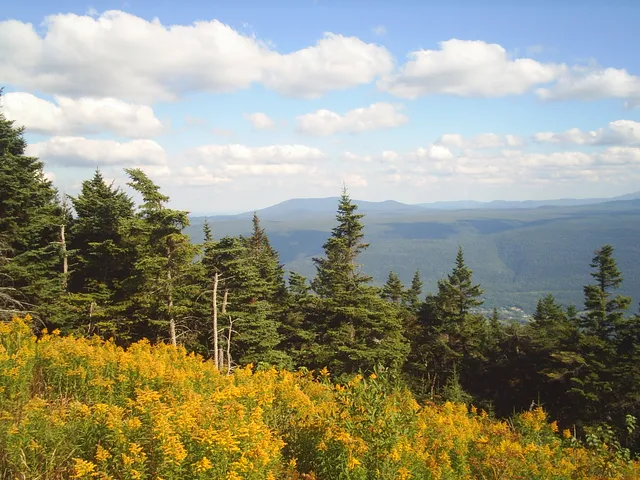
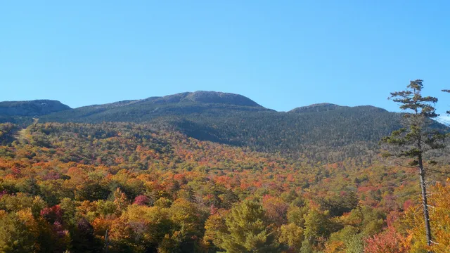
Vermont's high point tops out at 4,393 feet, and from the valley floor the ridge reads as a face lying on its back: Forehead, Nose, Chin, Adam's Apple, with the Chin the true summit. Three ways up. The Auto Toll Road, a 4.5 mile gravel climb running since 1923, ends in a lot near the Nose. The Stowe gondola lifts riders to the Cliff House. Hikers take the Long Trail along the spine, 1.4 miles north from the toll road lot to the Chin over open rock. Stay on that rock: roughly 200 acres of Ice Age alpine tundra survive up here, one of three such pockets in Vermont, and it bruises easily. Timing decides everything. The toll road runs late May to mid October and the gondola mid June to mid October, mud season closes the trails into early June, and VT 108 through Smugglers' Notch shuts from late October until May.
Burlington Waterfront Lakes & rivers

Burlington Waterfront

Burlington, VT · Champlain Valley, Vermont

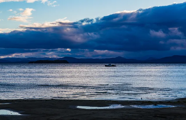
Burlington's waterfront is where the city meets a 120 mile inland sea. Lake Champlain runs deep and cold here, and the Adirondacks stack up across the water, close enough that summer sunsets go on a while. Waterfront Park anchors it: a wide lawn, a boardwalk, a skatepark, and the Burlington Greenway, 8 paved miles from Oakledge Park in the South End north to the pedestrian bridge over the Winooski River. ECHO, the Leahy Center for Lake Champlain, sits on the boardwalk with lake fish tanks and hands on exhibits, open daily 10 to 5. Church Street Marketplace is three blocks uphill, so a lake morning becomes lunch without moving the car. Peak season runs June into early October, and foliage weekends fill the Pease and Perkins Pier lots by late morning at $3 an hour. Crews plow the path within a few days of a storm but never salt it, so winter walking means ice.

Woodstock Village Attractions

Woodstock Village

Woodstock, VT · Upper Valley, Vermont

Woodstock sits on the Ottauquechee with an oval green at its center, and most of what people come for is within a fifteen minute walk. The Middle Covered Bridge, a Town lattice span built in 1969 and dragged across the river by a team of oxen turning a capstan, leads off the green onto Mountain Avenue. From there the Faulkner Trail switchbacks up Mount Tom's south peak, 1,250 feet, to carriage roads Frederick Billings laid out in the 1870s. Those roads belong to Marsh-Billings-Rockefeller, the national park built around the story of conservation history and land stewardship, with Billings Farm and Museum working its Jersey herd across the road. Quechee Gorge, 165 feet deep, is ten minutes east on US 4. Mansion tours run late May through October, Thursday to Monday, cap at 12 people, and sell out on Recreation.gov; the grounds and trails stay open dawn to dusk year round.

Lake Willoughby Lakes & rivers

Lake Willoughby

Westmore, VT · Northeast Kingdom, Vermont

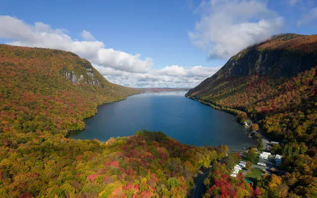
Lake Willoughby runs five miles through Westmore, a glacial trench barely a mile wide with Mount Pisgah on one side and Mount Hor on the other. The water drops more than 300 feet, deep enough to stay cold into July. That squeeze between two cliff walls is the Willoughby Gap, a National Natural Landmark since 1967, and the reason people keep reaching for Norway to describe it. The free public beach at the north end is the easy version: park, walk in, swim. Port-a-lets, no lifeguard. The south end holds the trailhead for Mount Pisgah's south trail, roughly four miles round trip, with Pulpit Rock about a mile up on a ledge hundreds of feet directly above the water. Services are thin, so stock up at the Willoughby Lake Store on Route 5A, open early and closing by evening. Foliage peaks in late September, ahead of most of Vermont, and the lots fill by mid morning.

Shelburne Museum Attractions

Shelburne Museum

Shelburne, VT · Champlain Valley, Vermont

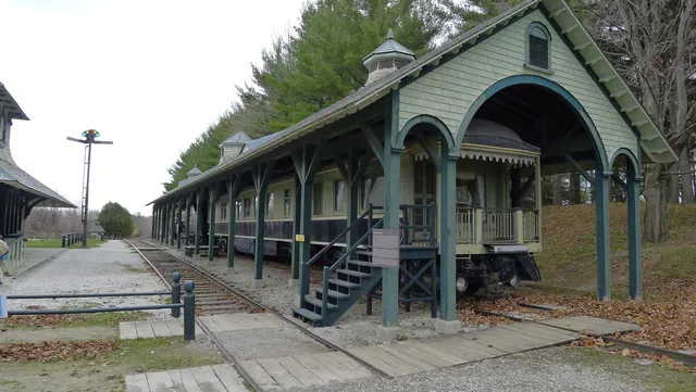
Electra Havemeyer Webb spent decades collecting American things nobody else took seriously, then in 1947 spread them across 45 acres in Shelburne. The result reads less like a museum than a village she assembled: 39 exhibition buildings, 25 of them historic structures hauled in, holding some 150,000 objects. The 220 foot Lake Champlain steamboat Ticonderoga sits two miles from the water, dragged overland across swamp, fields and a rail line over 62 days in the winter of 1955. Nearby stand an 1871 lighthouse from Colchester Reef and an 1845 covered bridge. The Webb galleries hold Monet, Degas and Manet, billed as the only Impressionists on public view in Vermont, alongside 500 quilts and 1,400 decoys. Go in season: the full campus runs daily 10 to 5, May 9 through October 25 in 2026, adults $27.50 at the gate and $25 online. Winter shrinks to two galleries, Wednesday through Sunday. Parking is free and fills first on foliage weekends.

Granville Gulf and Moss Glen Falls Lakes & rivers

Granville Gulf and Moss Glen Falls

Granville, VT · Green Mountains, Vermont

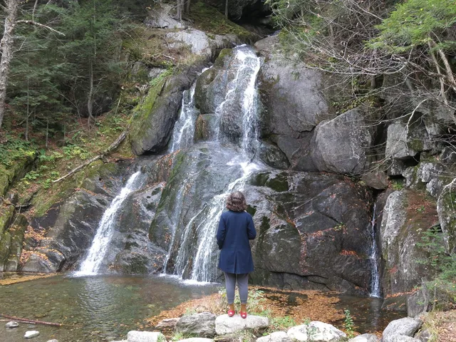
VT 100 drops into a narrow forested cleft here, and for six miles the highway, the brook, and the mountain walls share one floor. That is Granville Gulf, 1,171 acres the state has held since 1928. Moss Glen Falls spills off the ledge beside the road, visible through the windshield before you find the pull off. A wooden bridge and a short gravel path run about a tenth of a mile to a railed platform at the base, level the whole way and built as an accessible route. Look right on the walk in for Little Moss Glen Falls, a thin ribbon that runs hard in spring. No fee, no gate, no ticket. The gravel pull off has no marked spaces and spills onto the shoulder at foliage peak, late September into mid October. VT 100 is plowed year round, but the bridge and boardwalk can close when ice builds up, so check before a winter trip.

Camel's Hump Mountains

Camel's Hump

Huntington, VT · Green Mountains, Vermont

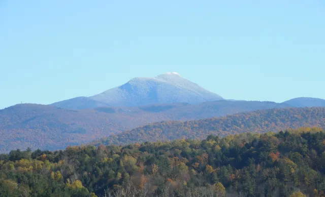
Camel's Hump is the profile Vermonters recognize from a moving car, the double hump that ended up on the state quarter. At 4,083 feet it ties Mount Ellen for third-highest in the state, and nothing has been built on top: no lifts, no auto road, no summit tower. The usual climb is the Burrows Trail out of Huntington, 4.8 miles round trip and roughly 2,300 feet of gain, steady work rather than technical until the last pitch of open rock. The final stretch crosses about ten acres of true alpine tundra, arctic plants holding on since the ice age, which is why a Green Mountain Club caretaker spends summer days up there asking hikers to step only on stone. No fee, no gate. Trails close for mud season each spring, roughly early April until the weekend before Memorial Day, and the lot at the end of Camel's Hump Road fills early on foliage Saturdays.

Mount Equinox Mountains

Mount Equinox

Manchester, VT · Taconic Range, Southern Vermont

Equinox Mountain tops out at 3,848 feet, the high point of the Taconic Range and one of the few Vermont summits you can reach without hiking. Skyline Drive, a private paved toll road opened in 1947, climbs about 3,200 feet in 5.2 miles from Historic Route 7A, switchbacking through hardwoods into stunted spruce at grades that average over 11 percent. Use low gear coming down. The mountain and the road belong to the Carthusian monks of the Charterhouse of the Transfiguration, the only Carthusian monastery in North America, visible from the drive but closed to visitors. At the top, the Saint Bruno Scenic Viewing Center frames the Green Mountains, the Adirondacks and, on clear days, Mount Greylock. Plan around the calendar: the road runs Memorial Day weekend through October 31, closed November into spring, and October foliage traffic backs up at the toll house early.