Places to go in Arizona.

Springs, beaches, parks and gardens worth the drive. Save the ones you want to visit and tick off the ones you’ve been to.

Explore places across the United States →
Lakes & riversCanyons & desertsCavesAttractions

All places

Browse everything by category or region.

12 places

Grand Canyon National Park Canyons & deserts

Grand Canyon National Park

Tusayan, AZ · Grand Canyon

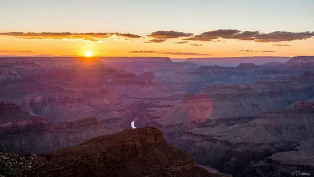
One of the world's great natural wonders, the Grand Canyon is a mile deep, up to 18 miles wide, and 277 river miles long, carved by the Colorado River over millions of years. The South Rim is open year round and packs the most accessible viewpoints, lodges, and trailheads, making it the side most visitors choose for a first trip. Sunrise and sunset set the layered red rock walls ablaze, and the sheer scale rewards anyone willing to make the journey.
Petrified Forest National Park Canyons & deserts

Petrified Forest National Park

Holbrook, AZ · Painted Desert, Northern Arizona

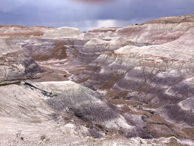
Petrified Forest is where an ancient forest turned to stone, with fallen logs near Holbrook, Arizona that have weathered into rainbow-banded quartz over 200 million years. Walk the Crystal Forest or Giant Logs trail to see fossilized trunks streaked with jasper and amethyst, then drive north into the candy-striped badlands of the Painted Desert. The roughly 28-mile park road links it all, and fall brings the clearest, mildest days.

Saguaro National Park Canyons & deserts

Saguaro National Park

Tucson, AZ · Sonoran Desert

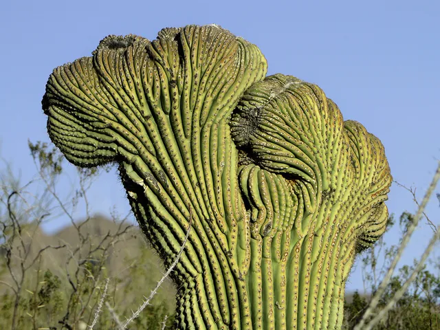
Saguaro National Park wraps around Tucson in two desert districts, protecting the country's densest forests of the giant saguaro, the towering candelabra cactus that can climb 50 feet and live two centuries. Walk the paved Cactus Garden Trail at the Red Hills Visitor Center or drive the unpaved Bajada Loop on the west side through thick cactus stands. Visit in cooler winter months, when the park doubles as a certified dark-sky place for stargazing.

Kartchner Caverns State Park Caves

Kartchner Caverns State Park

Benson, AZ · Sonoran Desert

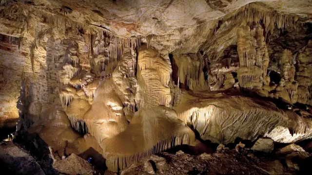
Hidden under the Whetstone Mountains until cavers found it in 1974, Kartchner is a living cave where water still drips calcite onto formations that have been growing for 50,000 years. The Throne Room holds Kubla Khan, a 58-foot column that is the tallest in Arizona, alongside one of the world's longest soda-straw stalactites at 21 feet. You walk in through misting airlock doors that keep the air at 99 percent humidity, and cameras stay outside so the rooms of flowstone, draperies, and brushite moonmilk keep forming in the dark.

Havasu Falls Lakes & rivers

Havasu Falls

Supai, AZ · Havasupai Reservation, Grand Canyon, Arizona

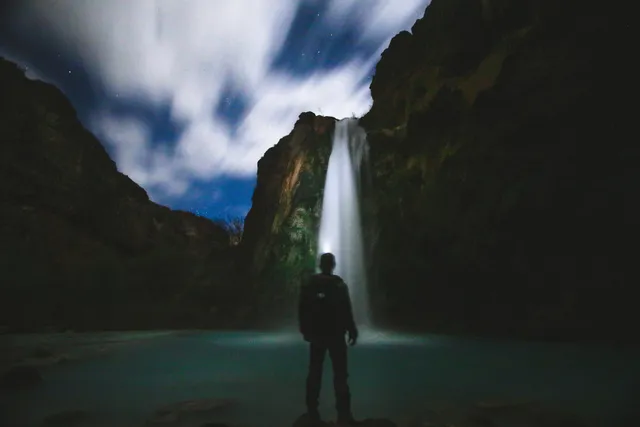
Havasu Falls owes its color to chemistry. Havasu Creek runs thick with calcium carbonate, and as the water drops roughly 90 to 100 feet off a red sandstone cliff, that mineral turns it a saturated turquoise and coats the terraces below in chalky travertine. The pools hold their blue-green year-round because the creek is spring-fed rather than snowmelt, so the falls look much the same in January and July. It sits deep on the Havasupai reservation, about 1.5 miles below the village of Supai and roughly 10 miles from the nearest road. Reaching it is the whole commitment. Every visitor needs a reservation permit (around $455 per person for the required three nights of camping), and they sell out within minutes when they open February 1. The hike starts at Hualapai Hilltop and drops about 2,000 feet through the canyon. No day trips are allowed.

Kitt Peak National Observatory Attractions

Kitt Peak National Observatory

Sells, AZ · Quinlan Mountains, Southern Arizona

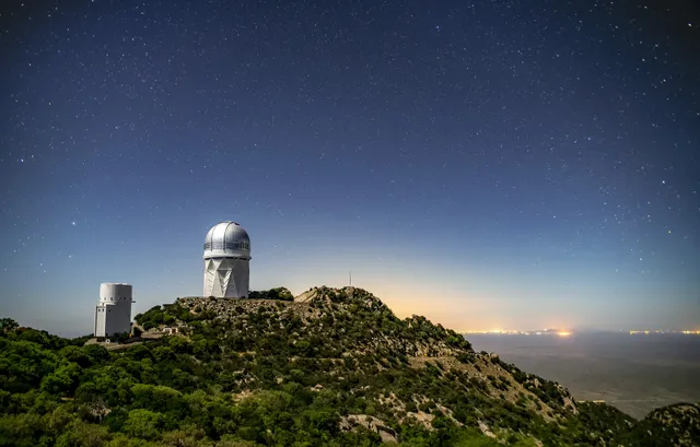
Kitt Peak sits at 6,875 feet in the Quinlan Mountains on the Tohono O'odham Nation, about 55 miles southwest of Tucson. The summit holds more than 20 optical telescopes and two radio dishes, one of the largest clusters of astronomical instruments in the northern hemisphere. The site was chosen in 1958 for dark, steady air, and Tucson and Pima County have guarded it since 1972 with outdoor lighting codes. The Nightly Observing Program opens with sunset from the summit, works through constellations by binocular, then gives each group an hour at a visitor center telescope. The ending sticks: a caravan eases down the first mile of Route 386 with headlights off so the research telescopes stay undisturbed. Book two to four weeks out, aim for a new moon, and dress for 30 degrees colder than Tucson. The gate closes at 4 p.m. to anyone without a reservation, so you cannot drive up and stargaze on your own.

Monument Valley Navajo Tribal Park Canyons & deserts

Monument Valley Navajo Tribal Park

Kayenta, AZ · Colorado Plateau, Navajo Nation, Northern Arizona

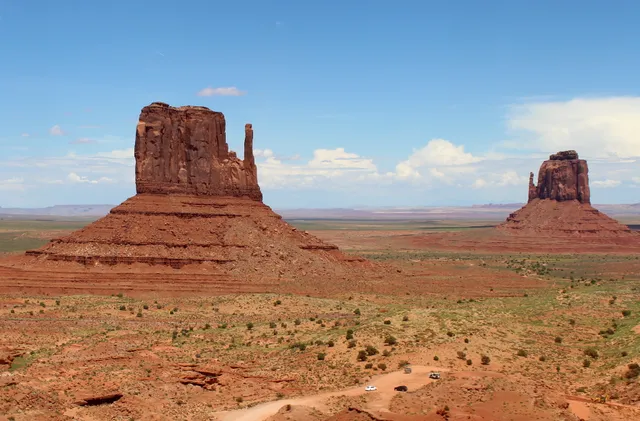
The buttes rise 400 to 1,000 feet off a red sand floor, and from the visitor center terrace the Mittens sit close enough that the scale finally registers. This is Navajo Nation land, not a national park, so the America the Beautiful pass buys nothing at the gate. Expect a per person fee plus a vehicle charge, and check the current rate before you go. Valley Drive is the self-drive option, a 17 mile unpaved loop past John Ford's Point, about two hours with stops. Deep sand and washboard ruts keep it slow. A sedan usually manages when dry. RVs and motorcycles are barred. Wildcat Trail, a loop of three to four miles around West Mitten Butte, is the only walk you take unaccompanied, and it has no shade and no water. Everything beyond needs a licensed Navajo guide. July to September monsoon storms flood the washes and close the road without warning, and the valley floor gets punishing hot.

Antelope Canyon Canyons & deserts

Antelope Canyon

Page, AZ · Colorado Plateau, Navajo Nation near Page

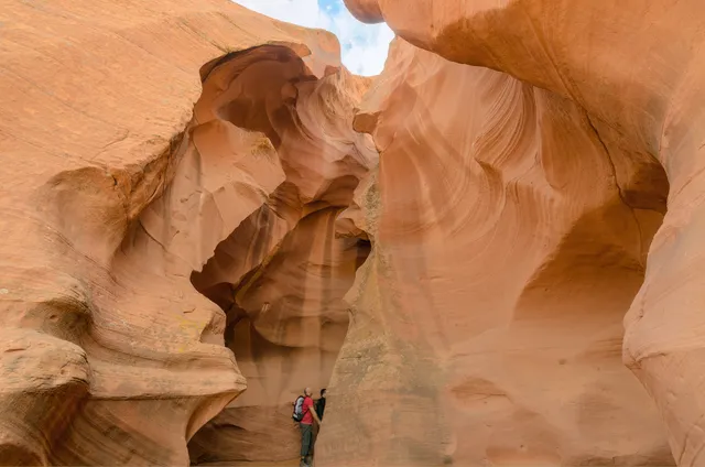
Antelope Canyon cuts through Navajo Sandstone on Navajo Nation land east of Page, and the walls are the point: flood water has sanded them into stacked, flowing curves that shift orange, purple and gold as the sun moves. Upper Antelope runs about 660 feet, flat and sandy throughout, where shafts of light drop through the slot overhead around midday in late spring and summer. Lower Antelope is longer at roughly 1,335 feet and narrower, entered by descending five flights of steep metal stairs. Both are guided only. Book a Navajo authorized operator well ahead and expect a $15 per person Navajo Parks fee on top of the tour price. A sedan reaches both check in lots off Highway 98, and guides drive the sandy wash to Upper in high clearance trucks. Summer heat runs past 100 degrees, and tours cancel when rain falls anywhere upstream, even under blue sky, because a 1997 flash flood killed eleven people in Lower.

The Wave (Coyote Buttes North) Canyons & deserts

The Wave (Coyote Buttes North)

Fredonia, AZ · Vermilion Cliffs National Monument, Arizona Strip

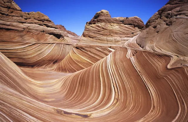
The Wave is a bowl of Navajo Sandstone in Coyote Buttes North, where 190 million year old dune beds erode into intersecting troughs of red, cream and pale orange, iron oxide banding in windblown sand. It is smaller than the photographs suggest, and the walk is the real work: 6.4 miles round trip from the Wire Pass trailhead, cross country over slickrock and deep sand, no trail, no shade, no water. Access is lottery only, 64 people and 16 groups a day. Forty eight come from an advanced lottery drawn four months out, 16 from a daily lottery entered by phone two days ahead from inside a geofenced corridor between Kanab and Page. Odds run in the low single digit percentages in spring and fall. House Rock Valley Road is 8.3 miles of dirt wanting high clearance, impassable when wet. Heat has killed hikers here from May through September, so carry four liters and start early.

Sedona Red Rock Country Canyons & deserts

Sedona Red Rock Country

Sedona, AZ · Verde Valley and Red Rock Country, Northern Arizona

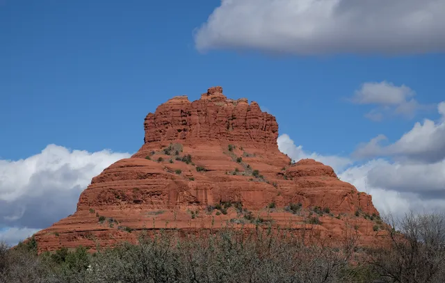
Cathedral Rock is the shape everyone recognizes, a cluster of red sandstone fins standing over Oak Creek and glowing hardest an hour before sunset. The Forest Service rates the trail to the saddle strenuous: 1.1 miles round trip, 669 feet of gain on bare slickrock, with toeholds chipped into the steepest pitches and no shade or water on it. Bell Rock, Courthouse Butte and the Airport Mesa loop offer the same red rock with less scrambling. Trailhead parking takes a Red Rock Pass ($5 daily, $15 weekly, $20 annual) or an America the Beautiful pass. Thursday through Sunday year round the Cathedral Rock lot is closed and the free Sedona Shuttle from the North SR 179 park and ride is the only way in. The Pocket Fire closure order has Devils Bridge, Soldier Pass and Fay Canyon shut through September 30, 2026, and summer highs top 100, so start at dawn and check the forest closure list before you drive.

Canyon de Chelly National Monument Canyons & deserts

Canyon de Chelly National Monument

Chinle, AZ · Colorado Plateau, Navajo Nation, Northeastern Arizona

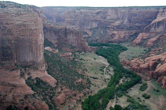
Three canyons meet here, cut into De Chelly sandstone that rises in sheer red walls, over 1,000 feet at the deepest. People have farmed the floor for nearly 5,000 years, and Navajo families still live down there, so the canyon bottom is closed to unaccompanied visitors. The two paved rim drives are the exception, ten overlooks, ending at Spider Rock, a spire 750 feet above the floor. The only self-guided hike is the White House Ruin Trail, 2.5 miles round trip, 600 feet of switchbacks to a cliff dwelling. No entrance fee or reservation, and the rim drives stay open year round. Everything below the rim takes an authorized Navajo guide plus a backcountry permit from Navajo Parks (928-674-2106). Approach from US-191 in Chinle; Route 7 from the east near Sawmill is unpaved and unmaintained. Start early, carry water, skip 10am to 4pm in summer, and turn back if rain threatens: this canyon floods fast and sheds rock.

White Pocket Canyons & deserts

White Pocket

Page, AZ · Vermilion Cliffs, Colorado Plateau, Northern Arizona

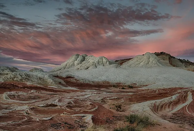
White Pocket is a square mile of Navajo sandstone that looks poured rather than laid down. Cream and coral domes crack into polygonal plates people call brain rock, with red and orange swirled through. Formations start about a hundred yards from the lot, and there is no trail past that. Most people wander a mile or two over open slickrock and sand. The Wave runs on a Recreation.gov lottery and Coyote Buttes South needs a permit. White Pocket sits outside both, with no permit, no fee and no quota. The road is the toll: 23.5 miles of dirt down House Rock Valley Road, then roughly ten more of deep sand that strands high-clearance 4WD trucks every year. Sedans and crossovers do not make it, and rain or snow can shut the route to everything. Many hire a guide from Kanab or Page. No water, no toilets, no shade, no cell service, and BLM is blunt that rescue is not guaranteed.