Places to go in Utah.

Springs, beaches, parks and gardens worth the drive. Save the ones you want to visit and tick off the ones you’ve been to.

Explore places across the United States →
Canyons & deserts

All places

Browse everything by category or region.

9 places

Zion National Park Canyons & deserts

Zion National Park

Springdale, UT · Southern Utah

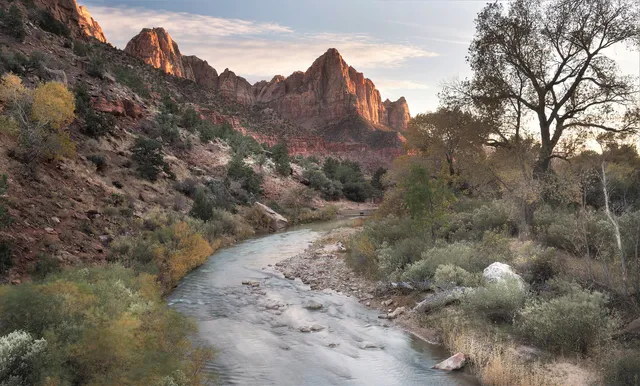
Zion National Park is a canyon wonderland in southwest Utah where the Virgin River has carved a deep gorge through towering walls of cream, pink, and red Navajo sandstone. Soaring cliffs, hanging gardens, and slot canyons make it one of the most dramatic and accessible parks in the country, with a free shuttle that carries visitors deep into Zion Canyon. It rewards both casual sightseers and serious adventurers, so it is well worth the trip for almost any traveler.
Arches National Park Canyons & deserts

Arches National Park

Moab, UT · Southern Utah

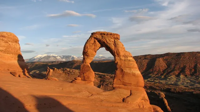
Arches National Park packs more than 2,000 natural sandstone arches into a compact, otherworldly landscape of red rock fins, balanced boulders, and soaring spires just north of Moab. A single scenic drive and short trails put icons like Delicate Arch and Landscape Arch within reach, making it one of the most rewarding national parks for a day visit. Go early or late to dodge midday crowds and catch the glowing light that sets the rock on fire.

Bryce Canyon National Park Canyons & deserts

Bryce Canyon National Park

Bryce Canyon City, UT · Southern Utah

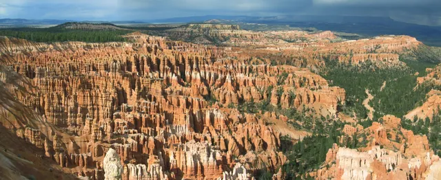
Bryce isn't really a canyon but a string of natural amphitheaters carved into Utah's high plateau, packed with orange hoodoos that catch fire at sunrise. Hike the Navajo Loop down among the spires past Thor's Hammer and Wall Street, or trace the rim past Inspiration and Sunset Points. At over 8,000 feet, this certified Dark Sky Park ranks among the best stargazing in the country.

Canyonlands National Park Canyons & deserts

Canyonlands National Park

Moab, UT · Southern Utah

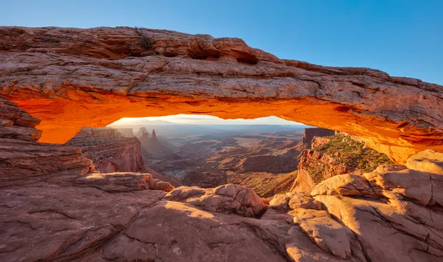
Carved where the Green and Colorado rivers meet, Canyonlands splinters into mesas, spires, and stacked canyons spread across four wild districts outside Moab. Most visitors head to Island in the Sky, where the half-mile walk to Mesa Arch frames a sunrise that ignites the underside of the stone above a thousand-foot drop. For solitude, the Needles offers redrock pinnacles and miles of backcountry trail.

Capitol Reef National Park Canyons & deserts

Capitol Reef National Park

Torrey, UT · Southern Utah

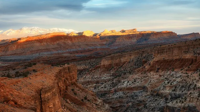
Capitol Reef wraps around the Waterpocket Fold, a nearly 100-mile wrinkle in the earth's crust where white Navajo sandstone domes stack above red cliffs near Torrey. Hike the moderate trail to Hickman Bridge, a 133-foot natural span, then drop into the historic Fruita district to pick apples and peaches from pioneer orchards and grab a pie at the Gifford House. Spring blossoms and fall harvest are the sweetest times to come.

Natural Bridges National Monument Canyons & deserts

Natural Bridges National Monument

Blanding, UT · Cedar Mesa, Southeastern Utah

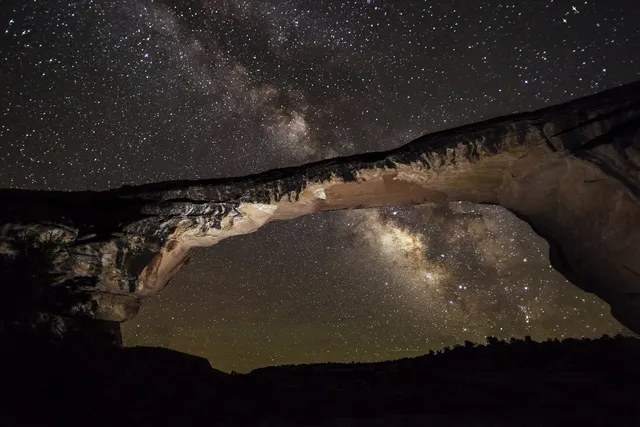
In March 2007 the International Dark-Sky Association named this small Cedar Mesa monument the world's first International Dark Sky Park, and it holds Gold tier on a sky measured at Bortle Class 2, the darkest reading the Park Service night sky team had logged anywhere. Outdoor fixtures were reshielded to keep light from bleeding upward, and the monument runs largely on its own solar array. The payoff is Owachomo Bridge, a sandstone span 180 feet across and 106 feet high at the end of the shortest walk here, framing the Milky Way core like a window cut in rock. Entry is $20 per vehicle for seven days, the park road and trails stay open 24 hours, and the 13-site campground at 6,500 feet is reservation-only on Recreation.gov. Nearest gas is 40 miles east in Blanding. Plan a moonless night in July or August, when the core rides highest, and bring water; there is none at the campground.

The Narrows Canyons & deserts

The Narrows

Springdale, UT · Colorado Plateau, Southwest Utah

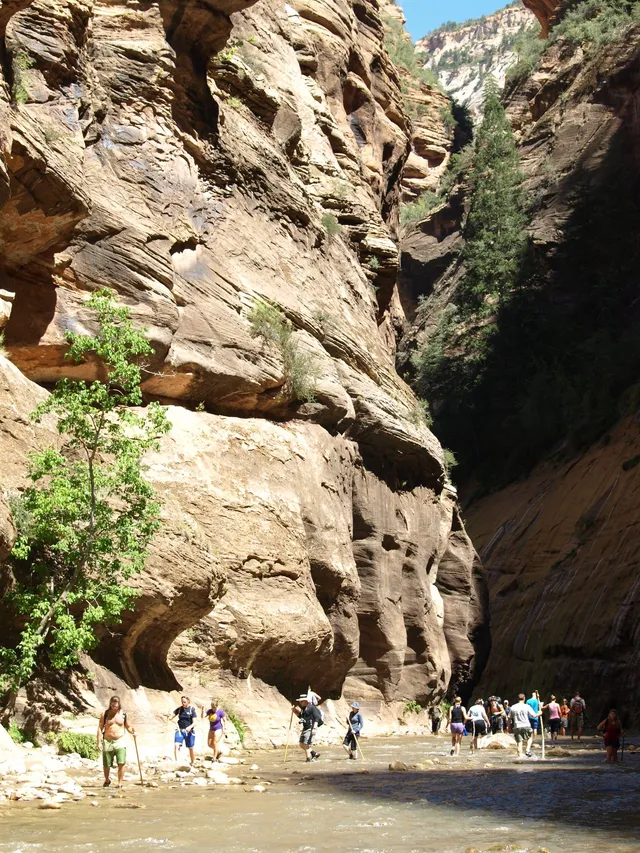
The Narrows is not a trail so much as a river you walk up. From the Temple of Sinawava, the last stop on the Zion shuttle, a paved mile of Riverside Walk ends at the water. After that it is wading, over slick cobbles that roll underfoot, with Navajo sandstone rising a thousand feet on both sides. A couple of hours upstream, Wall Street pinches to twenty or thirty feet wide and daylight reaches the floor only around midday. Big Spring, the no-permit limit, is about ten miles round trip. Bottom-up needs no permit, just the $35 vehicle entrance fee, and from March through November the shuttle is the only way to the trailhead. The park closes The Narrows whenever flow tops 150 cfs, which can shut it for weeks during April and May runoff. Flash floods have killed hikers here. Never drink the river; cyanobacteria toxins have been found in it.

Buckskin Gulch Canyons & deserts

Buckskin Gulch

Kanab, UT · Colorado Plateau, Southern Utah

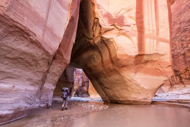
Buckskin Gulch runs about 16 miles through Navajo sandstone, one of the longest continuous slot canyons anywhere, with stretches barely 10 feet wide under hundreds of feet of rock. Daylight arrives secondhand. The floor shifts between packed sand, logjams wedged overhead, and cold pools that can go chest deep for weeks after rain. Most hikers walk in from Wire Pass, 1.7 miles to the confluence, then turn back. The full through hike out at White House runs about 21 miles over two days. Day use is $6 per person and $6 per dog on Recreation.gov, no lottery. Overnight takes a Paria Canyon permit, $5 per person per night, 20 people a day across all trailheads, released monthly about four months out. House Rock Valley Road is 8.3 miles of dirt, passable by car when dry and not when wet. The narrows run 11 miles with one technical escape route, so check the forecast for the whole upstream watershed before you drop in.

Peek-a-boo and Spooky Gulch Canyons & deserts

Peek-a-boo and Spooky Gulch

Escalante, UT · Grand Staircase-Escalante, Southern Utah

Two famously tight slots sit side by side in the Dry Fork of Coyote Gulch, and the usual loop climbs up one and squeezes down the other. Peek-a-boo starts with a 12 foot dryfall gained on moki steps chipped into the sandstone, then opens into stacked arches and potholes. Spooky pinches to roughly 10 inches, tight enough that most people turn sideways and carry the pack by hand. BLM and Kane County search and rescue installed sizing posts at the trailheads so you can learn whether you fit before you commit. No permit or fee for day hiking. The trailhead sits 26 miles down Hole-in-the-Rock Road, graded dirt that passenger cars usually handle when dry and clay that traps vehicles when wet; low clearance drivers should park at the upper lot and walk the last mile. Both slots flood and the open approach bakes in summer, so check the forecast, carry extra water, and turn back if storms sit upstream.